
Date of Hike: 4/23/18
Ammonoosuc Ravine Trail: 2.4 miles / Crawford Path, Washington Cone Snowfields, Gulfside Trail: 4.2 miles / Ammonoosuc Ravine Trail: 2.4 miles
Total Miles: 9.0 (4,470 feet elevation gained)
Trip Report:
- Whitney and friends (Denise, Jeff, Karine, and Sue) were doing a Presi Traverse, so I decided to meet up with them on their Washington portion of the hike.
- With the deep snow coverage above treeline it was a make your own trail Monday up from Lakes to the summit of Washington.
- Warm temps, barely a breeze, hundred mile views, what else is there to say!




Ammonoosuc Ravine Trail: 2.4 miles / Crawford Path, Washington Cone Snowfields, Gulfside Trail: 4.2 miles / Ammonoosuc Ravine Trail: 2.4 miles
Total Miles: 9.0 (4,470 feet elevation gained)
Trip Report:
- Whitney and friends (Denise, Jeff, Karine, and Sue) were doing a Presi Traverse, so I decided to meet up with them on their Washington portion of the hike.
- With the deep snow coverage above treeline it was a make your own trail Monday up from Lakes to the summit of Washington.
- Warm temps, barely a breeze, hundred mile views, what else is there to say!
Breaking above treeline on the Ammonoosuc Ravine Trail
Heading up to Lakes of the Clouds Hut
A buried Lakes of the Clouds Hut!
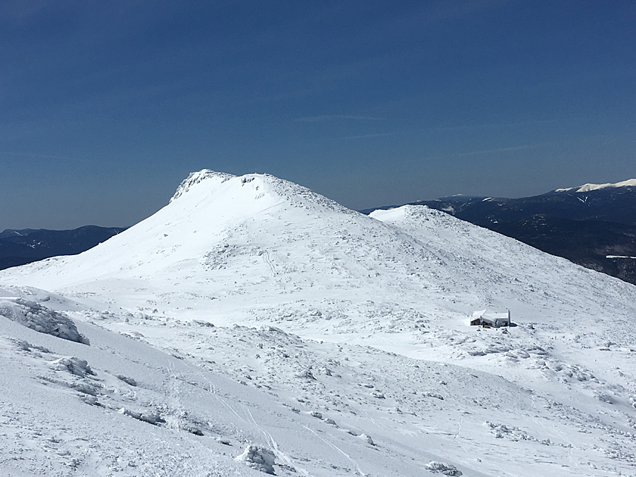
Mount Washington as seen from Lakes of the Clouds, which is under a ten foot snow drift at the moment
Lakes of the Clouds and Mount Monroe
Heading up to Mount Wshington
Westside Trail junction sign!
Making my own path up to the summit
Cool rime ice formation
Closer look at the rime wave formation
Reaching the summit area
Rime ice blasted summit tower
Stage Office building
Standing on the observation deck
Northern Presidential Range
Nelson Crag Trail junction sign!
Hiking down the tracks and catching up with the Presi Traverse party
Hiking up the snowfields to the summit
Once in a lifetime day up there on Monday!
The cog tracks, buried beneath snow, usually you can walk or dip down and go under the tracks at this spot.
Mount Clay, Jefferson, Adams, and Madison
Summit tower buildings
The towers made me a little uneasy, with it being so warm I was a little frightened of the thought of a huge chunk of rime ice crashing down
Walking past the Stage Office building
Heading down from Washington, making our own path
Lakes of the Clouds and Mount Monroe
Mount Monroe
Lakes of the Clouds
Lakes of the Clouds Hut


.jpg)


