Showing posts with label 4000 footers. Show all posts

Sarge's 50th Summit of Mount Washington

1/28/24

Cog Railway: 3.0 miles / Gulfside Trail: 2.5 miles / Mount Jefferson Loop: 0.6 miles / Gulfside Trail: 1.5 miles / Jewell Trail: 3.0 miles
Total Miles: 10.7 (4,950' elevation gained)

Trip Report:
- Sarge had been waiting about two months to get Rockpile #50 and Sunday he was rewarded for his patience. Temperatures were mild above treeline, mid to high twenties which is quite warm for late January, and the wind was nonexistent. To add to our good fortune, we were treated with undercast, so it was a "unicorn' type of day in the alpine zone.
- We took the express way up to the summit, the Cog Railway Path, it's a steady steep climb along an open swath that parallels the tracks over an average grade around 25%. 
- At Marshfield Station I put on my microspikes and let Sarge set the pace as we made out way up the packed styrofoam snow that had a light dusting over it making for ideal winter conditions. 

Sarge at Marshfield Station waiting for me to put my spikes on

Looks gloomy as we head up but we know what waits above the clouds!

Break time at Jacob's Ladder.

- Past Jacob's ladder we hustled by the two steep no fall zones, they were easily navigated, but a few more good dumps of snow and a melt/freeze pattern could change that.
- Once past the steeps we enjoyed the last mile taking in the undercast views as we made our way to the summit.

Sarge waits for daddy to catch up

Undercast to the west of us

Sarge hiking up Mount Washington's summit cone with Mount Jefferson behind him

Sarge takes in the view of the North Presidential Range
Clay, Jefferson, Adams, Madison (left to right)

Pemi Wilderness rising above the clouds

Observation deck and summit tower

#50!

Carter Range floating above the clouds

Summit deck Sarge!

- Our original plan was to head back down the Cog but we decided to switch it up and take the longer/easier way via the Jewell Trail. As we made our way over to the Jewell Trail junction the weather was too nice to head back down so we continued on.

Sarge scopes out the Jewell Trail with Jacob's Ladder, Lakes of the Clouds Hut, and Mount Monroe behind him

- It was just past 9AM and there wasn't a hint of wind, the clouds were not moving down on us, and the storm was still several hours out so we decided an out and back of Mount Jefferson was in order.
- From the junction we dropped toward the Clay Col and that is when Sarge took off running, ahead of him he saw familiar faces, Corey and Ashley, who were out enjoying the mint conditions.
- After chatting with them we took off towards Jefferson making our way up to Monticello Lawn and eventually to the summit.

Sarge with Clay and Washington behind him

Monticello Lawn

Sarge making his way up to Mount Jefferson

Carter Range off in the distance

Sarge just below the summit of Mount Jefferson

Sarge on the summit!

- Unfortunately, it was time to head home, so we backtracked to the Jewell junction, banged a right, and slowly made our way back to treeline soaking in all the views as we both knew that days like this are few and far between when it comes to winter in the White Mountains

One happy Dood!

Sea of clouds. Eisenhower to the immediate left, far left in the back is Carrigain, Willey is to the right, and the peaks that make up the Pemi make up the backdrop

Treeline on Jewell Trail

- So how does Sarge feel about #50? No idea, he's just a dog! But he loves every minute on trail sniffing, eating snow, rolling in snow, waiting for me!

Undercast & Solitude . . . Hale - Zealand - Bonds

Date of Hike: 12/1/18

Zealand Road: 2.6 miles  /  Hale Brook Trail: 2.2 miles  /  Lend-A-Hand Trail: 2.6 miles  /  Twinway: 4.2 miles  /  Bondcliff Trail: 0.6 miles  /  West Bond Spur: 1.0 miles  /  Bondcliff Trail: 8.2 miles  / Lincoln woods Trail: 3.0 miles
Total Miles: 24.2 miles (6,063 feet elevation gained) Garmin Forerunner 920XT

Trip Report:
- On Saturday morning I joined a super strong group of hikers to tackle breaking out a majority of the Hale-Zealand-Bonds Traverse.  The group was made up of Jason, Leah, Nate and his dog Piper, and Todd.
- We started just after 7am and happily hiked the broken out Zealand Road and Hale Brook Trail to Mount Hale's summit.  From here we would be breaking trail for the next eight hours over thirteen miles through one to two feet of snow with higher drifts in spots.
- While breaking trail is nothing new for any of us, what made the day extra challenging and exhausting were the several miles of trees that were so heavy with snow that they were bent over across the trail.  To navigate through these sections we spent a lot of time knocking ice and snow off of trees, then snaking around the trees slowing our progress considerably.
- However, we were rewarded handsomely with some of the most incredible undercast I have ever seen, second only to a Presi Traverse from December of 2014 (Trip Report). 
- Views from Guyot, West Bond, and Bond were incredible.  We caught sunset from Bond and hiked in the twilight along the Bondcliff Ridge while a sea of clouds floated everywhere below 4,000 feet as far as the eye could see.
- We all took turns breaking trail and knocking the stunted growth pines free of snow and ice.  It was a total team effort and impressive to watch everyone break trail and route find in places where the trail corridor would basically disappear in a maze of bent over trees.
- We finally hit a broken trail at the last water crossing of the Bondcliff Trail, a much welcome sight, we still had seven miles to the car but at least we wouldn't have to route find in the dark.  This made hiking much easier and we were able to cover the last seven miles in under two and a half hours finishing just after 8PM .
- What an incredible day, spent with an easy going, strong, and energetic group!

Near Zeacliff on the Twinway.  From here Leah did a great job route finding through a section were many start going the wrong way

 Jason heads up the Twinway

Leah with Hale behind her

Hiking towards Zealand

Breaking above treeline on North Guyot

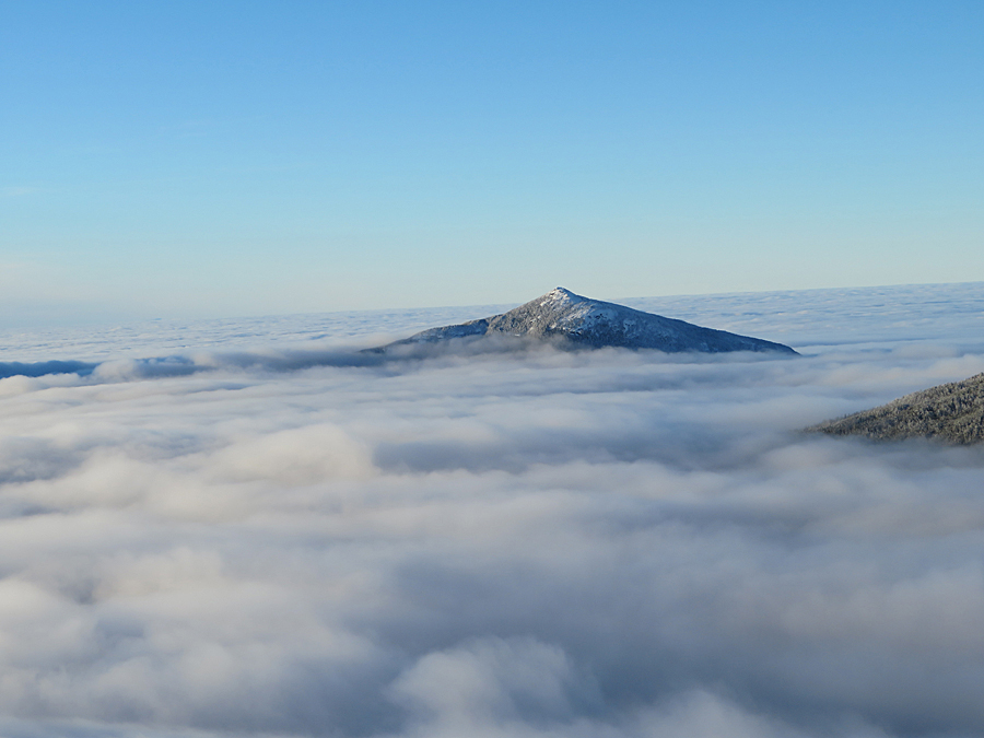
 Looking at the undercast surrounding Mount Carrigain

Presidential Range

Guyot and West Bond

Todd taking it all in

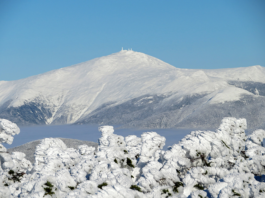
Mount Washington, Monroe, and Eisenhower

Mount Carrigain

West Bond

Jason taking in the incredible views

Southwest Twin and Garfield

Piper!

Todd hikes to the almost buried Bondcliff Trail junction

 South Twin

Bondcliff slowly emerging from the undercast

Bondcliff as seen from West Bond

Franconia Ridge and Mount Garfield

Mount Garfield

Taking pics from West Bond

The group enjoys the views from West Bond

Looking to the north  

 Presidential Range

Presidential Range 

Looking back towards Zealand Mountain

Bondcliff Ridge

Hancock Range

West Bond and Franconia Ridge 

Sea of undercast in the Pemi Widlerness 

 Heading to Bondcliff

Bondcliff Ridge

 Hancock Range

Twilight hike to Bondcliff

Bondcliff Ridge

Goodnight Pemi!