Showing posts with label Hiking. Show all posts

Sarge's Winter 48 Finish on West Bond

Date of Hike: 3/10/21

Lincoln Woods / Bondcliff Trail / West Bond Spur: 22.8 miles, 4,700' elevation gained

Trip Report:
- Over the past few winters when Sarge isn't heading into Tuckerman Ravine for "Bowl Pawtrol," he has, unbeknownst to him, been slowly picking away at his Winter 48 - 4000 footers of New Hampshire. 
- On Wednesday morning we headed to Lincoln Woods for an out and back of the Bonds.  With weather forecasted to be above freezing we got an early start, 6:30AM, to be able to get up and down before the snow started to get soft and sloppy, and hopefully have the whole ridge to ourselves.
- Trail conditions were the best I can recall for an out and back of the Bonds, all trails were completely packed down, with only minor drifting between Bond and West Bond, even the ridge walk between Bond and Bondcliff, which is usually wind blown with rock-snow-ice had complete snow cover.
- We made good time up to Bondcliff, making it there by 9AM under abundant sunshine and zero wind.  I took a few pics of Sarge and gave him some water, but he was more interested in eating ice chips and crunchy snow, so I put some ice in the water and he slurped it right up.
- From Bondcliff we made the beautiful trek up to Bond along the exposed ridge before dropping back into the trees again on our way to West Bond.
- Along the way we enjoyed views into Hellgate Ravine, across to Owl's Head and Franconia and Garfield ridges, Guyot and South Twin, along with Redrock Ravine.
- I was happy we got the early start as it was getting pretty warm along the ridge as we made our way back across Bond and over to Bondcliff.  Sarge enjoyed himself running up ahead of me and eating ice and snow chunks as I caught up to him. 
- We took one last break at Bondcliff taking in the views and eating snacks before the long trip back to Lincoln Woods.  On the way down, the top part of Bondcliff trail started to soften up so we nailed the timing perfectly making it to the super packed portion after the highest water crossing and not having any issues with chewing up the trail or postholing.
- After fifteen miles of having the trails to ourselves we started seeing a handful of hikers about two miles before the Camp 16 turn, still it was relatively quiet as we saw only ten hikers heading in on the Bondcliff Trail and amazingly only another six people walking the Lincoln Woods Trail.
- It was a great day in the Bonds with Sarge, and I was happy he finished his winter 48, and he was happy to get a bunch of extra treats for the occasion!

Early morning on the Lincoln Woods Trail just past Camp 8 clearing

Sarge makes his way to Bondcliff

Bondcliff summit

Sarge charges up towards Bond with Bondcliff behind him

Summit of Mount Bond

Hiking between Bond and West Bond

West Bond Spur, it's a real treat in late winter hiking through here with high snow depth
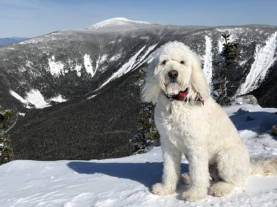
Summit of West Bond with Redrock Ravine and South Twin in view.  If you know where to look you can see Bear Pond!

Lincoln and Lafayette off in the distance

Sarge makes his way back to Bond

Presidential Range, everyone was up there today so it made things quiet over here!

Back on Bond

One last climb back up to Bondcliff

Owl's Head and Franconia Ridge behind Sarge. Happy dog!


Over the Hill(s)

July Hiking/Running (292 miles & 112,000 feet elevation gained)

In early July I turned 40 years old, officially joining the "over the hill" stage of life, or as I like to refer to it, "over the mountain" hike of life. :)

I wanted and try to make the month I turned forty memorable and it ended up being a great one.  Warm weather and lack of storms made for favorable hiking conditions for pre and post work hikes & runs during the week with Sarge, along with more adventurous routes on the weekends.

Sarge was able to hike a few more new 4,000 foot mountains with the puppy brigade (Piper, Toby, Dylan, & Wish), while running up and down the Black Mountain ski trails every Friday Night with several other dogs as part of Friday Night Vert. Click here for info on FNV.

I myself was able to knock off a few bucket list items, my main goal for the summer was to hike 24 4K Peaks in one push over a calendar day (Peak to Peak). Trip Report Here.  Along with completing this goal I was also able to summit Mount Washington for the 100th time, run a sub five hour Presi Traverse (4:47), and gain over 100K in elevation during the month.

So it was a good start to being forty, hopefully I can keep it going on and off trail, hiking and running, at a variety of speed and mileages for a few more years before my body tells me it's time to throttle down!

Sarge's Instagram can be followed here  /  My Strava feed is here (you need to have an account to see more than just the overview page)

Enjoy the pictures :)

 Sarge heading towards the summit of Shelburne Moriah

Sarge on the Polecat Ski Trail 

The snow arch in Tucks lasted until mid July before collapsing!  

Lakes of the Clouds and Mount Washington 

Lakes, the hut, and Washington as seen from Mount Monroe

Sarge looking into the Pemigewasset Wilderness from North Twin 

Sarge & Piper!

Sarge on West Bond with Bondcliff in the background 

 High Fives with Ashley on Mount Bond!

Sarge hiking to Bondcliff 

Sarge on Bondcliff looking into Hellgate Ravine 

A nice cascade along the Great Gulf Trail 

Heading up the Great Gulf headwall 

 Moose strolling along Tuckerman Ravine Trail

Sarge and Toby!

Sarge, Dylan, and Toby 

Cookie time with Larisa! 

 Dry River Falls

Todd makes his way up the lightly used and narrow Dry River Trail

Lakes of the Clouds

Todd running along the Crawford Path

Dropping down the Wamsutta Trail with Adams and Madison in view

Looking down to Mount Monroe high above on the Crawford Path

Cog Tracks during the golden hour

Summit of Mount Jefferson

Sarge on Bald Peak

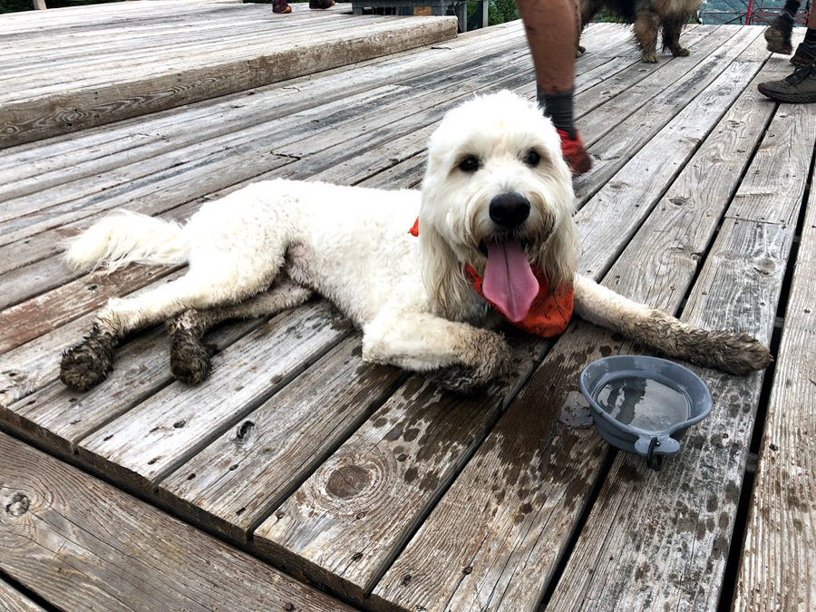
Friday Night Vert, muddy and tired puppy! 

 Friday Night Vert

Sarge sitting shotgun!

Sarge's First Presidential Undercast . . . From Mount Washington

Date of Hike: 4/25/19

Jewell Trail: 3.7 Miles  /  Gulfside Trail: 2.8 miles  / Jewell Trail: 3.7 miles
Total Miles: 10.2 (4,318 feet elevation gained) Garmin Forerunner 920XT

Trip Report:
- Long time, no trip report!  I have still been hiking with Sarge quite frequently, with an Instagram page for him here (sgt._pepper_goldendoodle).  Also, all my hikes automatically get uploaded to Strava, so unless it's one of my original routes or one where I snapped some really good pictures, I will not be updating the blog as much.  Luckily, there are a tremendous amount of reports here over the past ten years making for a solid catalog of data and info for hikers to peruse through.  My Strava profile is here (Chris Dailey Strava), you need Strava to view my hikes and follow me, but I do upload the links to the trip report page on this blog and those can be viewed individually.

- On Thursday, Sarge and I joined Ashley for a spring hike of Mount Washington.  Trail conditions have drastically changed over the past two weeks in the White Mountains, from deep solid snowpack to mud, running water, and snow with failing monorail.  I chose the Jewell Trail because it melts out relatively fast compared to the Amoonoosuc Ravine Trail which holds snow much longer below treeline as it doesn't get good sun exposure.
- The first two miles were mostly bare ground with a few tenths of a mile of rotting snow.  The last mile to treeline was when conditions got really interesting, balance beam of snow, some solid, some failing.  It was quite the workout, we made the best of it and laughed off our slip and falls.
- When we broke above treeline conditions were still tedious as the previous days snowfall was melting fast but made things very slippery.  We were hiking in thick clouds when all of a sudden around 5,800 feet we were suddenly above the clouds in bright sunshine!
- We moseyed our way up to the observation deck enjoying the undercast.  At the summit, Ashley went inside to visit her OBS friends who work up there, (fyi, the observatory is still closed to the public).  Sarge and I basked in the sunshine and hung out on the deck until Ashley reappeared with some cookies the staff made!
- After chilling on the summit and snapping photos we started to descend, and just as we started heading down the clouds broke open below us making for stunning views of the Great Gulf and the Northern Presidential Range.
- We timed our descent perfectly, the views kept get better and the trail had now melted and dried up making our drop back to treeline much easier.  Once back in the woods we battled the failing monorail for a mile before a relaxing last two miles back to the car.
- It was a great day to head up to the rock pile, Sarge had a blast and so did Ashley and I. :)

 Below treeline, hiking on top of the rare Old Man's Beard monorail

Sarge at the tracks wanting to see a train

Still waiting for that train!

Top of Mount Washington

Sarge with a sea of clouds behind him

Summit photo!

Ashley on top of the tower

Just hanging out

Ashley and Sarge on Washington!

Sarge enjoying the undercast

I'm going to dodge it.  Train dodge, dig it!

Trust me, this is his excited face!

 Clearing out of the Great Gulf

This was pretty cool to see as we hiked back down

Ashley enjoying the clearing of the Great Gulf

Peekaboo Sarge, do you see him??!!