Showing posts with label Wildcat Mountain. Show all posts

Wet & Wildcats

Date of Hike: 7/4/23
Polecat Ski Trail: 2.6 miles / Wildcat Ridge Trail: 2.4 miles / Nineteen-Mile Brook Trail: 2.8 miles / Aqueduct Loop: 1.0 miles / NH16 & Lot C Access Road: 2.0 miles 
(10.8 miles, 3,400' elevation gained)

Trip Report:
- With unsettling weather in the forecast on Independence Day I headed to Wildcat Ski Area with the intention of pushing the pace up to the summit of D Peak via the ski trails and heading back down.
- I started out at 7AM and wound my way up the Polecat Ski Trail, which doubles as an UTV access road for ski area workers. The road is in ok shape, crushed rock and dirt with a few eroded spots and a constant steep grade. I was able to trail run at a good clip while enjoying the views of the Presidential Range across the notch.

Looking north to Mount Adams and Madison while early morning fog lingers north of the notch hovering over NH16

Looking down the muddy Polecat Ski Trail

- It was a hot and humid morning along the Polecat Ski Trail with a constant threat of rain as clouds quickly started to build as I reached the top of the chairlift and up to the summit outlook platform, making it from bottom to top in 43 minutes and 30 seconds before taking a break to catch my breath. I felt good so I decided to continue on across the ridge through the sloppy wet and muddy conditions from the nonstop month + of rain we have been having here in the White Mountains.
- By the time I reached Wildcat C Peak the Presidential Range across the notch was engulfed in clouds.

Top of the ski slopes with Mount Washington in view 

Making my way across the wet and muddy Wildcat Ridge Trail, past some good and not so good bog bridges 

By 8AM the clouds overtook Mount Washington and no views were to be had from Wildcat C Peak

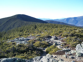
- Wildcat Ridge Trail between D & A Peak heads up and down over a series of "Hog Backs" with steep bursts up to C and B summits with a few other PUDs mixed in along the way. It's rocky and rooty with a few obstructed views here and there until reaching the summit of A Peak where there is a grand view of Carter Notch and Carter Dome. Unfortunately, it was almost fogged in while I was there but I was able to snap a decent picture with Carter Dome slightly visible through the fog and clouds.
- There was not much action along the Wildcat Ridge, I ran into a few Appalachian Trail hikers, three NoBo one SoBo, and one day hiker.

Carter Dome through the fog and clouds with Carter Notch barely in view down below

- From the summit of A Peak I steeply dopped 0.7 miles to Nineteen-Mile Brook Trail junction before heading over to Carter Notch. The clouds broke as I reached the notch opening up a nice view up to Wildcat A Peak from Carter Notch Lake.
- It was very quiet at the hut when I arrived. I talked to a trail runner who saw that I was wearing a White Mountain Endurance Racing hat, he had ran the Chocorua Mountain race in the spring of 2022 and was thinking of running Kilkenny Ridge Race this fall. He was at the hut after spending the night with his daughters.
- After filling up with water at the hut I had another conversation with an AMC volunteer/astronomer who was spending a few nights at the hut while sightseeing. He told me about recent research he had done in the new designated International Dark Sky in Maine from a few years ago (details here) all while whittling wood. 

Carter Notch Lake and Wildcat A Peak

View from upper Carter Notch Lake looking towards the Ramparts

Carter Notch Hut

- Once I was finished refueling and hydrating, I made my way done the Nineteen-Mile Brook Trail which was mostly a shallow stream from all the rain. It had been a while since I was on this trail with no snow so it was a little shocking to see some of the erosion in places. 
- With a mile and a quarter left from the bottom of Nineteen-Mile Brook Trail I jumped off trail at the old dam and hopped onto the Aqueduct Loop, part of the Great Glen Trails, to shave off about two miles of trail and road run.
- At the bottom of the Great Glen trail system I still had a two mile road run on NH 16 back to Wildcat Ski Area, which I made quick work of and got back to my Jeep just as it started to drizzle.
- Today was a good morning on trail and while not the most exciting route around I'm glad I beat the rain and was able to push the pace at times, something I haven't neem able to do much of since I bruised my knee in May. I'm looking forward to upping miles over daily trail runs as the summer continues. Hopefully this awful rainy weather pattern we've had up here will dissipate eventually!

Nineteen-Mile Brook Trail, the upper half is mostly rock with some nice runnable sections mixed in

One sad looking log bridge at the upper water crossing

Nice little cascade at the water crossing. Most summers this is not flowing

This is where I crossed over to the Great Glen Trails system. Nineteen-Mile Brook Trail is on the other side, I crossed over the cement dam on the left. This is one of the best on trail swimming holes around!

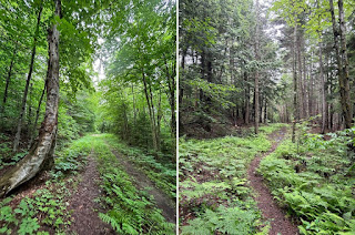
Aqueduct Loop is a mix of old woods road and single track

Nice little swimming hole for Great Glen employees to cool off in

Great Glen Trails

NH 16

Signs and interesting points of interest along the way

Moriah / Carters / Wildcat Traverse

Date
Memorial Day Weekend ~ Click below to view trip report
Miles
Elevation Gain
5/28
13.0
4,400
5/29
20.0
8,150
5/30
26.2
6,600

Date of Hike: 5/29/11

Carter-Moriah Trail: 13.8 miles
Wildcat Ridge Trail: 3.0 miles
Ski Trails (Upper Polecat, Middle Wildcat, Lower Wildcat, Wild Kitten): 3.2 miles
Total Miles: 20.0 (8,150 elevation gain)
- With the weather improving it was time to start hiking big traverses, up first the Wildcat/Carter/Moriah Traverse.  The first 8.5 miles I'd be hiking solo from Moriah to North Carter where I'd meet up with Alton and Patrick and hike over the Carters and Wildcats.
- On Trail at 5:30am, Moriah, 7:30am, North Carter 9:45am, Height 11:30am, Carter Dome, 12:00pm, Wildcat A 1:15pm, finished 3pm. Temps in the 60's in and out of the clouds with hazy views and light wind.
- I'm not a huge fan of the Carter Moriah Trail past Mount Surprise, it always takes me longer to get to the summit than it seems it should.
- From Moriah to North Carter would be my first time on that section of the Carter-Moriah Trail.  From Mount Moriah to the Stony Brook Trail junction is simply beautiful walking in and out of the scrub over ledges with terrific views of the Carters and the Presidential Range. I wouldn't want to be out there in the winter though, looks like it'd be tough to follow the trail in the snow.  I also really enjoyed the steep ascent up to North Carter which has a few tough scrambles.
- I ran into a bunch of people backpacking the Carters and Moriah along the way.  Some were happy but others looked spent and miserable!
- At the North Carter Trail junction I proceeded to hike at a solid pace over the Carters and Wildcats.  I stopped at Mont Height where views were good to the north but socked in everywhere else.
- The hike up to Wildcat and over the ridge drained me.  This hike has lots of elevation gain and it's over unforgiving terrain but I sucked it up and kept on moving.
- I took the ski slopes back down, staying on the Polecat Ski Trail for awhile then cut back across the mountain under the ski lift, and wrapped back down going under the zip lines.
- While heading down the slopes the Views across to Washington opened up make for some spectacular scenery!

 Carter-Moriah Trail heading away from Moriah towards the Carters

 Imp and Moriah Mountains from just below North Carter

Hiking down the Wildcat Ski Trail with Mount Washington in view

Middle & South Carter, Carter Dome, Wildcat A & D Peak (#18, #19, #20, #21, #22)

Date of Hike: 2/13/10

Nineteen-Mile Brook Trail: 1.9 miles
Carter Dome Trail: 1.9 miles
Carter-Moriah Trail: 6.8 miles
Wildcat Ridge Trail: 2.7 miles
Polecat/Tomcat Ski Trails: 2.5 miles
Total Miles: 15.8 (6,200 elevation gain)

Trip Report:
- Left RI at 3am, on trail at 7am, finished around 3:30
- Temps in the mid teens to high twenty's, wind gusts around 25mph out of the NW above 4,000 feet. Cloudy skies until noon then clear skies with 75 miles plus visibility!
- Made good time up Nineteen-Mile and Carter Dome trails. Carter Dome Trail has a series of seven switchbacks on it which are pretty annoying, two of which are really long and boring!
- At Zeta Pass I switched from microspikes over to snowshoes and booked it over to South Cater, however as soon as I started over to Middle Carter the trail was hard to follow with some snow drifts. Unfortunately the White AT blazes on the trees that you always see when you don't need to see them were few and far between but I stayed on the trail except for one part and was able to get to Middle Carter summit without much of a problem
- Once I got back to South Carter I finally started running into a bunch of people, a dozen over to Carter dome and another eight or so down to Carter Notch
- The hike up to Carter Dome was a struggle at times, the trail was very choppy and narrow and the winds picked up near the summit
- Switched back to microspikes for the hike down to Carter Notch and on the steep parts I glissaded down being careful not to lose control and go into a tree, rock, or over a very long drop!
- Stoped in at Carter Notch Hut to refuel, warm up, and energize myself for the steep climb (1,050 feet in .7 miles) up to Wildcat A Peak
- In the "It really is a small world" outside the hut I bumped into Bill who was the guy who picked me up when I was trying to hitch-hike last month! We then set off for Wildcat and bumped into Jeremy (Rocket 21) who I met on Franconia Ridge in December, and Eric and we all set off to tackle the Wildcat Ridge. Both Jeremy and Eric have done a single season Winter 48 in the past which is a pretty amazing accomplishment!
- The Hike over the Wildcat Peaks was great and the views of the northern presidentials were kick ass!
- Once we got to the Wildcat Ski Area we descended the Polecat trail and enjoyed the close up views of Tucks and Huntington Ravine as skiers and snowboarders zoomed by us
- Back at the Parking lot Jeremy had his truck and let Bill and I get a lift along with him and Eric back to the trailhead which saved us a boring dreadful road walk!

Pictures: Click here for all pictures

Carter-Moriah trail
Carter Dome from Wildcat A Peak
Mount Adams and Madison
Mount Washington from Wildcat Ridge trail
Wildcat Ski Area
Views while hiking down Polecat ski trail
Video: Walking down polecat with skiers going by

Mount Height, Carter Dome, Wildcat A - D

Date of Hike: 11/22/09

Nineteen-Mile Brook Trail: 1.9 miles
Carter Dome Trail: 1.9 miles
Carter-Moriah Trail: 2.6 miles
Nineteen-Mile Brook Trail: .4 miles
Wildcat Ridge Trail: 2.8 miles
Polecat Ski Trail: 2.6 miles
Route 16: 2.5 miles
Total Miles: 14.7 (elevation gain, around 5,000)

Trip Report:
- On trail at 7:45, finished at 3pm. Weather was in low 30's to low 40's, no wind, sunny, no clouds, fantastic 75+ miles views
- All trails in good shape, very little ice on ridges, no blow-downs anywhere
- Carter-Moriah trail to Mount Height becomes very steep
- Views on Mount Height are phenomenal!  You have a clear view of the northern Presidential range including up close views of Tuckerman and Huntington Ravine as well as the Great Gulf, and Madison Gulf, as well as terrific views to the north and east into Maine
- Big group of teenagers at Carter Notch Hut, they had good equipment and must have been part of a hiking club
- The buildings at Carter Notch seem to be newer, lots of improvements seem to have been made over the past few years
- Climb up to Wildcat A was excruciating, elevation gain over 1,000 feet in just .7 miles, the first .4 is up-up-up then comes very annoying switchbacks the last .3 miles
- Met a "hippie type" person on summit of A Peak, he was there with his dog, he and the dog smelled like weed!
- Caught second wind on the ridge over B, C, and A peak
- Killer views from the ski station of Washington, Adams, and Madison
- There was a trail runner there with a can of bear mace, kind of overkill
- Spent a good half-hour at summit stuffing my face with PB&J sandwiches and M&M's!
- Walk down Polecat ski trail was great, had the ravines of Washington in front of me the whole way!
- Walk back on route 16 was tiring, thought about hitching but I gutted it out, fat tourists driving by gave me the weirdest looks!
- Hiked at a quick pace, I did 5,000 feet elevation gain in 5 hours...I slept 11 hours when i got back to RI!

Pictures: Click here for all pictures

Carter Dome from Mount Height

Mount Washington from Mount Height

Carters from Carter Dome

Carter Notch Hut and Wildcat A Peak

View from Wildcat Ski Station

Madison Gulf, Mount Adams & Madison from Polecat Ski Trail

Wildcats and Carter Dome

Date of hike: 8/16/08

Lost Pond Trail: .9 miles
Wildcat Ridge Trail: 5.1 miles
Carter-Moriah Trail: 2.6 miles
Carter Dome Trail: 1.9 miles
Nineteen Mile Brook Trail: 1.9 miles
Total Miles: 12.4

Trip Report:
- Solo hike, weather was terrific (65 degrees) up until Carter Notch Hut
- Wildcat Ridge Trail was steeper than I expected!
- Magnificent views from the top Wildcat ski area into the ravines of Mount Washington and the Northern Presidentials
- Within minutes of summiting Carter Dome, temperature dropped 10-15 degrees, wind picked up, sky turned black, rain, hale, thunder and lightening all around me
- Ran down trail to Zeta Pass to safety and aborted my original plans on hiking the rest of the Carter-Moriah Trail to Mount Moriah

Pictures: Forgot my camera!

Carter Notch Pond

Wildcat "A" Peak (4,422 feet)

Wildcat "A" Peak and Carter Notch from Carter -Moriah Trail

Wildcat Mountain AKA Wildcat "A" Peak is the northernmost peak on the Wildcat Ridge and it's five peaks A through E, with D Peak being the other "official" 4,000 foot peak. Wildcat summit is located on the Wildcat Ridge Trail (AT) and is a wooded summit that has an outlook nearby the looms high above Carter Notch with views across to Carter Dome and the Carter mountain range. The quickest way to get to Wildcat A Peak is from the Nineteen-Mile Brook Trail to Wildcat Ridge Trail.

Trails I've Hiked:

-Wildcat Ridge Trail: From Pinkham Notch Visitor Center 5.2 miles, 3,250 feet via Lost Pond Trail. From Nineteen-Mile Brook Trailhead 4.2 miles, 3,000 feet.  The hike to A Peak from Nineteen-mile Brook Trail has easy to moderate grades with good footing until you reach the Wildcat Ridge trail where the terrain becomes very steep with a rough and rugged trail for the last .7 miles and elevation gain of 1,050 feet.  The hike to Wildcat A Peak along the Wildcat Ridge over all peaks is very steep from the trailhead to Wildcat E Peak with some pretty open ledge scrambles that can be difficult to novice hikers and dangerous when wet.  The hike along the ridge is very rough with many ups and downs along the way that can be tiring. However the views from the open ledges of Mount Washington and Pinkham Notch are spectacular!

Trip Reports:

March 16th, 2015: Up Polecat Ski Trail, across and down Wildcat Ridge Trail, down Nineteen-Mile Brook Trail

January 17th, 2015: Up Nineteen-Mile Brook Trail, across and down Carter-Moriah Trail, up and across Wildcat Ridge Trail, down polecat ski trail, road walk on Route 16

December 22nd, 2014: Up Polecat Ski Trail, across and down Wildcat Ridge Trail, up and across Carter-Moriah Trail, down Imp Trail, Camp Dodge Cutoff, and Route 16

June 22nd, 2013: Wildcat/Carter Traverse

May 5th, 2012: Wildcat/Carter Traverse

July 30th, 2011: MMD - More and More Difficult: "Pinkham Notch Loop" Dolly Copp Road, Route 16, Up North Branch of Imp Trail, across Carter-Moriah and Wildcat Ridge, down Polecat Ski Trail, up-over-down Lila's Ledge to Old Jackson Road, Up Tuckerman Ravine and Lion Head to Washington, across Clay, Jefferson, Adams, and Madison via Gulfside, Clay Loop, Jefferson Loop, Isreal Ridge/Lowe's Path, and Osgood Trail, down Daniel Webster-Scout Trail, road walk back to Barnes Field

May 29th, 2011: Moriah/Carter/Wildcat Traverse

September 5th, 2010: Wildcat/Carter Traverse

February 13th, 2010: Up Nineteen-Mile Brook, Carter Dome Trail, Carter-Moriah Trail (South & Middle Carter), on to Carter Dome, down to Carter Notch, up and across Wildcat Ridge Trail, down Polecat Ski Trail

August 16th, 2008: Lost Pond Trail, up-across-down Wildcat Ridge Trail, Up Carter-Moriah Trail, down Carter Dome and Nineteen-Mile Brook Trail


November 22nd, 2009: Up Nineteen-Mile Brook, Carter Dome Trail, Carter-Moriah Trail, up and across Wildcat Ridge Trail, down Polecat Ski Trail