
Date of Run: 7/19/17
Valley Way: 3.8 miles / Osgood Trail: 1.0 miles / Gulfside Trail: 0.3 miles / Airline: 0.6 miles / Lowe's Path: 0.3 miles / Gulfside Trail: 1.4 miles / Jefferson Loop Trail: 0.7 miles / Gulfside Trail: 0.8 miles / Clay Loop Trail: 1.2 miles / Gulfside Trail: 1.1 miles / Crawford Path: 1.6 miles / Monroe Loop Trail: 0.7 miles / Crawford Path: 1.2 miles / Eisenhower Loop Trail: 0.8 miles / Crawford Path & Webster-Cliff Trail: 4.3 miles
Total Miles: 20.0 (8,908 feet elevation gained) A.M.C. White Mountain Guide Online
Trip Report:
- The weather forecast for Wednesday morning was perfect to be above treeline, mid to high 50's above 5,000 feet, with a steady and refreshing breeze. I took advantage of the optimal weather to run a Presidential Range Traverse.
- I started at 5:25AM from Appalachia and headed up Valley Way setting an aggressive pace over the first two miles before throttling down for the final two mile push up to Mount Madison, reaching the top in 1 hour 25 minutes. From the top, I zoomed back down to Madison Spring Hut for a five minute break to refill on water and refuel before moving on.
- Conditions above treeline couldn't have been any better, the boulder field that makes up the northern Presidential Range was easy to maneuver since the rocks were dry and grippy, and it was not hard to maintain the pace I wanted to from Madison through Washington.
- My strategy for this section was to "run" the flats and downs, and by run I mean jog, there's only a small handful of trail runners I know that can aggressively run through this stretch. As far as the ups went I would quick hike them, but not overdo it as I wanted to save my strength for the Southern Presidential Range.
- The ascents I had to deal with were the following...
- (1) Madison Spring Hut to Adams, via Gulfside Trail and Airline, which is a steady uphill grind, the Gulfside Trail has good footing, Airline has odd shaped boulders, not built for speed. I reached Mount Adams 2 hours 1 minute after starting
- (2) Edmands Col to Jefferson, via Gulfside and Mount Jefferson Loop, the Gulfside rises steeply over nasty footing up to the Jefferson Loop Junction, it's a butt-kicker, once on the loop trail the grade eases and the footing improves but it's still a grind up to the summit. I reached Mount Jefferson 2 hours 39 minutes after starting
- (3) Sphinx Col to Clay, via Gulfside and Mount Clay Loop, steady grind but easier than the previous two, footing is ok to rough, there's a small PUD between the actual summit and a false summit. I reached Mount Clay 3 hour 6 minutes after starting
- (4) One mile to Washington, via Gulfside or Gulfside and choo choo tracks. On this day I took a "shortcut" as the Gulfside skirts the tracks, so I jumped off trail and followed the swath next to the tracks up to the summit, the advantage of this is the path next to the tracks is a mix of gravel and small compacted rocks making it easier to maintain a solid quick hiking pace, the disadvantage is the cog train, it's not a pleasure to walk next to, especially if it's the coal train which smells and is very loud! Luckily, it was early enough in the morning that no trains had reached the final push up to the summit cone so I took advantage of easy path next to the tracks. I reached Mount Washington 3 hours 35 minutes after starting
- I almost had the whole summit to myself, I took a quick picture of the summit sign and headed into the cafeteria for a quick ten minute break to refill my water, prepare my gear for the second part of the hike, and to chug a Powerade that I bought, along with a Snickers bar for a much needed taste change from the gels and energy waffles I had been consuming over the first ten miles.
- Now it was time to run the Southern Presidential Range, basically it's all downhill with three very short and easy ups, Mount Monroe, Eisenhower, and Pierce. I got back on trail 3 hours and 45 minutes into the run and I had saved my energy for this section, I set my sights on a sub 5 hour and 30 minute finish.
- The southern section I break down into four parts...
- (1) The drop down to Lakes of the Clouds and up to Mount Monroe, via Crawford Path and Mount Monroe Loop. The 1.5 mile descent to Lakes of the clouds is down a rock staircase with meticulously placed boulders making for a sidewalk type of footing compared to the northern section. From Lakes of the Clouds is a short steep up to the summit of Mount Monroe. I reached Mount Monroe 4 hours 11 minutes after starting.
- (2) Monroe to Eisenhower, Crawford Path and Mount Eisenhower Loop. This section is where the rock field of a trail disappears into mostly dirt and some slab, it's built for speed and why I saved my energy for the second half so I could open up my stride to try and achieve the sub 5:30 goal. I reached Mount Eisenhower 4 hours 38 minutes after I started
- (3) Ike to Pierce via Crawford Path and Webster-Cliff Trail. Child's play compared to the rest of the run, easy drop off of Eisenhower and and easy up to the summit of Pierce. I reach Mount Pierce 4 hours 57 minutes after I started.
- (4) Descent to the Highland Center via Crawford Path. This trail is heavily used, so it keeps getting more eroded as years pass by, but the A.M.C. trail crews have been out the past two years working on slowing this erosion down, building rock steps and water bars, and it's helping, as there is definitely less standing and running water over the lower half of the trail. I had recently ran this section as part of my RUN NH48 project so I knew what I was in for. I finished 5 hours 24 minutes after I started, feeling really strong and fresh, much different than last weeks Pemi Loop run where I was exhausted, of course there is no cafeteria in the middle of a Pemi Loop!
- Back at the Jeep I changed into dry clothes, relaxed, ate some real food, and headed home, not a bad way to spend the morning.
- And that is how you run a Presi Traverse :)
Breaking above treeline at Madison Spring Hut just before breakfast would be served
Madison casts a shadow over Madison Spring Hut
Summit of Mount Adams
Mount Washington looming large over the Great Gulf Wilderness
Sun shining brightly over Madison's summit cone
View of JQ Adams, Star Lake, and Mount Madison from Mount Adams
Next three objectives in sight, Jefferson, Clay, Washington
Just past Thunderstorm Junction is a stretch of the Gulfside that is what the Presidential Range is all about...rocks, lots and lots of rocks!
Dropping down into Edmands Col
Mount Clay and Washington as seen from Jefferson's summit
Looking back north to Mount Adams
Running down the Mount Jefferson Loop
Monticello Lawn, a beautiful spot!
Heading up Mount Clay Loop, the trail curves on up to the summit on its final push
Mount Clay has two bumps, the northern one is the actual summit, between these bumps is a tiny PUD
Northern Presidential Range
If you get up here early enough you have the summit to yourself!
Hi up on the Crawford Path looking down upon the Southern Presidential Range
Lakes of the Clouds and Mount Washington
What a spot for a great view, taken along the Mount Monroe Loop
Cross cairn on the Mount Monroe Loop
Next up, Mount Eisenhower
Heading up the Mount Eisenhower Loop, if you look back down you get a cool view of cris crossing paths
View to the north from Mount Eisenhower
Descending the Mount Eisenhower Loop, Mount Pierce in view
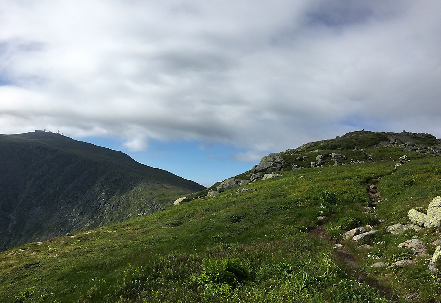
Class end of the day Presidential Range pic, taken a few hundred feet from Mount Pierce's summit
Trails taken throughout the day
Summit pins *** this is an old photo from last November, but i think it's cool to add in here
Elevation over distance profile. I skipped Franklin, the trail skirts just below the actual summit. If you are hiking it I highly recommend taking the herd path to the summit, it's a very short side trip, with great views into the Dry River Wilderness
Route for the day
Splits. My watch recorded 18.2 miles, the A.M.C. White Mountain Online Guide recorded 20 miles!
No comments:
Post a Comment