Date of Hike : 8/28/21
Airline: 4.3 miles / Lowe's Path & Israel Ridge Trail: 0.3 miles / Gulfside Trail: 4.1 miles / Westside 0.9 miles / Crawford Path: 2.9 miles / Mount Eisenhower Trail: 2.1 miles / Dry River Cutoff: 1.7 miles / Mount Clinton Trail: 0.5 miles / Webster-Cliff Trail: 0.9 miles / Crawford Path: 1.2 miles / Mount Eisenhower Loop: 0.8 miles / Crawford Path: 1.4 miles / Mount Monroe Loop: 0.7 miles / Crawford Path: 1.5 miles / Gulfside Trail: 1.1 miles / Mount Clay Loop: 1.2 miles / Gulfside Trail: 0.7 miles / Mount Jefferson Loop: 0.7 miles / Gulfside Trail: 2.4 miles / Osgood Trail: 1.0 miles / Valley Way: 3.8 miles
Total Miles: 34.2 (13,300' elevation gained)
Trip Report:
- This summer has been very warm and humid above treeline along with low wind speeds, directly resulting in lower motivation and enthusiasm to get out and spend several miles roaming around in the alpine zone. Luckily, the humidity finally broke on Friday and Saturday setting up a perfect day to do the lazy runner Double Presi Traverse which includes all the sights and sounds of a double with twenty percent less effort!
- The route for the day was to bag Mount Adams first, bypass all the peaks as I headed south before dropping down into and out of the Dry River Wilderness until reaching Mizpah Hut, then hitting up Pierce, Eisenhower, and the rest of the gang on the way back north. Hence, the A-P-E in the Very APE Presi.
- I arrived at Appalachia just before 5:45AM to a full parking lot, thankfully I was able to score the first spot outside the lot and quickly got my gear ready before taking off up the Airline Trail.
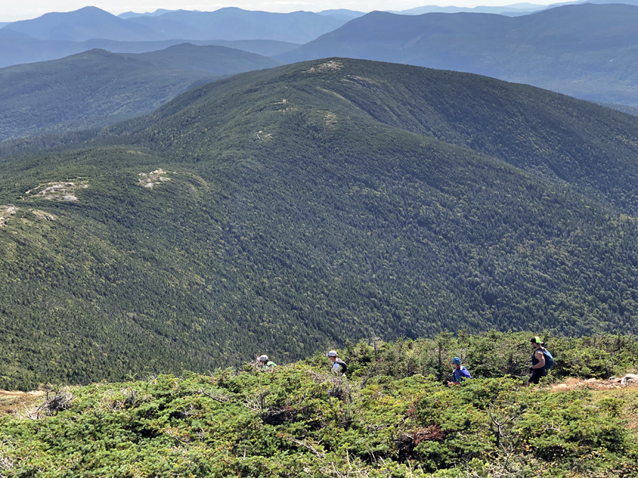
- Airline can be broken up into four sections, the first 1.5 miles is an easy grade with good footing through open hardwoods, very beautiful during October foliage. After 1.5 miles the woods start to close in while transitioning to softwoods, not beautiful - gangly pines, the trail also becomes steep and extremely rugged for the next mile until just before reaching treeline. Next up is the section of the small knifes edge of Durand Ridge which affords excellent views into King Ravine. Finally, the last half mile Airline blends into the summit mass of Mount Adams over the usual boulder terrain of the northern Presidential Range.
- Since I got an early start the trail was extremely quiet, I only saw three hikers on the way up to Adams and made sure to enjoy the lack of people as I knew it would only be a matter of time before I was swimming by schools of hikers.
- Once past Adams I hooked onto the Gulfside Trail and cruised around the summits of Jefferson and Clay, under overcast skies, temps around fifty with a nice breeze, still along very quiet trails, so far so good!
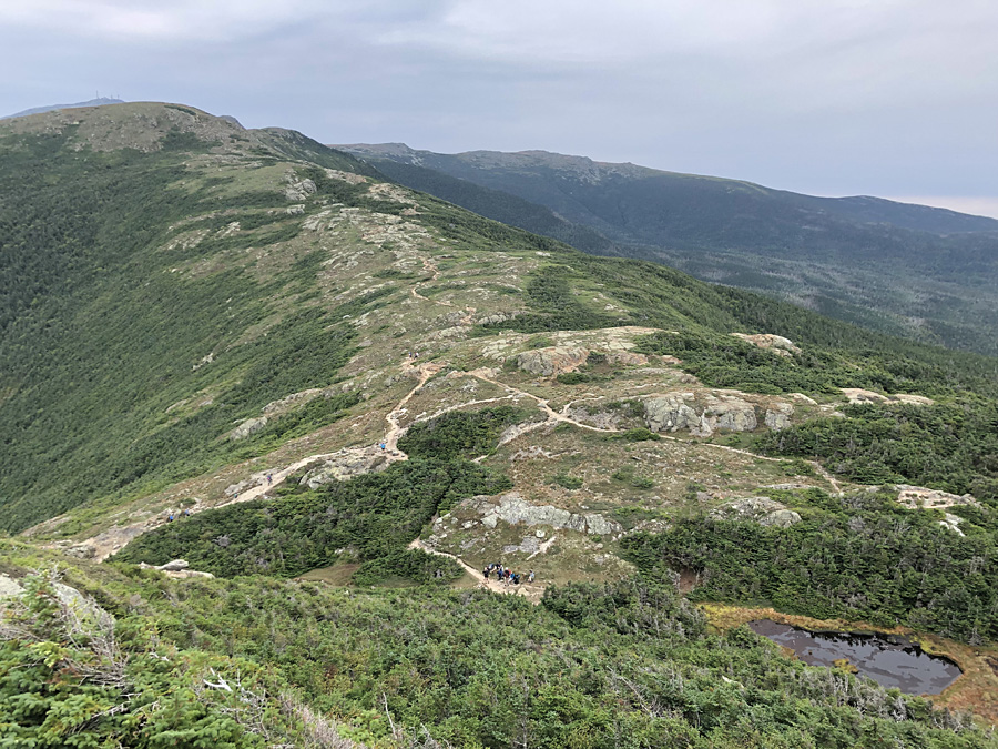
- However, the quiet and peaceful trails would soon come to a crashing end, as I was curving below the summit cone on the Westside Trail I could see a line of hikers shuffling their way up Crawford Path. After seeing about ten hikers over the first ten miles I probably passed three dozen in the one mile down to Lakes of the Clouds Hut. At the hut I quickly filled up my water and went on my way along the Crawford Path around Mount Monroe towards Mount Eisenhower, it was already busy here too, which was somewhat surprising, the good news was soon enough I'd be back to peace and quiet.
- Before reaching Mount Eisenhower I dropped off the Crawford Path into the Dry River Wilderness. Over the next four miles I would be completely alone on the Mount Eisenhower, Dry River Cutoff, and Mount Clinton trails. Seldom used, these trails have not been worn down to rock and show no signs of erosion, they are over cushiony dirt, fallen pine needles, old bog bridges, a little mud, and a little overgrown.
- I made good time running down the Mount Eisenhower Trail then quick hiking the Dry River Cutoff and Mount Clinton trails up to Mizpah Spring Hut, arriving at 10:45AM, five hours after I left Appalachia. It was quiet at the hut so I took a short break to eat and refill my water before the steep burst up to Mount Pierce's summit.
- Once on the summit I was back on popular trails, passing by dozens upon dozens of hikers and a few runners. A few people were really interested in what I was up to but they all quickly become confused when I tried describing the route and pointing things out, so I just gave up and said I'm doing the traverse.
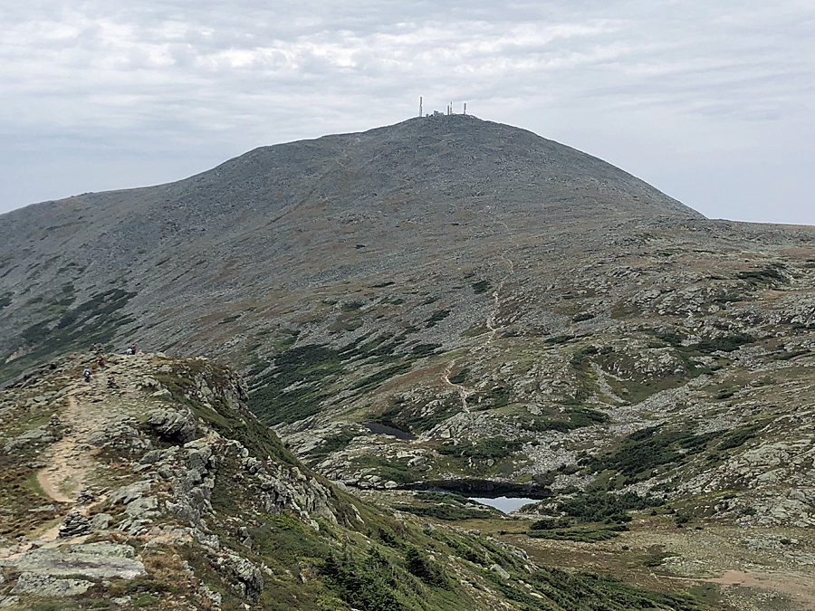
- Some other observations from the hike between Pierce and Washington. Yes, the Crawford Path and loop trails to the peaks are more crowded than ever, between new people to hiking, backpackers, thru-hikers, and trail runners there is not much of a reprieve from the masses but 99% percent of the people are in a great mood and happy to greet you. However the summit of Mount Washington was tough to be on when I quickly passed through just before 1PM. People swarming everywhere (see pic below). To make things worse there were a couple of people smoking cigarettes on the summit, pretty gross. Thankfully I restocked on water at Lakes of the Clouds so I there was no need to stop so I zoomed on off the summit, unfortunately I caught the smelly coal train chugging up to the summit as I crossed the tracks.
- After passing the Cog, I scooted up and over Clay and Jefferson enjoying comfortable temps in the mid fifties along the way, there was no wind but no humidity as well making for easy hiking and running. Almost everyone I saw was in long sleeves and light gloves, there were only a handful of people in shorts and tshirts, not too many locals out and about today, as we are in shorts and T's between mid April and October when the temps are above forty five degrees!
- Since I summited Adams in the morning I cruised around the summit cone down to Madison Springs Hut before my last climb of the day to Mount Madison arriving just after 3PM. I took a break here to finish off the last of my electrolyte drink, stuff my face with chocolate, snap some pics, and talk to a couple of guys doing a multi day south - north traverse staying at the huts. I was pretty hungry so I was jealous thinking of the hut dinner and desserts they were going to get this evening.
- The trip back down Valley Way to Appalachia was uneventful as usual, I lucked out as it started to rain as I hit treeline, but after about a mile the rain stopped and the trails were dry making the last three miles easy as I finished just at 4PM about 10 hours and 15 minutes after I started.
- Back at the Jeep I cleaned myself off, changed into dry clothes, and downed some ice cold water before heading home to hang out with Sarge. :)
Elevation over distance profile
Airline, steep and rugged heading up to treeline
Madison Spring Hut and the summit cone of Mount Madison early in the morning
Star Lake and Mount Madison as seen from Mount Adams
Tiny bit of undercast in the Great Gulf below Jefferson and Washington
Some rays of sun breaking through and shining over the Carter-Moriah range
Along the Gulfside Trail heading to Mount Jefferson
Gulfside Trail with Mount Clay in view
View of the Cog Railway and the southern Presidential Range from the shoulder of Mount Clay
North Presidential Range (Jefferson, Adams, Madison)
On the Crawford Path approaching Lakes of the Clouds with Mount Monroe in view
Lakes of the Clouds and Mount Washington
View from the Mount Monroe Loop Junction
Heading towards Mount Eisenhower
Mount Eisenhower Trail
Dry River Cutoff
Dry River Cutoff and Mount Clinton Trail
Reaching Mizpah Spring Hut
Mizpah Spring Hut
Summit of Mount Pierce looking north to Eisenhower
Looking back at Mount Pierce from the Mount Eisenhower Loop
View from the summit of Mount Eisenhower
Red Pond and the diverging paths at the bottom of Eisenhower's summit cone
Presidential Lawn AKA Franklin Flats between near Mount Franklin
Looking south from Mount Franklin
Dry River Valley
Lil' Monroe, Monroe, and Washington
Monroe as seen from Lil' Monroe
Washington from Monroe's summit
Busy afternoon on the rockpile!
Choo Choo!
Three trains heading down the tracks in the early afternoon
Looking at Jefferson from Mount Clay Loop
Monticello Lawn - Clay and Washington
Mount Adams from Mount Jefferson Loop
Thunderstorm Junction
Madison Spring Hut from Osgood Trail
Adams and Washington from Mount Madison's summit
Tiny Pine Mountain and the town of Gorham, home of Sgt. Pepper!
Trails taken, Appalachia through Dry River Wilderness
Trails taken, Mizpah Hut back to Appalachia
Signs spotted along the trek