1/6/24
Lincoln Woods Trail / Bondcliff Trail / West Bond Spur: 22.6 miles (4,700' elevation gained)
Trip Report
- On Saturday I joined five other Gridders in welcoming a new Gridder to the Gridiot club. (hiking all the New Hampshire 4000 footers in each month 48X12=576).
- Today's group consisted of Jason, two NH48 Grids and one NE67 Grid, Leah, one NH48 Grid and 2 peaks away from the NE67 Grid, myself, 2 NH48 Grids, Todd & Nate, one NH48 Grid each, and Tyler, who would be finishing his NH48 Grid on West Bond. Today also doubled at Tyler's 33rd Bday!
- We started at 8AM an hiked five miles along the old East Branch railroad grade to camp 16 clearing. Three miles on the Lincoln Woods Trail and two miles along the lower section of the Boncliff Trail. Originally, this five mile stretch was called the Wilderness Trail, then the first three miles changed to the Lincoln Woods Trail, then all five miles became the Lincoln Woods Trail, and now it's Lincon Woods Trail to the Pemigewasset Wilderness boundary and Boncliff Trail from there all the way to the Twinway junction on Mount Guyot.
- We made quick work of the five flatish miles to the hard left turn at Camp 16. With the lack of snow this winter we traveled over mostly bare ground with some ice and frozen mud scattered about here and there.

Crossing a mostly frozen tributary that spills into the East Branch of the Pemigewasset River. Most winters this is buried in snow and easily crossed.
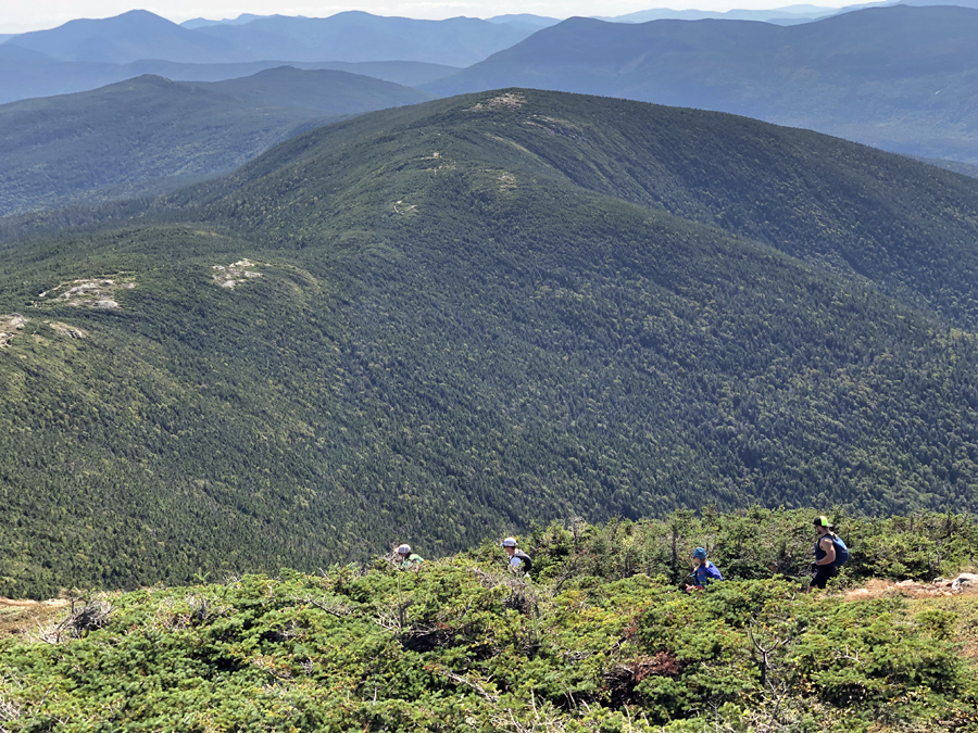
- Once turning left at Camp 16 clearing we made the long slog up to Bondcliff. It is around 4.5 miles, all but 0.1 miles of this is along a gradual to moderate grade so the trail takes its sweet time making it up the summit. The reward of this long approach is a top five view in the White Mountains when one reaches the Cliffs of Bond sitting high above Hellgate Ravine.

Bondcliff, rising high above Hellgate Ravine with West Bond and its slides (Guitar and the four Monster Slides) and Mount Bond in the upper right background.

Simba leading the way past the Bondcliff summit area

View of Owl's Head with Franconia Ridge and Garfield Ridge behind it

Tyler and Simba on Bondcliff
- From Bondcliff we quickly dropped into the col before trudging up to the summit of Mount Bond. The hike along Bondcliff Ridge to the summit of Bond is almost all above treeline, just the final 0.25 miles is back in the woods before popping out onto the open summit of Bond.

The gang leaving Bondcliff

Simba pacing us all up to Mount Bond

Hanging out on Mount Bond

All smiles on Mount Bond!
- After taking a short break we made our way over to West Bond running into a few familiar faces along the way before steeping on the summit, #576 for Tyler's Grid finish!
- West Bond's summit is perched high above Hellgate and Redrock ravines with tremendous views of the Pemi wilderness.
- We took a nice little break on the summit to celebrate and snap pictures while taking in the great views.

Celebratory shot of fire ball

Enjoying Tyler's finish on West Bond

Bondcliff as seen from West Bond
- Now it was time to reverse course and retrace our footsteps back to Lincoln Woods. As we headed over Mount Bond and down to Bondcliff the clouds started lowering and the first snowflakes from the incoming storm started to fall but we were well below treeline before the summits became obscured so we got to enjoy the 360 degree views on the hike back across the ridge.

Heading back to Bondcliff

Todd, Nate, and Leah in the Bondcliff/Bond col with Owl's Head and Lafayette and Lincoln, in the clouds, behind it

Heading down from Bondcliff's summit

The gang makes their way to treeline
- Back below treeline we carefully jogged down to the railroad grade and then ran the grade back to the wilderness boundary where we quick hiked the final three miles to our cars, finishing just over six and a half hours after we started.
- At Lincoln Woods we hung out for about twenty minutes while having a tasty beverage and snacks before heading our separate ways after a great day out on the trails.
- Huge congrats to Tyler for completing a major hiking accomplishment and I was happy to be able to tag along with a strong and fun group that made the long miles pass by quickly and easy.

Gridiots
Summit of West Bond
From left to right (myself, Todd, Tyler, Leah, Nate, Jason)