Showing posts with label Mount Tripyramid Trail. Show all posts

The Tripyramids

Date of Hike: 10/27/12
Livermore Trail: 3.6 miles
Mount Tripyramid Tral: 4.9 miles
Livermore Trail: 2.6 miles
Total Miles: 11.1 miles
3,000 feet elevation gain

 
 Livermore Trailhead
 Hiking along the Livermore Trail
 All the leaves are down on the Livermore Trail
 The Livermore Trail
 Soft footing on the Livermore Trail
Hurricane Irene erosion 
 Washed out Livermore Trail
 Hurricane Irene devastation
 Avalanche Camp
 Moun Tripyramid Trail North Slide Junction
 Mount Tripyramid Trail
 Heading to the North Slide
Bottom of the North Slide 
 Mount Tripyramid Trail
 Looking up the narrow bottom of the slide
 A short steep crack in the trail
 Looking down the short steep crack
 Osceolas and Tecumseh Mountains
 Kelsey makes it back to the trail
 Looking up the North Slide
 North Slide of Tripyramid
 Mount Tecumseh and Waterville Valley
 The North Slide of Mount Tripyramid
 Top of South Slide
 Looking down the South Slide
 Mount Tripyramid Trail
 Sandwich Range Boundary
 Mount Tripyramid South Slide Junction
 Dogs on Livermore Trail
 Friendly dog!
 Livermore Trail
 Livermore Trail info
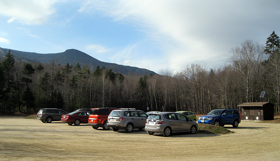
Livermore Parking area and Mount Tecumseh

The Tripyramids

Date of Hike: 8/8/10

Livermore Trail: 3.6 miles
Mount Tripyramid Trail: 4.9 miles
Livermore Trail: 2.6 miles
Total Miles: 11.1 miles (3,000 feet elevation gain)

Trip Report:
- One of my favorite sections of trail to hike in the White Mountains is the slide below the summit of Mount Tripyramid's North Peak. It's extremely steep (ascending 1,200 feet in just .5 miles), has some pretty fun scrambles, and amazing views once you break out into the exposed upper section of the slide.
- On trail at 7am, finished at 12pm, temps in the 60's with great views from both the north and south slides.
- The hike along the Livermore trail was very boring early in the morning but went by pretty quickly and so did the bottom half of the Mount Tripyramid trail until I reached the foot of the north slide.
- Once I started hiking up the slide the real fun began as the higher I climbed the greater the views became of Waterville Valley / Mount Tecumseh, the Osceola's, and the Franconia Ridge all the way to the Presidential Range.
- Near the top of the slide I ran into the first two hikers of the day who had camped out near North Tripyramid's summit and were actually hiking down the North Slide, they were taking there time and having lots of fun taking in the incredible views.
- Once gaining the ridge the hike over to Middle and South Tripyramid was very uneventful as there are no views except for an outlook at Middle Tripyramid.
- Heading down the South Slide went pretty smoothly, I find it much easier to navigate than the North Slide as it doesn't seem nearly as steep.
- Hiking the Livermore Trail was much more fun on the way back as I passed by hikers, bikers, runners, and a few dogs all enjoying the perfect weather.
- Back at the car I contemplated hiking up Mount Tecumseh seeing that it was only noon-time but I decided to head back to RI.  I was pretty worn down from the long hike I did the day before and I was battling a nagging annoying cough which I blame on my air conditioner!

Pictures: Click here for all Pictures

Lower Section of the North Slide
East Peak Osceola and Mount Osceola
Hiker Making His Way Down
the Upper Section of the North Slide
Mount Tecumseh and Waterville Valley

Middle Tripyramid Mountain (4,140 feet)

Tripyramids from Waterville Valley Ski Slopes

The Tripyramids are located in the Sandwich Wilderness and of the three summits two of them are official 4,000 footers (North and Middle).  The summits are wooded although Middle Tripyramid has two decent outlooks on the summit.  There are a couple of different hiking options to reach the summits, from Route 112 (Kancamagus highway) you can take the Sabbaday Brook and Pine Bend Brook  trails which are pretty tame and in the woods the whole way.  From Waterville Valley - Tripoli Road - Livermore Trailhead you can hike a loop via the Livermore Trail to the Mount Tripyramid Trail through steeper, tougher, and more fun North and South Slides and take in the magnificent views while climbing up and down the slides!

Trails I've Hiked

-Livermore / Mount Tripyramid Trail: 4.8 miles, elevation gain of 2,600 feet to North Tripyramid. 6.8 miles elevation gain of 3,000 feet. Loop over the Tripyramids and back 11.0 miles, elevation gain of 3,000 feet. The Livermore trail is basically old logging roads with great footing and almost level walking. The Mount Tripyramid Trail makes a loop over all three summits back to the Livermore trail. The trail has moderate grades below the slides with ok footing. The slides are steep with awful footing but the views are incredible. The North Slide is more open and more challenging and is easier to ascend than descend. Experienced hikers will love this as it's pretty steep over slabs then loose boulders and scree. The South Slide is not as open but easier to navigate (although more loose) as it's mostly crushed rocks and gravel. The hike along the ridge between the three peaks has easy and moderate grades but is in the woods with no views. Caution should be used on the slides, which can be dangerous when wet and icy or unnerving even when dry for inexperienced hikers. The Livermore trailhead is located on Tripoli Road near the Waterville Valley Ski Area.

-Pine Bend Brook / Mount Tripyramid Trail: 4.0 miles, elevation gain of 2,800 feet to North Tripyramid. 4.8 miles, elevation gain of 3,200 feet to Middle Tripyramid. The Pine Bend Brook Trail is in the woods with no views. The trail has easy grades with decent footing until reaching the Sandwich Wilderness boundary where the trail soon becomes steep and the footing becomes rough until reaching the junction of the the Scaur Ridge Trail where the grades become easier until the final pitch up to the summit of North Tripyramid over minor scrambles over ledges that are usually wet. Continue on the Mount Tripyramid Trail to Middle Tripyramid with a moderate descent and ascent in the woods along the ridge with ok footing.

Trip Reports:

April 16th 2016: Up Livermore, Scaur Ridge, and Mount Tripyramid Trails, out and back via Kate Sleeper, Rollins, and Dicey's Mill Trails, down Mount Tripyramid and Livermore Trails

December 5th, 2015: Up Livermore and Mount Tripyramid Trail, down Pine Bend, Scaur Ridge, and Livermore Trail


November 16th, 2015: Up and down Livermore Trail, up and down Scaur Ridge, Pine Bend Brook, and Mount Tripyramid Trail, up and down Livermore Trail

September 6th, 2015: Up Downes Brook, Kate Sleeper, and Rollins Trail, across Kate Sleeper Trail, up Mount Tripyramid Trail, down Sabbaday Brook Trail (NO REPORT)

March 29th, 2015: Up Pine Bend Brook, across Mount Tripyramid, Kate Sleeper, and Rollins Trail, up Dicey's Mill trail, down Walden, Square Ledge, Passaconaway Cutoff, and Oliverian Brook Trails

March 21st, 2015: Up and down Pine Bend Brook and Mount Tripyramid Trails

February 13th, 2015: Up and down Pine Bend Brook and Mount Tripyramid Trails

May 31st, 2013: Up and down Livermore and Mount Tripyramid Trails

October 27th, 2012: Up and down Livermore and Mount Tripyramid Trails


July 23rd, 2011: Sandwich Range Traverse: Up Downes Brook and Abandoned Downes Brook Passaconaway Slide, across Rollins Trail, over Kate Sleeper Trail, across Mount Tripyramid Trail, down Pine Bend Brook Trail


August 8th, 2010: Up and down Livermore and Mount Tripyramid Trails


January 17th, 2010: Up and down Pine Bend Brook and Mount Tripyramid Trails


June 7th, 2009: Up and down Livermore and Mount Tripyramid Trails

North Tripyramid Mountain (4,180 feet)

Tripyramids from Mount Passaconaway's Dicey's Mill Trail Outlook

The Tripyramids are located in the Sandwich Wilderness and of the three summits two of them are official 4,000 footers (North and Middle).  The summits are wooded although Middle Tripyramid has two decent outlooks on the summit.  There are a couple of different hiking options to reach the summits, from Route 112 (Kancamagus highway) you can take the Sabbaday Brook and Pine Bend Brook  trails which are pretty boring and in the woods the whole way.  From Waterville Valley - Tripoli Road - Livermore Trailhead you can hike a loop via the Livermore Trail to the Mount Tripyramid Trail through steeper, tougher, and more fun North and South Slides and take in the magnificent views while climbing up and down the slides!

Trails I've Hiked:

-Livermore / Mount Tripyramid Trail: 4.8 miles, elevation gain of 2,600 feet to North Tripyramid. 6.8 miles elevation gain of 3,000 feet.  Loop over the Tripyramids and back 11.0 miles, elevation gain of 3,000 feet.  The Livermore trail is basically old logging roads with great footing and almost level walking.  The Mount Tripyramid Trail makes a loop over all three summits back to the Livermore trail.  The trail has moderate grades below the slides with ok footing.  The slides are steep with awful footing but the views are incredible.  The North Slide is more open and more challenging and is easier to ascend than descend.  Experienced hikers will love this as it's pretty steep over slabs then loose boulders and scree.  The South Slide is not as open but easier to navigate (although more loose) as it's mostly crushed rocks and gravel.  The hike along the ridge between the three peaks has easy and moderate grades but is in the woods with no views.  Caution should be used on the slides, which can be dangerous when wet and icy or unnerving even when dry for inexperienced hikers.  The Livermore trailhead is located on Tripoli Road near the Waterville Valley Ski Area.

-Pine Bend Brook / Mount Tripyramid Trail: 4.0 miles, elevation gain of 2,800 feet to North Tripyramid. 4.8 miles, elevation gain of 3,200 feet to Middle Tripyramid.  The Pine Bend Brook Trail is in the woods with no views.  The trail has easy grades with decent footing until reaching the Sandwich Wilderness boundary where the trail soon becomes steep and the footing becomes rough until reaching the junction of the the Scaur Ridge Trail where the grades become easier until the final pitch up to the summit of North Tripyramid over minor scrambles over ledges that are usually wet.  Continue on the Mount Tripyramid Trail to Middle Tripyramid with a moderate descent and ascent in the woods along the ridge with ok footing.

Trip Reports:

April 16th 2016: Up Livermore, Scaur Ridge, and Mount Tripyramid Trails, out and back via Kate Sleeper, Rollins, and Dicey's Mill Trails, down Mount Tripyramid and Livermore Trails

December 5th, 2015: Up Livermore and Mount Tripyramid Trail, down Pine Bend, Scaur Ridge, and Livermore Trail

November 16th, 2015: Up and down Livermore Trail, up and down Scaur Ridge, Pine Bend Brook, and Mount Tripyramid Trail, up and down Livermore Trail

September 6th, 2015: Up Downes Brook, Kate Sleeper, and Rollins Trail, across Kate Sleeper Trail, up Mount Tripyramid Trail, down Sabbaday Brook Trail (NO REPORT)

August 1st, 2015: Up Downes Brook Trail and Abandoned Downes Brook Slide Trail, down Dicey's Mill Trail, across Rollins Trail and Kate Sleeper Trail, down Mount Tripyramid Trail, across Livermore Road, up Mount Tripyramid Trail, down Sabbaday Brook Trail, across the Kancamagus Highway

March 29th, 2015: Up Pine Bend Brook, across Mount Tripyramid, Kate Sleeper, and Rollins Trail, up Dicey's Mill trail, down Walden, Square Ledge, Passaconaway Cutoff, and Oliverian Brook Trails

March 21st, 2015: Up and down Pine Bend Brook and Mount Tripyramid Trails

February 13th, 2015: Up and down Pine Bend Brook and Mount Tripyramid Trails

May 31st, 2013: Up and down Livermore and Mount Tripyramid Trails


October 27th, 2012: Up and down Livermore and Mount Tripyramid Trails

July 23rd, 2011: Sandwich Range Traverse: Up Downes Brook and Abandoned Downes Brook Passaconaway Slide, across Rollins Trail, over Kate Sleeper Trail, across Mount Tripyramid Trail, down Pine Bend Brook Trail


August 8th, 2010: Up and down Livermore and Mount Tripyramid Trails


January 17th, 2010: Up and down Pine Bend Brook and Mount Tripyramid Trails


June 7th, 2009: Up and down Livermore and Mount Tripyramid Trails