Date of Hike: 7/23/21
Great Gulf Trail: 1.8 miles / Osgood Trail: 3.8 miles / Gulfside Trail: 0.3 miles / Airline: 0.6 miles / Lowe's & Israel Ridge Path: 0.3 miles / Gulfside Trail: 1.2 miles / Mount Jefferson Loop: 0.7 miles / Gulfside Trail: 2.9 miles / Crawford Path: 1.6 miles / Mount Monroe Loop: 0.7 miles / Crawford Path: 1.4 miles / Mount Eisenhower Loop: 0.8 miles / Crawford Path: 1.2 miles / Webster-Cliff Trail: 0.2 miles / Crawford Path: 3.0 miles
Total Miles: 20.5 (8,468' elevation gained)
Trip Report:
- Almost five years to the day of completing my Grid and summitting my 1,000 New Hampshire 4,000 footer (July 21, 2016), I was quickly approaching NH 4K #2,000 and the weather broke just right to do a moonlight presi traverse with friends Friday night into Saturday.
- As luck would have it there was a full moon that night, referred to as a Buck Moon or Thunder Moon. According to the Maine Farmer's Almanac - which first published the Native American names for the full Moons in the 1930's - the name comes from the Algonquin tribes of what is now the northeastern United States. They also called the July full moon the Thunder Moon, because of early summer's frequent thunderstorms. The Buck Moon is a nickname given to full moons that take place in July, and it's named for the fact that male deer antlers typically reach the peak of their growth at this point in the summer.
- We (Kristina, Rem, Todd, & myself) started at 7:15 from the Great Gulf Trailhead and jogged the Great Gulf Trail to the Osgood Trail. Osgood Trail was very greasy below treeline as a thunderstorm had just passed through dumping rain about an hour before we started. However, once above treeline on Osgood Ridge conditions improved drastically as the rock hopping boulder field of the Presidential Range had quickly dried out leaving for good friction along the rocks.
- We made great time up to Osgood Ridge and didn't need our headlamps until just before Osgood Junction where the Parapet goes left and the Daniel Webster Scout Trail heads right. Soon enough we were relaxing on summit #1 of #7 of the night, Mount Madison. The weather was perfect to be traversing the Presi's, mild temps hoovering around fifty degrees and light winds, all I needed for layers was a light hat, gloves, long sleeve T, light windbreaker.
- Descending Madison we bumped into three Presi hikers. Throughout the rest of the night we would see three more traversers near Thunderstorm Junction, and then two early birds just before finishing on Crawford Path. Pretty cool to have the trails all to yourself between Thundy Junx and the summit of Pierce, where just twelve or so hours later there would be hundreds of people milling around coming from all directions.
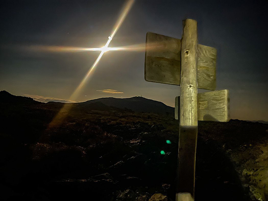
- With stellar footing conditions we easily made our way across the range watching the moon rise above us as we summited Adams, Jefferson, and Washington. As we were descending the summit cone of Mount Washington around 12:30ish the moon reached it's highest point in the sky.
- Once past Lakes of the Clouds the footing transitions to mostly dirt and slab, allowing us to make quick work of Monroe, Eisenhower, and Pierce as the clock crept past 1AM and 2AM.
- Views from Eisenhower looking down towards Bretton Woods and the Mount Washington Hotel were especially unique as the full moon lit up the valley just enough to see a thin undercast floating around down below.
- We made it to Mount Pierce at 2:20AM, enjoyed one last moment of being above treeline and then jogged back to Crawford Notch finishing at 3:10PM, making it home by 4AM to a puzzled but very happy Sarge, took a shower and was in bed snuggling with Sarge soon after. :)
Osgood Ridge at dusk
Rem hiking up with the moon rising above the Carter Range
Kristina gets a picture of me hiking up the Osgood Trail
The gang heads up Mount Madison
Mount Washington from Mount Madison's summit
View from Mount Adams
Somewhere along the Gulfside Trail
Sphinx Trail junction
Approaching the Cog Railway
View of the northern Presidential Range from the Cog
Hiking the tracks up to Washington
Kristina snaps a pic of Todd on Washington
Mount Washington Summit Observatory
Midnight on the Rockpile
Descending Crawford Path
Along Crawford Path looking back at Washington
Summit of Eisenhower, looking down towards Bretton Woods and the Mount Washington Hotel (Kristina's picture)


No comments:
Post a Comment