
Date of Hike: 11/1/16
Valley Way: 3.8 miles / Osgood Trail: 1.0 miles / Gulfside Trail: 0.3 miles / Airline: 0.6 miles / Lowe's Path: 0.3 miles / Gulfside Trail: 1.5 miles / Jefferson Loop: 0.7 miles / Gulfside Trail: 2.9 miles / Crawford Path: 1.5 miles / Monroe Loop: 0.7 miles / Crawford Path: 1.3 miles / Eisenhower Loop: 0.8 miles / Crawford Path: 1.2 miles / Webster-Cliff Trail: 2.6 miles / Webster Jackson Trail: 2.6 miles
Total Miles: 21.83 (9,514 feet elevation gained) A.M.C. White Mountain Guide Online
Trip Report:
- The very first day of November was a perfect day for a Presi Traverse! Unfortunately, I was stuck in a 9 to 5 "Ninja Selling" training class in Hamden, Connecticut, and to make things worse it had nothing to do with a favorite movie from my childhood, The Karate Kid.
- Luckily, I would be hiking vicariously through Whitney, as she and our friend Denise spent the day roaming above treeline in the snow through challenging shoulder seasons conditions. I'll let Whitney fill you in with the rest, enjoy!
Denise is working on finishing up her Grid and needed almost all the Presi peaks for the month of November. Mother Nature was kind enough to bless us with a Presi day so off we went. Anyone who hikes in shoulder season knows it comes with its own set of challenges and this day was no exception. This was my 6th Presi Traverse and by far the most challenging one. A total mixed bag of snow/ice/bare rock conditions meant spikes on, spikes off, snowshoes on, snowshoes off, blah, blah, blah throughout the day. There was much slipping, post-holing, falling, and f-bomb dropping. But it was an absolutely beautiful day with a great friend.
Obligatory shot of "The Sign"
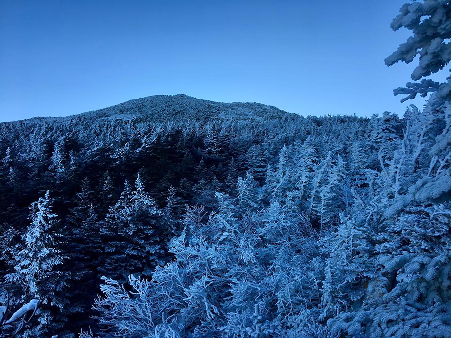
Looking up at Madison, the sun is still behind the summit
Madison Spring Hut boarded up for the season
Denis making her way up the Osgood Trail on Madison
It's a beautiful day. I've spent many early mornings on Madison and I never tire of this view.
Looking over to Washington, with a little morning fog in Pinkham Notch
Mount Adams and Washington
It's already a winter wonderland in front of Madison Spring Hut
A minefield of barely covered talus rock and soft snow meant post-holing galore!
Along the Airline Trail between JQ Adams and Mount Adams summit there's a slight level spot with an "infinity" view
Snowshoe Time! Mount Jefferson, Clay, and Washington in view
Jefferson snowfield is taking form. The snow was nice and soft by the time we got there so super easy crossing it this day.
Denise Making her way up Mount Jefferson as Mount Adams looms large above Jefferson Ravine
Mount Clay and Washington from Jefferson
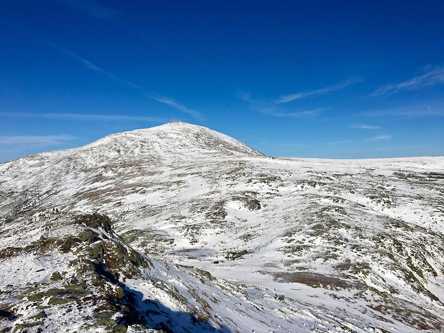
One of my all time favorite views in the Whites, Mount Washington from Monticello Lawn
Can't really photograph wind but trust me when I tell you it was gusty on this final push to Washington's summit!
Obligatory Cog tracks photo
Denise with the Northern Presidentials behind her (Jefferson, Adams, Madison)
A feathered rime ice Tip Top house
The summit is a ghost town, amazing
The happy gridder on Washington
My friend the white blaze
Snowfields on the Crawford Path
Heading down Crawford Path
The lake is still low, you can tell by zooming in on Sharky and looking at the water mark.
Washington as seen from the summit of Monroe
The clouds rolling in and the sun fading as we head over to Mount Eisenhower
Looking back on our day from the summit of Ike
On Planet Eisenhower
From the summit of Mount Pierce
The sky turns every shade of pastel beautiful as the sun starts to go down
I didn't think we would get to see the sunset but we made it to this open spot above Mizpah Spring Hut just in time.
We still had another 1.5 miles to go in the dark to the summit of Jackson, then 2.6 down miles down (the terrible, awful Webster-Jackson Trail). Easily the most challenging part of the day.
She's still smiling!
 Elevation over distance profile
 Route for the day
Woow...great hike, and many beautiful pics :)
ReplyDeleteThe highest part of the White Mountains, reminds me of my beloved Giant Mountains, the highest part of the Sudeten, after which I often go.
More here:
https://en.wikipedia.org/wiki/Krkono%C5%A1e
https://en.wikipedia.org/wiki/Sudetes
Greetings