Date of Hike: 6/1/14
Lincoln Woods Trail: 3.0 / Franconia Brook Trail: 2.5 miles / Bushwhack: 3.5 miles / West Bond Spur: 0.2 miles / Bushwhack: 5.0 miles / Franconia Brook Trail: 3.6 miles / Lincoln Woods Trail: 3.0 miles
Total Miles: 20.8 (4,285 feet elevation gained)
Trip Report:
- Sunday's weather forecast looked too terrific not to take advantage of it. I decided to head deep into the Pemigewasset Wilderness and tackle the V Guitar Slide on the southeast slop of West bond from Hellgate Ravine. After hitting the summit I would then drop down into Redrock Ravine via the north talus field and head over to Bear Pond before calling it a day.
- I left RI around 3 a.m. and on the ride up I felt extremely tired so I had to pull into the Park & Ride off exit 23 and take a half hour power nap. I think all the driving over the past few weeks has finally caught up to me, I'm getting old!
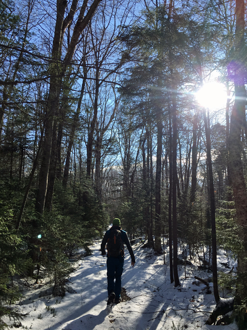
- Even with the nap I was still on the trail very early at 6:30 a.m. The temperature was in the mid 40's but warmed up real fast as I made my way to the Pemigewasset Wilderness boundary where I hooked onto the Franconia Brook Trail.
- The first 5.5 miles of my hike was flat over an old railroad bed that was used for logging in the late 19th and early 20th centuries. When I first started hiking in the Pemi Wilderness back in 2009 I always loathed hiking over these trails but I now really enjoy it because of all the history. In the fall when the leaves fall you can spot some artifacts/junk here and there off trail.
- I saw a couple of backpackers on my way to Hellgate Brook. Two spent the night at Thirteen Falls and another set up camp off trail and was going to tackle Owl's Head with his two energetic dogs.
- Hellgate Brook is the first major crossing on the Franconia Brook Trail after the junction with the Lincoln Brook Trail. I took a right onto Hellgate Brook and stayed close to the brook. At times I followed a faded heard path and railroad grade but most of the time I was walking through the woods. I've heard there is a well defined logging/railroad grade a little ways from the brook but I didn't go exploring too much.
- Unfortunately, I didn't do my usual in depth research on where to leave the brook and go uphill to the bottom of the Guitar Slide. I overshot it and ended up on what I refer to as the West Bond Monster Slide (left access). I actually had no idea I was on the wrong slide until I got home and looked at my GPS trek. I kept thinking to myself while on the slide, "This is not as wide open and is a little steeper than I anticipated!"
- Anyway, the slide was pretty gnarly. It started off in the woods and was very narrow then broke open. It was a mixed of slab and loose rock with wet slime in the middle. I stayed to the left of the slide then cut across to the right and found good handholds the whole way up.
- Views were pretty unique, I could see straight down into Hellgate ravine and the Bondcliff Ridge across the way. The highlight of the climb was coming across an old moose skull (I think, see picture below).
- From the top of the slide to the ridge and the false western most summit was the thickest whack I have ever encountered. I cut up my forearm, cut my ankle, and cut both my ears! I was bleeding a little as I staggered my way to the true summit, where two hikers looked at me in horror!
- Next it was time to head into the West Bond Col and take a left into the woods and drop onto a talus field. Luckily the whack was pretty open and I was saved from any additional scrapes and bleeding.
- The boulder field was one of the highlights of the hike. It's wide open and not too steep. The footing is awkward, the boulders are not set so some move around when stepped on (think northern presidential range) but with caution it's easy to maneuverer. Views into Redrock Ravine and the slides below Guyot and the Twinway were out of this world!
- At the edge of the slide I walked on a side slope and finally dropped down into a tributary of Redrock Brook that was at the bottom of the slide. Since the water level was so low I just walked the brook and rocked hopped through it, it reminded me of the lower section of the Bennies Brook Slide in the Adirondacks. The boulders in the brook look quite new, probably a result of Hurricane Irene from 2011.
- As the slope above the brook eased up I jumped out and cut across to intersect the Redrock Brook at Camp 14. I remembered Camp 14 from my hike out here last fall and was thrilled that I was back on familiar terrain. From here I ascended gently up to Bear Pond. The whack to Bear Pond is relatively easy except for the last one hundred feet which is very very thick.
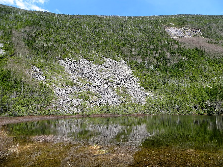
- Bear Pond was full of water, I believe in the summer the water level falls and it becomes a shallow and a mud pit around the edges. I walked around the pond to the talus field. I noticed a few interesting things; there are two inlets feeding the pond on the west side (near the big slide), and there is one outlet on the east side, where the thick whack is.
- I climbed halfway up the talus field to the flat rock and relaxed for awhile. The weather was absolutely perfect and looking down at the pond made my day. Bear Pond is such a peaceful and secluded place to visit!
- After my break I headed back, making sure to hook onto the old railroad grade. Along the way I found an old piece of rail that I saw last fall. The hike out was very muddy in spots but was pretty easy and quickly went by. When the grade curved to the right towards Twin Brook I hopped off and b-lined intercepting the Franconia Brook Trail just north of the Redrock Brook Crossing.
- At the brook, I changed out of my long pants and long sleeve shirt and put on shorts and a t-shirt. I cleaned off in the freezing brook and dipped my feet in. I accessed all my scratches and cuts, applied some ointment on the bad ones and was good to go.
- I had about 6.5 miles of flatness back to my car. I proceeded to shut my brain off and think about what I wanted to hike the next time I go off trail.
- I made it back to the car around 3:30 p.m. and relaxed before heading back to RI. It was good to be back in the White Mountains again, and it was a fun experience heading up the Monster Slide. I'll definitely go back into Hellgate Ravine, but this time I'll pay a little more attention and make sure I find the V Guitar Slide!
East Branch Pemigewasset Suspension Bridge
There was a washout along the bank. WMNF re-routed the trail away from the edge to avoid further erosion
Hiking along the old railroad bed on the Franconia Brook Trail
Beaver Pond just past the Lincoln Brook Trail Junction
Hellgate Brook, where I jumped off trail
primitive tentsite off Hellgate Brook
Mini gorge in Hellgate Brook
Bushwhacking along the north bank of the brook
I found this old balloon in the middle of the woods, I must be going the right way!
Hellgate Brook
On an old logging / railroad grade
Nice open field, soon after this I should have made my way upslope to V Guitar Slide
Bottom of the Monster Slide
Looking down the slide
The slide starts off narrow then gradually opens up over slab and ledges
Bondcliff from a ledge on the slide
Heading up to the top of the slide
Slime, stay away! I stayed to the edge where it was a little drier
Looking back down into the narrow part of the slide
I see dead things!
I think it's a moose??!!
Loose part of the slide, where it opens up
Mixed of loose rock and slab
Bondcliff Summit zoomed in
Heading up the upper slab section of the slide. I stayed to the left then cut across to the right
Mount Bond from Monster Slide
Bondcliff from the upper ledge of the slide
Thick whack to gain the ridge
True summit from the false summit!
Mount Lafayette, Truman, Lincoln (Right to Left)
Truman / Lincoln Slide
After getting scratched up badly this heard path was a welcome site!
Redrock Ravine
Ledges just west of the true summit, looking back to the false summit bumps
Redrock Ravine
Bear Pond from West Bond
Bondcliff
Dropping down into the talus field
Beautiful descent into Redrock Ravine
The boulders where loose but the angle was not too steep making for a slow but pleasant descent
Looking back up to the West Bond Col
Angle of the slide
Bottom of the slide
Descending through a brook
Easy rock hop to the bottom of this tributary of Redrock Brook
Camp 14!
Bear Pond outlet
Bear Pond
Primitive tentsite at Bear Pond
Bear Pond
Late spring at Bear Pond
Talus field above Bear Pond
Bear Pond and West Bond
Talus field I descend below West Bond
Twinway Slide
Waterfall on Twinway Slide
Bear Pond in Redrock Ravine
Me standing on flat rock
Eastern shore of Bear Pond
Talus field above the pond, a perfect place to get away from everything
Old railroad grade in Redrock Ravine
This piece of rail was in the exact spot I found it last fall!
Descending through a lush and vivid green forest on the old railroad grade
One hundred years ago this was a major logging operation.
Redrock Brook
Franconia Brook Trail
Pine needle blanketed Franconia Brook Trail
It's hard to see, but this dead stump has a tiny pine growing out of the middle of it!
Franconia Brook footbridge at the Pemigewasset Wilderness boundary
Lincoln Woods Trail
East Branch Pemigewasset River
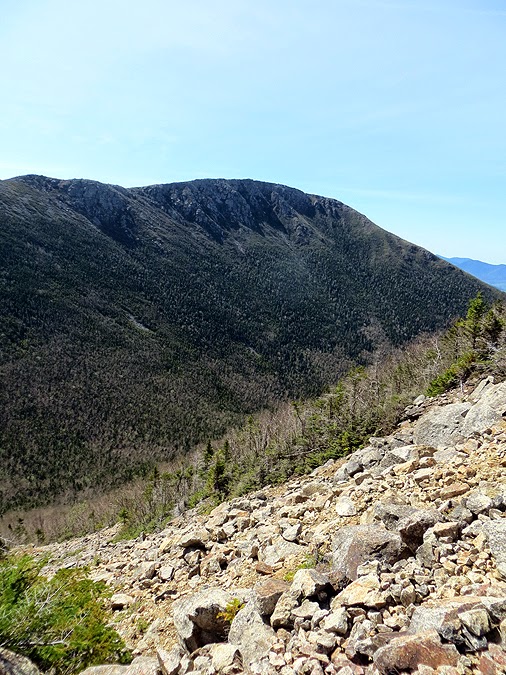
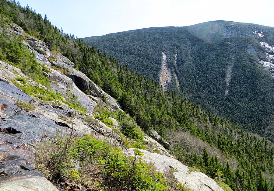
The slide I went up (picture taken last August from Bondcliff)
Here is a picture of the three slides in Hellgate Ravine. I call them the Monster Slides, I'm sure there is another name for them but it looks like a monster gashed the side of West Bond. I went up the left one
Strait on view of the slides from Bondcliff Ridge (from July 2013). Notice how steep!
The Slide I wanted to go up V Guitar Slide. (from August 2013) Next time!