Date of Hikes: 1/2/17 & 1/3/17
Sunset Ridge Trail & Long Trail: 6.1 miles (2,620 feet elevation gained)
Burrow's Trail & Long Trail: 4.8 miles (2,266 feet elevation gained)
Battell Trail: 2.0 miles / Long Trail: 5.7 miles / Jerusalem Trail: 2.4 miles
10.1 miles (3,504 feet elevation gained)
Mileage and Elevation from my Garmin Forerunner 920XT GPS watch
Trip Report:
- On New Year's day Whitney and I drove to Underhill Vermont area to meet Matt and Tim for two days of hiking in the Green Mountains.
- On Monday we enjoyed a beautiful morning hiking Mount Mansfield via the Sunset Ridge Trail. This trail is my preferred route up to Mount Mansfield as half of the hike is out in the open with terrific views to the west of the Adirondacks. The grade and footing is much easier than the Long Trail approach from the east side of the mountain too, which is in the woods for most of its length.
- We used microspikes until about a third of a way up the ledges, then we put on our crampons as it was cold enough early in the morning for our light traction to not bite into the ice as well as the crampons.
- Views from the summit were incredible, to the east we could see the White Mountains and the Presidential Range rising up high above everything else. To the west we could clearly see many of the Adirondack High Peaks. There was barely any wind at the top which made the early morning summit very enjoyable. On the descent we ran into well over a dozen hikers heading up to enjoy the bluebird day.
- When we got back to the car we drove over to Camels Hump State park and started hiking up the Burrow's Trail around 12:30PM . My previous two hikes up to Camel's Hump was by the way of the Monroe Trail on the east side of the mountain. The Burrow's Trail is shorter and quicker and makes easy work of the mountain. As we ascended, dozens of hikers were descending and when we reached the top there were only a couple of hikers at the summit. Views from the summit are 360 degrees and excellent, not a bad second hike to cap off the day!
On Tuesday, the weather was going to get nasty in the afternoon up on the mountains and down below, sleet-snow-ice. However, there was a window to get a hike in and avoid having to hike and drive in these conditions. We spotted my Jeep at the Jerusalem trailhead and drove over to the Battell trailhead and started hiking at 7am. The Battell Trail is a nice steady climb up to the Long Trail, there are quite a few switchbacks over the first mile followed by a moderate climb to the ridge.
- Once we hooked onto the Long Trail, we headed north an quickly made our way over Mount Abraham's exposed and very windy summit, luckily about fifty feet past the summit the trail heads back into the woods.
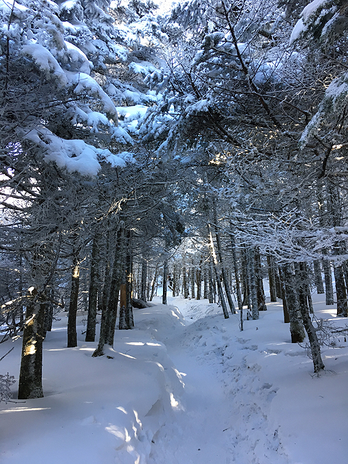
- For the hike along the ridge between Abraham and Ellen we put on our snowshoes and enjoyed a great snowshoe hike for the next 3.5ish miles. The wind was whipping but it real wasn't too uncomfortable as the pine trees covered in snow blocked any direct blows from the wind gusts.
- The interesting thing about this part of the Long Trail is it passes by three chairlifts from Sugarbush Ski Area. If you are hiking the Long Trail in the winter and heading north, every time you reach a chairlift, head left and down the ski trail for a few hundred feet then head left into the woods. The trail can be confusing on where to go at the chairlifts so just pay attention.
- Unlike Mount Abraham, Mount Ellen is just a small cairn on the side of the trail so it's not really exciting. However, just a few feet past Ellen is another chairlift with a great view, although there were no views on this day for us.
- From here we had to break trail for a little bit until reaching a ski glade section where the trail became well broken out again to the Jerusalem Trail junction. Once on the Jerusalem Trail it was all downhill and an easy hike back to the Jeep, passing by a real extravagant maple syrup operation over the last mile of the trail.




Sunset Ridge Trail & Long Trail: 6.1 miles (2,620 feet elevation gained)
Burrow's Trail & Long Trail: 4.8 miles (2,266 feet elevation gained)
Battell Trail: 2.0 miles / Long Trail: 5.7 miles / Jerusalem Trail: 2.4 miles
10.1 miles (3,504 feet elevation gained)
Mileage and Elevation from my Garmin Forerunner 920XT GPS watch
Trip Report:
- On New Year's day Whitney and I drove to Underhill Vermont area to meet Matt and Tim for two days of hiking in the Green Mountains.
- On Monday we enjoyed a beautiful morning hiking Mount Mansfield via the Sunset Ridge Trail. This trail is my preferred route up to Mount Mansfield as half of the hike is out in the open with terrific views to the west of the Adirondacks. The grade and footing is much easier than the Long Trail approach from the east side of the mountain too, which is in the woods for most of its length.
- We used microspikes until about a third of a way up the ledges, then we put on our crampons as it was cold enough early in the morning for our light traction to not bite into the ice as well as the crampons.
- Views from the summit were incredible, to the east we could see the White Mountains and the Presidential Range rising up high above everything else. To the west we could clearly see many of the Adirondack High Peaks. There was barely any wind at the top which made the early morning summit very enjoyable. On the descent we ran into well over a dozen hikers heading up to enjoy the bluebird day.
- When we got back to the car we drove over to Camels Hump State park and started hiking up the Burrow's Trail around 12:30PM . My previous two hikes up to Camel's Hump was by the way of the Monroe Trail on the east side of the mountain. The Burrow's Trail is shorter and quicker and makes easy work of the mountain. As we ascended, dozens of hikers were descending and when we reached the top there were only a couple of hikers at the summit. Views from the summit are 360 degrees and excellent, not a bad second hike to cap off the day!
On Tuesday, the weather was going to get nasty in the afternoon up on the mountains and down below, sleet-snow-ice. However, there was a window to get a hike in and avoid having to hike and drive in these conditions. We spotted my Jeep at the Jerusalem trailhead and drove over to the Battell trailhead and started hiking at 7am. The Battell Trail is a nice steady climb up to the Long Trail, there are quite a few switchbacks over the first mile followed by a moderate climb to the ridge.
- Once we hooked onto the Long Trail, we headed north an quickly made our way over Mount Abraham's exposed and very windy summit, luckily about fifty feet past the summit the trail heads back into the woods.
- For the hike along the ridge between Abraham and Ellen we put on our snowshoes and enjoyed a great snowshoe hike for the next 3.5ish miles. The wind was whipping but it real wasn't too uncomfortable as the pine trees covered in snow blocked any direct blows from the wind gusts.
- The interesting thing about this part of the Long Trail is it passes by three chairlifts from Sugarbush Ski Area. If you are hiking the Long Trail in the winter and heading north, every time you reach a chairlift, head left and down the ski trail for a few hundred feet then head left into the woods. The trail can be confusing on where to go at the chairlifts so just pay attention.
- Unlike Mount Abraham, Mount Ellen is just a small cairn on the side of the trail so it's not really exciting. However, just a few feet past Ellen is another chairlift with a great view, although there were no views on this day for us.
- From here we had to break trail for a little bit until reaching a ski glade section where the trail became well broken out again to the Jerusalem Trail junction. Once on the Jerusalem Trail it was all downhill and an easy hike back to the Jeep, passing by a real extravagant maple syrup operation over the last mile of the trail.
We drove up Mountain Road to the gate with the hiker symbol on it. If the road is passable and you get an early start you can park off to the side of the gate, if not you have to park a mile down the hill
To start off with a short road walk of a quarter mile
We pass through Underhill State Park Campground which is where we jump on the trail
After an easy mile or so in the woods we pop up above treeline for the remainder of the ascent.
Looking up at a false summit and the real summit, the 'Chin' of Mount Mansfield
Some cool clouds come moving through as we hike up to the ridge
Zoom-in of Mount Whiteface in the Adirondacks
Last fifty feet to the Long Trail
View from the top of Vermont's highest point
The gang heads back down from the summit
Beautiful winter hiking along the ridge
The trail was buried beneath feet of snow so we just hiked on top of the snow wherever we pleased :)
Dewcending back down the Sunset Ridge Trail
The clouds were really awesome during the morning hike
If you hike Mount Mansfield, wait for a good day and hike up the Sunset Ridge Trail, definitely worth it!
Maneuvering through one last icy section
Heading back down towards treeline
The Sunset Ridge Trail has a bunch of little foot bridges over the first half mile
Here's what they look like in the summer
Signs spotted along the way
Hiking up the well packed out Burrow's Trail
Bright early afternoon sun above the Long Trail
Mount Mansfield as seen from Camel's Hump
Looking to the east towards the White Mountains
Zoom-in of the Presidential Range
Signs spotted along the way
Batell trailhead parking
Battell Shelter
Inside the shelter is a map, and Hooty, the give a hoot don't pollute Owl!
Heading up the Long Trail
Getting blasted by the wind on Mount Abraham
No views today!
Breaking out the drifted in sections of the Long Trail
Between Abraham and Ellen the Long Trail runs along the ridge passing by a few of Sugarbush's chairlifts. This one is just north of Lincoln Peak
Heading down the ski slope for a tenth of a mile before cutting back into the woods
The trail was smoothed over by skiers and borders who use it for some backwoods fun
Passing by another chairlift along the Long Trail
Our last chairlift of the day was just north of Mount Ellen
Breaking out the Long Trail
Hiking through the open woods of the Jerusalem Trail
Pretty cool maple syrup vacuum setup along the trail
Each tree is tapped with a cool maple leaf plug
Jerusalem Trailhead
Signs Spotted along the way