
Date of Hike: 8/10/13
Pinkham B Road: 1.5
|
Pine Link: 2.4
|
Howker Ridge: 1.1
|
Osgood: 0.7
|
Star Lake / Parapet: 0.2
|
Madison Gulf: 2.7
|
Great Gulf: 1.7
|
Six Husbands: 2.3
|
Jefferson Loop: 0.5
|
Gulfside: 2.5
|
Airline Cutoff: 0.2
|
Airline: 0.3
|
Chemin Des Dames: 0.4
|
King Ravine: 0.9
|
Airline: 0.7
|
Lowe's Path: 1.5
|
Grey Knob: 0.1
|
Hinks: 0.7
|
Spur: 0.3
|
Randolph Path: 0.2
|
King Ravine: 1.3
|
Great Gully: 1.0
|
Lowe's Path: 0.4
|
Star Lake:1.0
|
Osgood: 3.8
|
Great Gulf: 1.5
|
Great Gulf Link: 0.9
|
Campground Roads: 1.2
| ||
Total Miles:
|
32.0 miles
|
Elevation Gain
|
15,000 feet
|
Trip Report:
- Two years ago I hiked MMD 50 K (More and More Difficult). This year I hiked, rocked hopped, and ran MMD over some of the steepest trails in the White Mountains through some of the most unforgiving terrain found in the north east. The reward, phenomenal and rarely seen views from secluded trails (Six Husbands, Chemin Des Dames, Great Gully, etc.,)
- I headed up to Barnes Field the night before and set up my tent and met some of the other runners in the field before calling it a night. The run started at 6 a.m. with most people showing up around 5:30 a.m. I was happy to see Jeff and Karine, they, like me are strong hikers who sometimes trail run. I also new Robert Lalus, who was fresh off completing a Double Pemi Loop and was tapering by only running the 'Fun Run' course for the day! Bob, who set everything up went over some last minute details about the course and to be careful, also he said that if you can't do the 50K opt for the marathon 'Fun Run' option of just 26 miles and 12,000 plus feet of elevation gain!
- I headed up to Barnes Field the night before and set up my tent and met some of the other runners in the field before calling it a night. The run started at 6 a.m. with most people showing up around 5:30 a.m. I was happy to see Jeff and Karine, they, like me are strong hikers who sometimes trail run. I also new Robert Lalus, who was fresh off completing a Double Pemi Loop and was tapering by only running the 'Fun Run' course for the day! Bob, who set everything up went over some last minute details about the course and to be careful, also he said that if you can't do the 50K opt for the marathon 'Fun Run' option of just 26 miles and 12,000 plus feet of elevation gain!
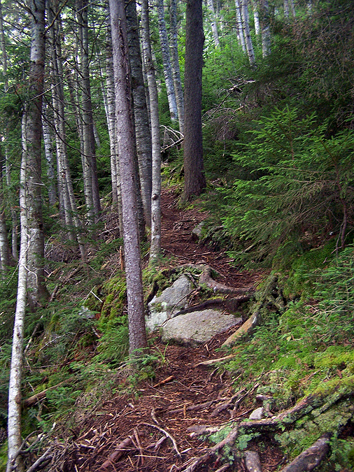
- Finally at 6:05 a.m. we were off, first up was a gradual incline over a mile and a half to the Pine Link Trail. Everyone ran/jogged to the Pine Link trailhead. The Pine Link trail was a little muddy in places but overall I liked the footing. The weather couldn't have been more perfect below treeline, 50's with low humidity. I hiked behind Gary who is an ultra runner. He does about one of these a month and has done some of the toughest 50K's to 100 milers in the U.S.
- As we approached treeline, Gary could see the four or so other runners ahead of us so he took off ahead of me as I stuck to my fast hiking pace and kept snapping as many pictures as I could along the way. The nice weather below treeline deteriorated to crummy weather above treeline, winds were wicked fast and the clouds blanketed everything above 4,700 feet. The wind was fast enough to blow the glasses off your face, some of the fastest gusts I've been in. Still, it wasn't too cold and my long sleeve and my hat did the trick above treeline to keep me warm.
- I stopped in at Madison Springs Hut just after 8a.m. warmed up, restocked water, Gatorade, and had a snack before heading back into the wind. The hut crew knew we were coming because one of their own, Steve, was running in it as well. The hut crew throughout the day would be very accommodating to all of us, many thanks!
- Next up was the steep and long slog down to the floor of the Great Gulf via the Madison Gulf Trail. The top of the Madison Gulf Trail is steep and after Friday's rain it was very wet making for a tricky and difficult descent until the last mile or so. After the run I would find out that Jeff left a little piece of his leg behind on the upper sections of the trail, he lost a fight with a boulder, ouch!
- on the way down Madison Gulf I caught up to Paul after the initial steep sections and and then caught up with Tim for the final section of the trail.
- on the way down Madison Gulf I caught up to Paul after the initial steep sections and and then caught up with Tim for the final section of the trail.
- Once on the Great Gulf Trail, Tim sped ahead and I resumed hiking as I hit my first wall of the day. I made sure to keep drinking and every half hour to forty five minutes I would eat energy gels, gummies, or 'magic' energy beans. I found that the energy beans worked best for me when running, the gummies the best when hiking, and the gels had mixed results for both.
- When I hit the Six Husbands Trail I took my chances and just filled up my water bladder with water from the West Branch. While I was relaxing Paul came up behind me and scared the bejesus out of me. From here we hiked up the Six Husbands Trail together, which was great because I got to take pictures of him through the ladder section.
- Once above the steep ladder section we hit treeline and the wind felt really refreshing and it rejuvenated me. Paul told me he wasn't having a good day so he stopped and let me go ahead. A few minutes later I was then passed by the Steve. He speeded up past me and caught up to Tim at the summit of Mount Jaefferson.
- The clouds finally started to break as we descended steeply to Edmands Col. The winds were still whipping but temps were now into the 50's above 4,500 feet so it was perfect hiking/running weather!
- Steve and Tim took off well ahead of me as I hiked up to Thunderstorm Junction. From here the course went around the summit mass of Mount Adams to Madison Springs Hut. I rock hopped and ran to the hut and as I got there Tim and Steve were just leaving. I relaxed for about ten minutes to take stock in what gels, beans, gummies, and food I had. I put more Gatorade powder in my bottle, refilled my bladder to 2.0 liters, and purchased a Cliff Bar just in case I needed something else for later on. The caretaker at the hut was very nice, she offered to give me Gatorade or food but I declined the offer at that point. I did eat a couple of mini chocolate covered pretzels I had in my pack before taking off to the Airline towards the Chemin Des Dames Trail.
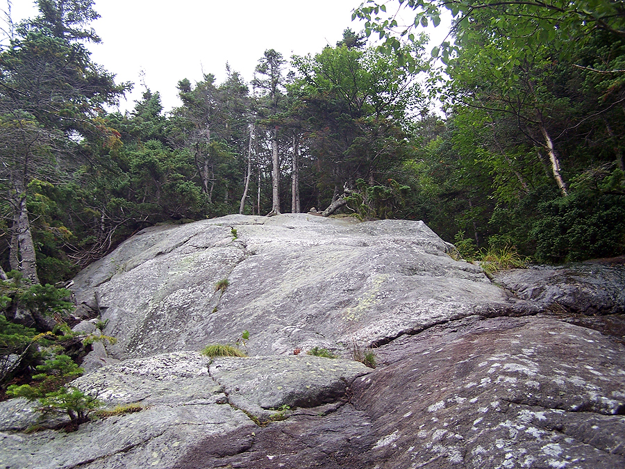
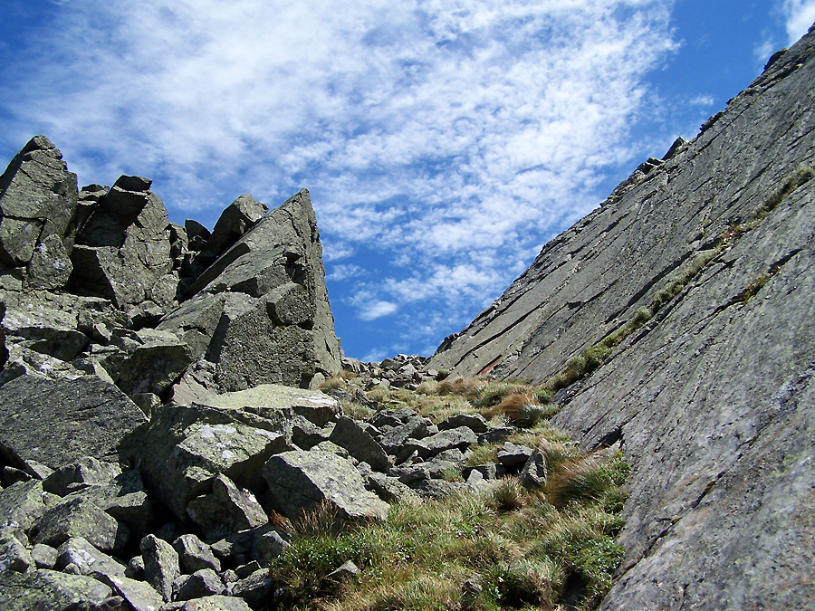
- The Chemin Des Dames Trail is ridiculously steep but the views are, well, ridiculously awesome! You drop straight down to the floor of the ravine in just 0.4 miles over some nasty boulders. I was enjoying the views so much that I lost the trail in the boulder field, luckily I knew where the King Ravine Trail was so I just headed in that general direction carefully climbing up and over car sized boulders with a few leaps of faith until I found the last few hundred feet of the Chemin Des Dames Trail. Once back on trail I hooked onto the King Ravine Trail and started heading up one of the steepest sections of trail in all of the White Mountains, rising about 1,100 feet in just over half a mile.
- I have been on the King Ravine Trail before so I knew what I was in for and I felt surprisingly strong as I ascended up the loose boulders to the 'Gateway' before topping out on the Airline Trail. I found a spot out of the wind and had a small bite to eat and some Gatorade before motoring up to the summit of Mount Adams via the Airline.
- It was now early afternoon and the sky was blue, winds still fast, and tons of people out on the trail. I think I started re-seeing hikers at this point that I had passed along the way but I was in a zone focusing on foot placement and snapping pictures every few minutes so I couldn't really tell. A few people knew what crazy trail run we were up to so they would give words of encouragement. Other people had no idea what this goofball in an bright orange shirt and bumble bee sneakers was up to but everyone was really nice and were thrilled to be up in the Presidential Range on a great weather day.
- At the summit of Mount Adams I now had to drop down the Lowe's Path to The Grey Knob cabin. Lowe's Path above treeline is one of the prettiest trails around. It's rough on the feet but worth every knee hammering step for the views down into the valley to the west!
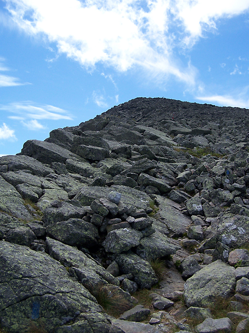
- At the Grey Knob Cabin I chatted it up with the caretaker, restocked on water, ate some gummies and relaxed for about ten minutes before heading down the Hinks, Spur, and Randolph Path where I hooked back onto the King Ravine Trail below the floor of the ravine. I wouldn't stay too long on the King Ravine trail, only until the Great Gully Trail where I would bang a right and once again ascend at a ridiculous rate, this time 1,700 feet in one mile. I had been on the Great Gully Trail before but not 22 miles and 13,000 feet of elevation gained into a hike!
- It was at this point where I got destroyed. I lost all energy and began doing the one step up at a time shuffle; right foot, left foot, stop. I knew this was the last big climb and the weather was great so I was panicking but it was very humbling. At this point my camera battery in Franken Camera #3 ran out of juice so I had to go with my apple phone for pics for the last ten miles. As I climbed I managed to find a small spurt of reserved energy here and there but most of the climb back up to the ridge was torturous! It was the hardest mile I have ever experienced while not being injured.
- As I approached Thunderstorm Junction I saw Bob, the organizer of MMD, heading north on the Gulfside Trail, he was waving and yelling to me. I was so out of it I couldn't understand what he was saying! However, when I hit Thunderstorm Junction a few minutes later I knew the day was over, baring a head injury of course. I was back to trails I have been on over two dozen times and could get down on one leg if need be. I headed up to the summit of Adams and then rocked hopped down the Star Lake Trail where I caught up to Tim and we made our way up to the Hut. At the hut, the caretaker gave me a bowl of French Onion Soup, it was incredible! I took about a ten to fifteen minute break and then hiked up Mount Madison's summit cone with Bob and Patrick. They both elected to do the 26.2 mile 'Fun Run'. It turns out most people turned out to do the fun run or just made the most of the great weather and hiked their own killer hike.
- At the summit I was done with all the elevation gain, and about a half mile down the trail in front of me I saw Tim rock hopping down the Osgood Ridge. From here there was just under seven miles back to the Barnes Field and the finish lime. At this point the buried athlete rose out of me and I took off. I wear La Sportiva Raptors, and while they're a little heavy on the feet for me for running uphill, they are the best for my feet downhill on boulders. I ran and kept running, faster and faster. Below treeline I ran into Tim, who said "Every time I think I have you dropped you have shown up on the descents."
- I booked it down the rest of the Osgood, Great Gulf, Great Gulf Link trails and out to the Dolly Copp Campground. From here was a mile and a quarter over paved campground roads, pure hell! I ran past the Daniel Webster Scout trailhead and finally out of Dolly Copp Campground to Barnes Field where I saw the campsite and was greeted with everyone cheering me on for the last hundred yards. It was a great feeling and everyone was so nice. The last seven miles I covered in an hour and a half, the fastest I've ever ran down a mountain and it was a really cool way to finish out what was one of the toughest hikes/run I've ever done. It was worth every step of it, I took over two hundred pictures and even made sure to take one or two on my sprint out so I can look back years from now and have the memories for each picture over the twelve hours and twenty three minutes (12:23) it took me to complete MMD 50K 2013.
- Back at the campsite there was lots of food and drinks to be had and a nice fire going as night fell upon us.
- There were 26 people who where on the final list for MMD, I think 19 started at 6 a.m. only six of us completed the 50K, the others did the 'Fun Run' or variations of it. The fun run to put into perspective was much more difficult than let's say a Pemi Loop! I came in third behind Gary and Steve. Gary finished about an hour and ten minutes faster than me at 11:10. I was pretty thrilled about the whole day and how my body held up during my first trail run!
- I really enjoyed MMD, everyone was friendly and very laid back, no one was competitive, it's in the White Mountains, and everyone hangs out afterwards. I wonder if there's a group in the ADK's that does something like this, now that would be cool, too! My only regret is that I forgot to take a painted rock at the end of the race, so next year I'll have to take two painted rocks!
Start 6:05 a.m. / Madison Summit 7:52 a.m. / Floor of Great Gulf 8:56 a.m. / Six Husbands Trail 9:35 a.m. / Jefferson Summit 10:55 a.m. / Madison Springs Hut 11:55a.m. / Floor of King Ravine 12:30 p.m. / Adams Summit 1:25 p.m. / Grey Knob Cabin 1:58 p.m. / Great Gully Trail 3:06 p.m. / Adams Summit 4:05 p.m. / Madison Summit 4:55 p.m. / Finished 6:28 p.m.

Group pic before the start

Barnes Field

Pinkham Road B

Runners jogging up Pinkham Road B early in the morning

Pine Link Trailhead

Weather Warning Sign

Gary booking it up the Pine Link Trail

Pine Link Trail

Nice section of footing on the Pine Link Trail

Early morning sun shining through the woods on the Pine Link Trail

As the trail gains elevation it gets a little rougher!

Pine Link Trail to the Howker Ridge Trail

Ascending up out of the woods

Into the scrub and views on the Pine Link Trail

Howker Ridge Trail

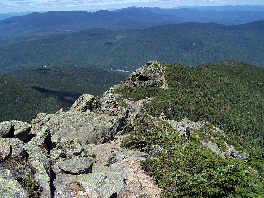
Northern flanks of Mount Madison

Heading north over the Howker Ridge Trail

Looking back down Mount Madison

So far the weather looks nice, just really windy

Then the clouds come rolling in on the Osgood Trail

Osgood Trail

Mount Madison Summit

Descending the Osgood Trail to Madison Springs Hut

Madison Springs Hut

Entering the Great Gulf Wilderness

Top of Madison Gulf Trail

Madison Gulf Trail

Steep rock slab on the Madison Gulf Trail

Looking back up the steep slab section of the Madison Gulf Trail
Looking back up the steep slab section of the Madison Gulf Trail

Waterfall on the side of the Madison Gulf Trail

Tim navigating a brook crossing along the Madison Gulf Trail

Ladder Steps on the Madison Gulf Trail
Madison Gulf Trail footing becomes much better over the final mile

Tim running across the Great Gulf Suspension Bridge

West Branch

Great Gulf Trail

Clam Rock!

Great Gulf Trail

West Branch on the Six Husbands Trail, where I filled up on water

West Branch on the Six Husbands Trail
Six Husbands Trail

Rock wall on the Six Husbands Trail, this is where the steepness begins!

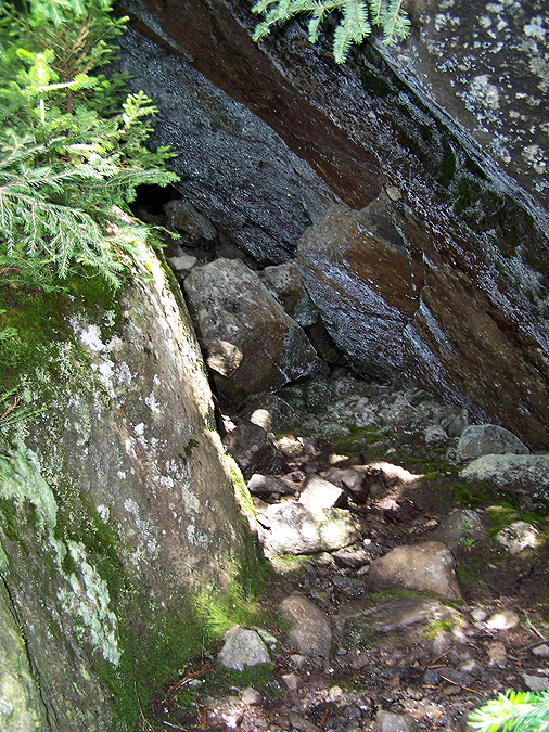
Paul navigating through a boulder cave

Paul scurrying up the first ladder

Ladder on the Six Husbands Trail

Looking down that ladder, yeah it's safe!!

Six Husbands Trail

Up to the overhanging ledge on the Six Husbands Trail

Looking back down the rock where you can scramble or walk on the edge. There's a hundred foot drop off to the right

Over-hanging ledge

Over-hanging ledge on the Six Husbands Trail

Buttress talus field and the Abandoned Adams Slide

Jefferson Ravine

Paul scrambling up to treeline

Above the 'knee' of Mount Jefferson on the Six Husbands Trail

Six Husbands Trail

Talus field on the eastern slopes of Mount Jefferson

Madison Springs Hut Dude powering his way up the mountain!

Looking back down the knee of Jefferson

The summit mass of Mount Jefferson

Mount Washington in and out of the clouds

Almost to the summit of Mount Jefferson

Mount Jefferson Summit Area

Heading down the Jefferson Loop Trail

Mount Adams from Edmands Col

Heading north on the Gulfside Trail

Looking back south up Mount Jefferson

Popping out of Edmands Col
Gulfside Trail

Mount Jefferson

Gulfside Trail

Gulfside Trail

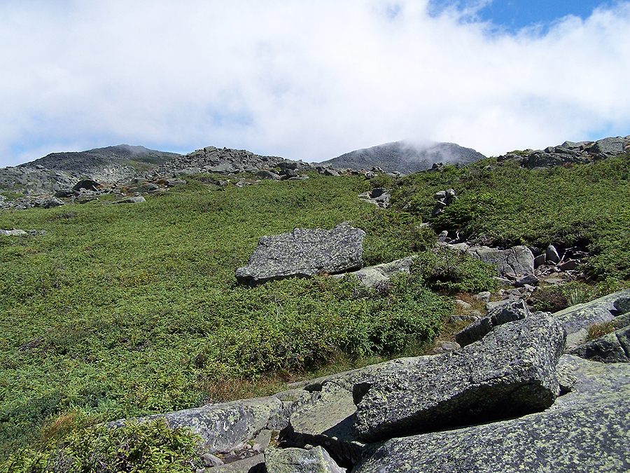
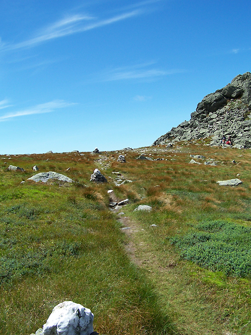
Nice grassy / rocky knoll below a sub-peak of Adams

Nice grassy / rocky knoll below a sub-peak of Adams

Gulfside Trail

Mount Jefferson

The knee and shoulder of Jefferson where the Six Husband Trail heads up above treeline

Approaching Thunderstorm Junction

Thunderstorm Junction

Thunderstorm Junction

Taking the Gulfside Trail around Mount Adams

Gulfside Trail

A well built cairn on the Gulfside Trail

One of the few very well footed sections of trail above treeline

Gulfside Trail 'sidewalk'

Mount Madison

Airline Cutoff

The Airline

The Airline Trail
Ariline's Knifes Edge

Chemin Des Dames Trail Junction

Descending the very steep Chemin Des Dames

Chemin Des Dames

Boulders of the Chemin Des Dames

Lemon Squeezer

Chemin Des Dames

The floor of the King Ravine

Top of King Ravine

King Ravine Headwall

Chemin Des Dames Trail

Chemin Des Dames

Chemin Des Dames

Chemin Des Dames

Chemin Des Dames

Off Trail on the Chemin Des Dames

The Headwall

King Ravine Trail

Boulder field in the King Ravine

King Ravine Trail

Looking back down to the floor of the ravine

Hikers 'crawling' up the King Ravine Trail

King Ravine Trail

King Ravine

King Ravine Trail

King Ravine Trail

Approaching the Gateway

The Headwall

Gaining the Ridge

The headwall shoots straight up to the right

The Gateway
The Gateway

Madison Springs Hut and Mount Madison from the Airline

Heading to Mount Adams

Airline

Airline up to Mount Adams
Airline

Mount Madison

Looking back down the Airline

Approaching the summit

Mount Adams!

Lowe's Path

Mount Washington

The Great Gulf and Mount Washington

The 'Rock Pile'

Approaching Thunderstorm Junction for the second time

South on Lowe's Path

Abigail Adams
I could have lied down and taken a nap!

Abigail Adams

Beautiful day in the northern presi's

Looking back to Mount Adams

Looking off to Mount Madison

Looking off to Mount Madison

Back to knee hammering rocks on Lowe's Path

Lowe's Path

Beautiful views from Lowe's Path

Grey Knob Cabin

Grey Knob Cabin

Hinks Trail

Hinks Trail

Spur Trail

Spur Trail

Randolph Path

Randolph Path

King Ravine Junction

Heading back to the floor of the Ravine

King Ravine Trail

King Ravine Trail Junction with the Shortline

Mossy Falls

Mossy Falls

Weather Warning Sign

King Ravine Trail

Floor of the Ravine

The King Ravine

The Great Gully!

Great Gully Trail Junction

Great Gully Trail

Overgrown Great Gully Trail

Great Gully Trail

Approaching the lemon squeezer

Great Gully Trail

Great Gully Trail

Great Gully Trail

Great Gully Trail

Looking over towards the Gateway

Gaining the ridge

Great Gully Trail

King Ravine

King Ravine

Back up on the range

Thunderstorm Junction, for the third time!

Approaching Mount Adams from the north on Lowe's Path

Mount Abigail Adams

Mount Adams!

The northwest flank of Mount Washington and Wildcat Ridge behind and below it

Mount Jefferson, Clay, and Washington

Mount Madison

Star Lake and Mount Madison

Star Lake Trail

Descending the Star Lake Trail

Tim heading down the Star Lake Trail

Star Lake and Mount Madison

Star Lake and Mount Madison

Madison Springs Hut

Madison Springs Hut

Bob and Patrick heading up the Osgood Trail

Star Lake and Mount Adams

The home stretch - Heading up Mount Madison on the Osgood Trail with Mount Adams rising high above the Madison/Adams Col

Mount Madison!

With Patrick and Bob on the summit of Mount Madison

Osgood Ridge

View from Osgood Ridge

Looking back up to Mount Madison

Hiking down the Osgood Trail

Descending to treeline with Carter Notch in view

Mount Washington in the late afternoon

Great Gulf Trail Junction

Great Gulf Link Trail

Dolly Cop Campground Road
Chris,
ReplyDeleteI am so proud of you and your ability to hike, run, take incredible pictures, and tell a great story. You are so un-assuming, be proud of your accomplishment, gloat for once, you earned it!
-Eva
Thanks Eva for the kind words. I'll never forget the sprints up the bleachers back in 2010 where you made me wear my backpack in 90 degrees with disgusting humidity!!
DeleteAmazing photos.I don't know how you managed to capture them all while doing this run/hike but I am glad you did so I can live vicariously. I saw J&K the next day and they were amazingly chipper. I hope you were as well.
ReplyDeleteThanks again,
Heather&Kali
Thanks Heather, glad you like the report and pics!
DeleteI definitely was chipper the next day, too...and very sore!!
I'll look out for you, Chris, and Kali on the trails the rest of the summer. Hope you guys get in some great hikes!
-Chris
Great job on the race, that is some fast hiking/running on some tough trails. Nice writeup and photos too, I'll have to try to make it next year.
ReplyDeleteJesse
Hi Jesse. Glad you like the pics and report, thanks! Hope you and your buddies had a fun Double Presi Traverse!
Delete-Chris
Hi Chris, we are actually doing the traverse this Friday. Hoping for some good weather above treeline, should be a fun day.
DeleteAwesome!!! Have a blast, let me know how it goes for you guys!
DeleteThe day's weather started out tough with some windy sections between Madison and Jefferson, then got progressively better. All in all, we had a good day above treeline. I did a writeup here: http://earlymorningtrails.blogspot.com/2013/08/double-presidential-traverse-run.html
DeleteThanks for posting the pics(BEST I've ever seen of this area) & sharing your overall experience for those of us who don't get out so much anymore, but who...still can remember the exhilaration of days gone by prepping for ultras, doing prez traverses and the like. As my heart sank/swelled with each pic, I found myself asking...WHY am I not doing this type of stuff anymore? and you know I couldn't come up with a valid "reason"/only excuses...Thanks for the gutcheck. Say Hi to Gary,(we went to HS together), and Steve P. next time you see them. Enjoy each moment/each shared mem/smile on trail, take the picture when so moved; sometimes days gone by can be easily lost forever...until someone likes you jogs those memories,(with your pics/narrative) and once again lights a fire under your ass/and deep down in your soul. Namaste'...
ReplyDeleteHi Thomas, I really appreciate your kind words and am thrilled you enjoyed the pics and report! Thank You!
DeleteHope you get out there a little more and back to the trails you love so much to make new memories up the White Mountains.
Happy Hiking!
-Chris
Thanks for the great pictures and recap Chris! Hope to see you there again next year.
ReplyDeleteThanks Paul, I'm glad you liked the pics and enjoyed reading about my recap! Great meeting you and I'll see you next August!
Delete