Showing posts with label Winter Hiking. Show all posts

Dood-o-lation . . . Mount Isolation

Date if Hike: 2/7/21

Rocky Branch Trail: 2.7 miles  /  Engine Hill Bushwhack: 1.2 miles  /  Isolation East: 1.4 miles  /  Davis Path: 1.8 miles  /  Isolation East: 1.4 miles  /  Engine Hill Bushwhack: 1.2 miles  /  Rocky Branch Trail: 2.7 miles
Total Miles: 12.4 miles / 3,514' elevation gained

Trip Report:
- After Saturday's Sargeless hike of the Carter's with Todd where my winter goal of avoiding breaking trail had been foiled, Sarge and I headed to the other side of the notch for a morning hike to Isolation over superb broken out trails. 
- We arrived to an almost empty lot, with one of the cars there belonging to Todd.  Sarge must have recognized his scent because he was going way out in front of me and looked like a dog possessed, that or he was picking up the scent of a moose, anyway I huffed and puffed after him and was relieved when we finally caught up to Todd soon after the Wilderness Boundary around two miles in.
- From here we followed the tracks of a lone barebooter of the day through the Birch glades, which is the bushwhack portion and the highlight of the hike.  The whack had been well traveled, it did miss two glades the normal route passes through and dropped down to the trail a little early but I could care less as it was broken out and made for easy snowshoeing.
- Once back on the trails we made quick time to the summit catching up with the barebooter we had been following, he was up there feeding three very hungry Gray Jays as we tagged the summit and took a few pics.
- We had good views up there as all the higher summits were below the cloud deck.  A small snowstorm was coming through in the morning we beat it by a few hours so we never saw a flake during our whole hike and compared to Saturday's outing this was a breeze of a hike.  It's also a breeze compared to non snow conditions as Davis Path and Isolation East have plenty of mud, rotted bog bridges, and erosion. 
- We made quick time down the mountain making it to the Jeep and getting home by noon.  I told Sarge he could stay up past his bedtime to watch the Super Bowl so he took a nap while I had lunch. Not a bad way to spend a Sunday :) 

Heading into the Birch glades

Todd and Sarge lead the way through the Engine Hill Bushwhack

Mount Isolation summit

Clouds overtaking the sun as a small snow storm slowly makes its way over the mountains

Monroe, Washington, and Boott Spur behind Sarge

The one water crossing we had was solidly bridged

Sarge charging through the glades

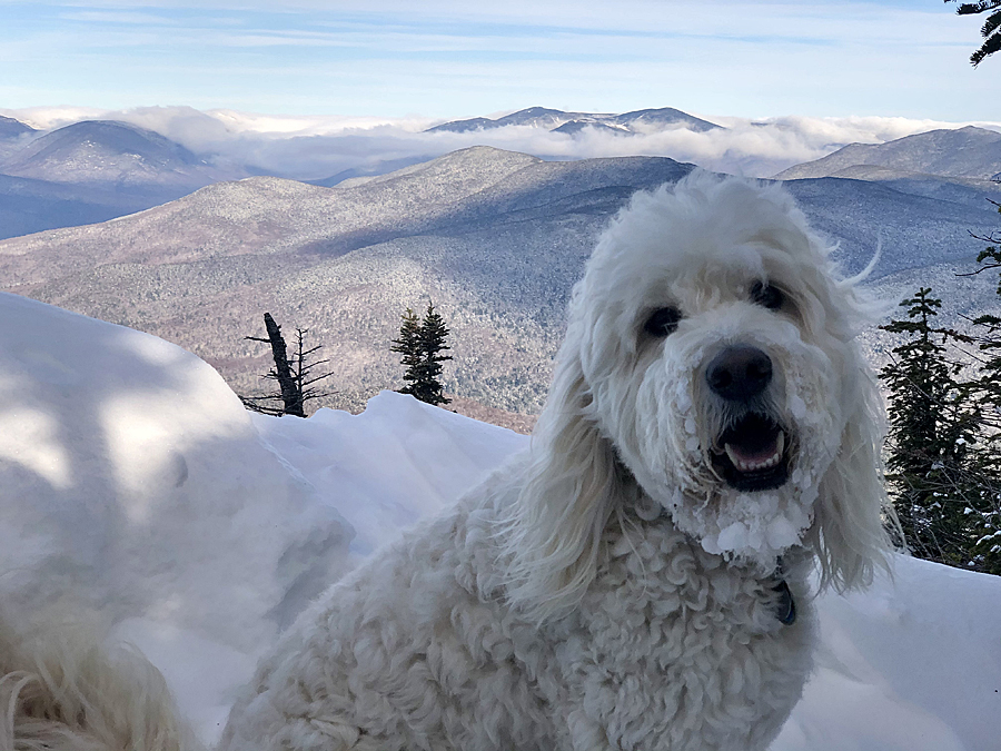
Frosty face, the usual!

Super Bowl Sarge!

Pupsceolas . . . East Osceola & Osceola

Date of Hike: 1/7/21

Greeley Ponds Trail: 1.3 miles  /  Mount Osceola Trail: 5.0 miles  /  Greeley Ponds Trail: 1.3 miles
Total Miles: 7.6  /  3,333' elevation gained

Trip Report:
- Sarge is slowly chipping away at his Winter 48.  While there are a few peaks he's hiked more than once, there are others he hasn't sniffed the snow on yet, like the Osceola's.
- The mild start to winter continuous as the second week of January begins.  Sarge and I took advantage of the warm temps and easy conditions with a quick hike up both peaks from the Kanc.  The trails were in good shape, both water crossings were bridged and most of the rocks are snow covered but one more good dump is desperately needed to bury what remains.
-  Sarge and I only saw four other hikers out and about today, one sporting crampons so he could scramble up the chimney, the rest of us whore light traction, and used the chimney bypass.  
- Mount Osceola Trail has sneaky good views along the ridge, and while both summits are wooded with no views, Osceola has a big ledge with expansive views just a hundred feet away.
- Once we hit Osceola main peak we jogged back across the ridge, tap danced down the steeps, and picked up the pace along the flats to make it back to the Jeep in time for lunch. :) 

Sarge charges up the slide 

Sarge hikes along the ridge and uses the chimney bypass

The always exciting summit of East Osceola

Sarge taking in the views!

Happy dog!

Tripyramids

Sarge heads to the summit of Osceola's main peak

Sarge's "I'm Thrilled" face

Tripyramids

East Osceola

Hancocks, Carrigain, and the Presidential Range

Lincoln, Lafayette, Owl's Head

Hancocks and Carrigain

Bonds and Twins

Sarge with Osceola main peak in the background

Happy Dood Year . . . Mount Carrigain

Date of Hike: 1/1/21

Sawyer River Road & Signal Ridge Trail: 14.0 miles / 4,400' elevation gained

Trip Report:

- After a year of compiling miles and elevation gain in the mountains (2,340 / 878,684') I am looking forward to getting back to my normal routine in 2021, hopefully by the summer as the pandemic starts to trend in the right direction. So it's back to trip reports and pics, complete with odd grammar mistakes!
- For the first day of the new year, Sarge and I planned a hike of the Prince of the Wilderness, Mount Carrigain. Joining us were a few of my trail running friends and their dogs for the easy mid-fall conditions hike of Sawyer River Road and Signal Ridge Trail. Conditions were really simple, from a dusting to just enough snow to bury the roots and rocks along the steeps and switchbacks with only a few icy spots that required care.  My studded shoes worked to perfection for the entire fourteen miles.
- We got an early start to avoid the crowds, passing four people and another dog on the way up and having Signal Ridge and the summit tower all to ourselves. Views from the top were surprisingly good as the new snow from the day before made the Presidential Range gleam in vivid white while just a few days before it was a mix of snow and rock and pretty sad looking for winter.
- After spending about ten minutes on the tower taking pictures and relaxing we trail ran back down to Sawyer River Road passing by a dozen or so hikers before reaching the summer trailhead and sprinting the road back to the cars at the winter trailhead off Route 302.
- It was a nice and relatively quiet way to start 2021, hopefully there will be many more days like this!

Sarge on Signal Ridge with the Presidential Range behind him

Sarge on the tower checking out the views

Signal Ridge

Pemigewasset Wilderness, Owl's Head, and Mount Lincoln and Lafayette of the Franconia Ridge

The scarred face of Mount Lowell and the Presidential Range

Looking south over to the Osceola Range

Presidential Range

Snozberry Sarge

Happy Dood Year!

Recent Pics from Recent Hikes :)

Date of Hikes 1/14, 1/15, 1/17

Mount Eisenhower, Pierce, and Jackson with Kyle and Matt: 11.5 miles (3,622' elevation gained)
Mount Isolation with Denise, Kyle, and Matt: 12.6 miles (3,145' elevation gained)
Mount Moriah - hike up CM, run down SB, road walk NH16 and RR tracks loop: 11.7 miles (3,295' elevation gained)

Mileage and elevation data  from Garmin Forerunner 920XT

 Breaking out above treeline on the Crawford Path on a crystal clear day is one of the more beautiful sights you'll see when hiking

Heading up the frosty Mount Eisenhower Loop

View of Mount Monroe, Washington, Clay, Jefferson, and Adams, as seen from Mount Eisenhower's summit

 Mount Eisenhower used to be named Pleasant Dome because of it's easily spotted dome appearance from other peaks.  It has a beautiful alpine meadow on the top of it

Zoom-in of Mount Monroe and Washington

 Clouds start to move in over Eisenhower as we descended

Heading south to Mount Pierce along the Crawford Path

 The Presidential Range as seen from Mount Pierce

Mizpah Springs Hut, closed until May!

 Alpine bog along the Webster-Cliff Trail.  Mount Jackson in view

Presidential Range as seen from Mount Jackson

Early morning on the Rocky Branch Trail

Engine Hill Birch Glades looking gloomy before the clouds clear off

Snow bridge!  This makes hiking in the winter easier, no need to rock hop!
   
Hiking along the Davis Path

We made it to the summit just a tad early as the clouds were not yet clearing off.  Looking north to North Isolation from Mount Isolation's summit

 Kyle tells a Gray Jay to stay away from his food!

The highlight of Mount Isolation is hiking through these wide open Birch Glades

Carter-Moriah Trail up from Bangor Street, not one of the most attractive trails!  Icy morning in spots along this path

However, there is a nice view of the Presidential Range from Mount Surprise.

Undercast floating through the notch while I was on Mount Moriah's summit

Descending the ledges below the summit there are great views of the Carter and Presidential ranges

"Look, you guys can go around if you want to; I'm crossing here. And while you guys are dragging your candy asses halfway across the state and back, I'll be waiting for you on the other side, relaxing with my thoughts." - Teddy Duchamp