Date of Hikes: 2/22 & 2/23
Baldface Circle Trail: 3.2 miles / Baldface Knob Trail: 0.9 miles / Slippery Brook Trail: 2.6 miles / Baldface Circle Trail: 0.9 miles : 7.6 miles (3,000 feet elevation gained)
Webster-Jackson Trail: 5.2 miles (2,600 feet elevation gained)
Mount Willard Trail: 3.0 miles (900 feet elevation gain)
Trip Report:
- On Saturday, I joined Kara and Sasha for a hike up to the Baldfaces via the Baldface Loop Trail. I have hiked the Baldfaces once before when I was a little kid and all I remembered was my dad carrying our Golden Retriever, Scarlet, over some of the steep ledges. I had been wanting to get back to them for a number of years since the views are some of the best the Whites have to offer.
- First thing about the hike was getting there, Route 113 to the trailhead was a mix of frost heaves, pot holes, standing water (it was warm out leading to snow melt), and the road was filled with PUDs.
- Second, we got a very late start for a winter hike. We didn't start until 1 pm, a week after our road trip we were still trying to catch up on sleep so we slept in.
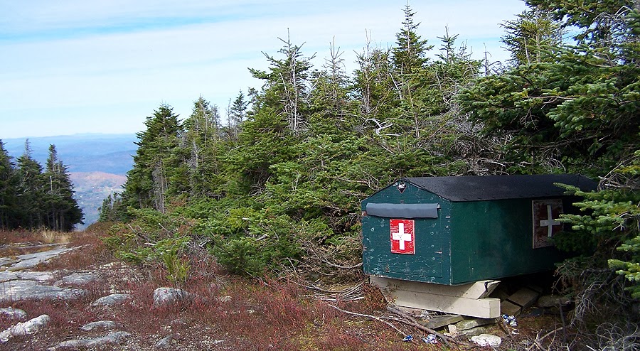
- The trails were broken out until the cabin, then it was all on us to break trail up the steep snow covered ledges. One thing I noticed about the hike was it was extremely boring visually until the cabin, then it becomes a lot of fun. It becomes steep and the views are phenomenal.
- I lead the way over to the Baldface Knob Trail junction. We made a group decision to head down from here via the Baldface Knob and Slippery Brook Trails back to the car. It was getting a little later in the day and we'd be breaking trail over South and North Baldface as it got dark and then have to find the trails down into the woods from the ridge. I wasn't comfortable on the unfamiliar trails, especially when it gets dark so I was happy we were heading back.
- However, the next 3.3 miles were all unbroken snow. Luckily, we only got off the trail a little bit heading to Baldface Knob. We wandered around a little bit and found a small cairn, and Kara pointed out a big one up above us on the knob so we just headed in the general vicinity and found some more cairns. From the top of the knob I was able to locate the trail off of it and within a hundred feet we were back in the woods and the trail corridor was very distinguishable again.
- From here it was descending through and unbroken trail of fluffy snow covered by a layer of crusty snow so it was pretty tiring at times to keep punching through and not being able to butt slide or run. Even with the breaking trail we had a lot of fun and were able to get back to the car without using the headlamps.
- At the trailhead we changed into dry clothes and headed to North Conway for a well deserved yummy dinner and cold beer at the Muddy Moose. I had never been there before but really liked the food and the atmosphere. It's school vacation week so it was jammed with vacationers. Sasha and Kara were able to score three spots at the bar so it worked out perfectly!
- After dinner I drove back south for a couple of hours of sleep before heading back up in the morning, this time to Crawford Notch and up to Mount Jackson.
- The trails were a sidewalk and microspikes were all that were needed for the Jackson hike. The views from the top were top notch, the windy was whipping so I didn't stay long. I thought about heading over to Mount Webster but it was unbroken and after yesterday I really didn't feel like breaking trail so I zoomed down the mountain and headed across the street for a quick walk up Mount Willard, where I lucked out and had the summit ledge to myself.
- A great way to end two days of hiking!
Baldface Circle Trail: 3.2 miles / Baldface Knob Trail: 0.9 miles / Slippery Brook Trail: 2.6 miles / Baldface Circle Trail: 0.9 miles : 7.6 miles (3,000 feet elevation gained)
Webster-Jackson Trail: 5.2 miles (2,600 feet elevation gained)
Mount Willard Trail: 3.0 miles (900 feet elevation gain)
Trip Report:
- On Saturday, I joined Kara and Sasha for a hike up to the Baldfaces via the Baldface Loop Trail. I have hiked the Baldfaces once before when I was a little kid and all I remembered was my dad carrying our Golden Retriever, Scarlet, over some of the steep ledges. I had been wanting to get back to them for a number of years since the views are some of the best the Whites have to offer.
- First thing about the hike was getting there, Route 113 to the trailhead was a mix of frost heaves, pot holes, standing water (it was warm out leading to snow melt), and the road was filled with PUDs.
- Second, we got a very late start for a winter hike. We didn't start until 1 pm, a week after our road trip we were still trying to catch up on sleep so we slept in.
- The trails were broken out until the cabin, then it was all on us to break trail up the steep snow covered ledges. One thing I noticed about the hike was it was extremely boring visually until the cabin, then it becomes a lot of fun. It becomes steep and the views are phenomenal.
- I lead the way over to the Baldface Knob Trail junction. We made a group decision to head down from here via the Baldface Knob and Slippery Brook Trails back to the car. It was getting a little later in the day and we'd be breaking trail over South and North Baldface as it got dark and then have to find the trails down into the woods from the ridge. I wasn't comfortable on the unfamiliar trails, especially when it gets dark so I was happy we were heading back.
- However, the next 3.3 miles were all unbroken snow. Luckily, we only got off the trail a little bit heading to Baldface Knob. We wandered around a little bit and found a small cairn, and Kara pointed out a big one up above us on the knob so we just headed in the general vicinity and found some more cairns. From the top of the knob I was able to locate the trail off of it and within a hundred feet we were back in the woods and the trail corridor was very distinguishable again.
- From here it was descending through and unbroken trail of fluffy snow covered by a layer of crusty snow so it was pretty tiring at times to keep punching through and not being able to butt slide or run. Even with the breaking trail we had a lot of fun and were able to get back to the car without using the headlamps.
- At the trailhead we changed into dry clothes and headed to North Conway for a well deserved yummy dinner and cold beer at the Muddy Moose. I had never been there before but really liked the food and the atmosphere. It's school vacation week so it was jammed with vacationers. Sasha and Kara were able to score three spots at the bar so it worked out perfectly!
- After dinner I drove back south for a couple of hours of sleep before heading back up in the morning, this time to Crawford Notch and up to Mount Jackson.
- The trails were a sidewalk and microspikes were all that were needed for the Jackson hike. The views from the top were top notch, the windy was whipping so I didn't stay long. I thought about heading over to Mount Webster but it was unbroken and after yesterday I really didn't feel like breaking trail so I zoomed down the mountain and headed across the street for a quick walk up Mount Willard, where I lucked out and had the summit ledge to myself.
- A great way to end two days of hiking!

Baldface Trail Junction

Approaching the ledges on Baldface

Kara and Sasha heading up the ledges

Approaching the sub summit of South Baldface

Mount Jackson Summit

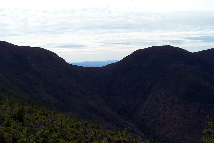
Mount Washington and the Presidential Range

Southern Presidential Range

Washington's Summit Cone

Mount Willey

Slides of Willey