Date of Hike 10/11/13
Cannon-Mittersill Trail: 5.0 miles
Mount Willard Trail: 3.2 miles
Total Miles: 8.2 (3,400 feet elevation gained)
Trip Report
- After reading three different trip reports
(Steve Smith's / John Compton's / Summerset Bank's) with beautiful pictures about the new Mittersill - Cannon Trail I was really itching to finally hike it.
- The trail starts off in lot #1 at the Mittersill Ski area, when you pull into the Mittersill Ski Area take an immediate right and lot #1 will be down the road on your left. At the end of lot #1 where the chair lift is there is a trail sign about twenty yards up on the ski slope.
- Ski trails offer a different kind of hiking experience for me. First, I find them to be calve-burners! I am so used to rock, root, and boulder hiking that it actually burns me out heading up hill! Second, I prefer hiking through the woods and up above treeline but the ski slope hiking offers a welcome different change of pace.
- The Mittersill-Cannon Trail travels up the ski slopes / access roads offering fine views over to Sugar Hill. The trail is easy to follow with yellow blazes on metal posts, trees, and rocks. The trail is in decent shape for most of its length but does have a few loose rock and eroded footing sections including one soggy earth section which is slowly falling from the slab underneath it.
- Views from Mittersill Peak are well worth the hike up. Terrific close up view of Cannon Mountain, the slopes, the tram building with Franconia Ridge looming across the notch. There is also the best view one can get of Coppermine Col and the Cannon Balls. Past the Cannon Balls are a nice view of the Kinsmans, too.
- From Mittersill Peak it's a short descent, followed by a left turn and then a quick right turn back up hill where you make your way up to the Cannon Tram building and hike the last few hundred feet on the gravel path with the tourists who tend to stay away from you because you smell like dirt!
- I saw a few dozen of the people who trammed it up around the summit, the weather was beautiful to be up there and everyone seemed to be enjoying the views.
- On the hike out I ran into a couple heading up, it was their first time on the trail as well, they were doing a loop, down Kinsman Ridge. It was nice to see other hikers out there enjoying the new Cannon-Mittersill Trail. If you get a chance check it out, it may be my new favorite way up Cannon.
__________________________________________________________________
- As usual when hiking alone I go at a quick pace so during the afternoon I headed to Crawford Notch for a quick hike up Mount Willard. I had never been up but knew that there were tremendous views to be had from the ledges. It is a quick and easy hike, a perfect introduction to new hikers.
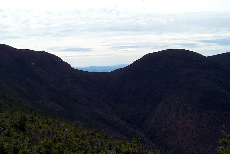
- The views are pretty sweet, you're standing high above Crawford Notch with the Willey Range above you on your right, the notch with Route 302 and the railroad below you, and the scarred walls of Webster Cliff above and to the left.
- I'll definitely head back here in the winter after a big snowfall hoping to break the trail out and catch some winter wonderland views!
Mittersill Alpine Village entrance
Lot #1
The chair lift at the end of Lot #1
The trail sign is located on the ski slope
Heading up the ski slop on a beautiful day!
As much 'in the woods' hiking as you get
Along an access road / ski trail
Crossing under the chair lift
Eroded section of the trail
Old chairlift from the 70's
The old Chair lift
Great footing
Beautiful semi open views
Soggy earth section with slab under it
Top of the chair lift
Chair lift with beautiful views to the north and west
'Single track'
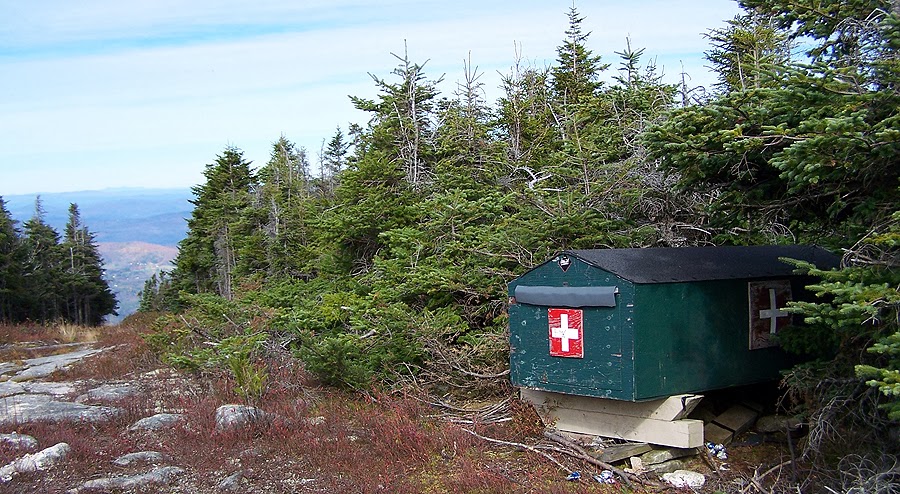
First aid cache at the top of Mittersill Peak
Cannon Mountain
Coppermine Col
Cannon Balls with the Kinsmans
Franconia Ridge
Mittersill / Cannon Col
Cannon Mountain
Sign says it all!
Mittersill Peak
Safety fence for us bad boarders and skiers to bounce off of!
Heading up to Cannon Mountain
The Rim Trail
Franconia Ridge
Franconia Notch
Sugar Hill
Sugar Hill
Mount Lafayette
Cannon Mountain tram building
Looking down the Cannon Mountain ski slopes
Environmental sensitivity area
Be careful!
Mittersill summit area
Hiking down the Mittersill Trail
Bald Peak and the Artists Bluff
Some nice birch glades along the trail
Bottom of the Mittersill Trail
Access Road at Lot #1
Mount Willard Trail
Centennial Pool
Webster Cliff and Crawford Notch
Crawford Notch
Sacco River
Mount Webster and Jackson
TRRRAAAAIIIINNNNN!!!!!!
Mount Willard Trail
Mount Willard Trail