Showing posts with label Middle Tripyarmid. Show all posts

MMD 50K 2018 . . . Death by Sandwich Range

Date of Run: 8/11/18

Tripoli Road: 0.7 miles  /  Livermore Trail: 3.6 miles  /  Mount Tripyramid Trail: 2.8 miles  /  Kate Sleeper Trail: 3.3 miles  /  Blueberry Ledge Trail: 0.7 miles  /  Tom Wiggin Trail: 1.1 miles  /  Dicey's Mill Trail: 3.2 miles  /  Rollins Trail: 2.6 miles  /  Kate Sleeper Trail: 0.8 miles  /  Downes Brook Trail: 2.3 miles  /  Bushwhack: 1.3 miles  /  Sabbaday Brook Trail: 2.0 miles /  Mount Tripyramid Trail: 3.3 miles  /  Livermore Trail: 2.6 miles /  Tripoli Road: 0.7 miles
Total Miles: 31.4 (10,700 feet elevation gained)

Trip Report:
- Another August and another fun trail run with a great group of runners of all ages.  This year's course had us running through the Sandwich Wilderness over some of the more enjoyable running trails, along with two super steep one mile bursts mixed in, and a bushwhack to make things interesting.
-  Some runners started at 5AM, others at 6AM, while Ben, Jerimy, Nate and his dog Piper, Stas, Tim, and myself started at 7AM.
- Stas was the rabbit for the first half of the run, he set off ahead of us setting a blazing pace through the Tripyramids and the Sleepers, we last saw him at the top of the north slide and wouldn't see him for awhile.  The rest of us stayed together throughout the run while leap frogging from time to time.  During the run, I would go a little faster on the downs (Tom Wiggins and leaving Passaconaway's summit), while everyone would catch me on the ups and pass me (Dicey's Mill), I'd settle in with the group during the minor up and downs (Kate Sleeper, Rollins).
- The weather was close to perfect, so hydrating and fueling was not an issue, especially with two water and fuel stations at mile 11 and 21, many thanks to Todd, Alan, Levi and Katrina.
- As we headed up Passaconway's summit cone we caught up to Stas and ran with him to the summit before parting ways as we reached the Rollins Trail.
- I held my own most of the day over this very fast route, probably 75% was made for running/fast hiking, where last year's route in the Great Gulf and King Ravine was probably 10-15% runable!
- When we reached the bushwhack section along the Downes Brook Trail we decided to stick together, the route was originally flagged but someone had gone in and taken down the flagging, they probably thought we weren't going to take it down once finished.  It wasn't a bad whack but it was thick and scratchy but not a knife fight.  It did slow us down quite a bit at first but then Tim got us on a good line and we made our way over to the Sabbaday Brook Trail.  My original goal was to run a sub 8 hour but without the flagging I reset my goal to 8:15.
- Once we hit the Sabbaday Brook Trail we all went at different paces.  Ben went into over drive with Tim following along for a little bit before Ben pulled away.  Nate and I struggled together up the steep last mile to the ridge, it was brutal but we made it!
- Once back on the Mount Tripyamid Trail, Piper and Nate took an extended break so Piper could get some water, relax, and cool down before the steep descent on the open south slide. I continued on motoring down the slide.
- I made great time down the slide but was unable to catch Tim over this technical section, once back in the woods the trail levels out and is built for speed so there would be no catching Tim on this day, but I was still thrilled with my time back down to the Livermore Trail and Tripoli Road finale.
- I quickly made my way back to Osceola Vista Campground with four straight sub eight minute miles to finish strong and come in at 8 hours and 11 minutes, four minutes behind Tim and twenty-two minutes behind Ben, good enough for third!
- After finishing, I relaxed and ate a tremendous amount of food while cheering on the other runners coming in and finishing and talking about hiking, running, and coming up with unique running/hiking routes with everyone until well past sunset. :)

Click here for the whole photo album that has multiple contributors.

Elevation over distance profile

Map of the route

Ben and Jerimy jogging up the Livermore Trail

Tim makes his way up the start of the north slide

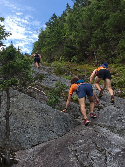
Stas sets a blazing pace up the slide

Tecumseh and Osceola's

Ben and Tim taking a breather while Stas motors ahead

Nate and Piper make their way up the slide
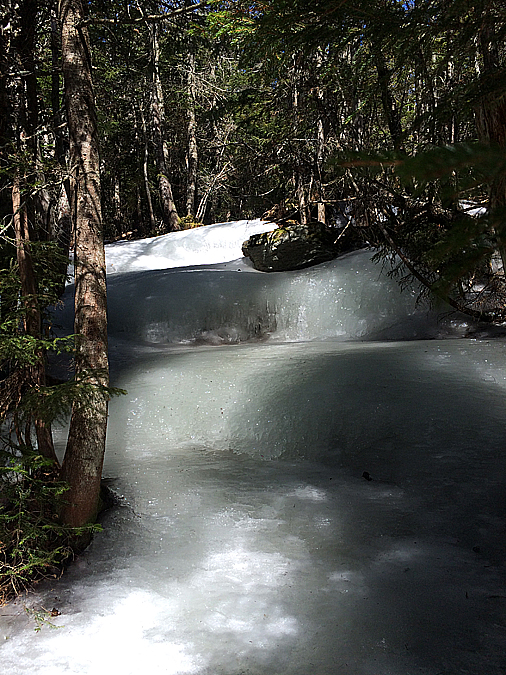
Kate Sleeper Trail

View from the Blueberry Ledge outlook

Mount Passaconway

Nate and Piper head up the relentless steep half mile up Sabbaday Brook Trail 

Death By Sandwich . . . Range : Tripyramids, Sleepers, Whiteface & Passaconaway

Date of Hike: 4/16/16

Livermore Trail: 3.8 miles  /  Scaur Ridge Trail: 1.1 miles  /  Pine Bend Brook Trail: 0.8 miles  /  Mount Tripyramid Trail: 1.3 miles  /  Kate Sleeper Trail: 3.0 miles  /  Rollins Trail: 2.2 miles  /  Dicey's Mill Trail: 1.6 miles  /  Rollins Trail: 2.2 miles  /  Kate Sleeper Trail: 3.2 miles  /  Mount Tripyramid Trail: 2.3 miles  /  Livermore & Big Pines Trails: 2.7 miles
Total Miles: 25.8 (7,945 feet elevation gained) Garmin Forerunner 910XT

Trip Report:
-  An amazing weather pattern came strolling through the northeast over the weekend so I took advantage of the abundant sunshine and warm temperatures to get in a pretty brutal hike in and out of the Sandwich Range Wilderness.  The hike began and ended at the Livermore trailhead, and from mile four through twenty the hike was filled with up and downs over bare ground, breakable ice, snow, ice flows, and ice bulges ranging from an easy to very difficult.
-  Knowing it was going to be a long day I got an early start at 6:45AM and easily made my way up the old Livermore Road to the Scaur Ridge Trail.  The Scaur Ridge Trail is probably the easiest way up to North Tripyramid, the footing is good and the grades are easy to moderate.  The ice started around 3,000 feet but was easy to walk up with my microspikes.
-  Once gaining the ridge I hooked a right onto the Pine Bend Brook Trail where things got really interesting, especially over the last quarter mile below the summit.  The trail became steeper and filled with 'bullet proof' ice, it was impossible to get any bite in the ice with my spikes so I headed into the woods and monkey climb paralleling the trail.  Since it was very early in the morning and still cold out the ice had yet to soften up, so I spent most of the last 0.2 miles in the woods off trail hugging trees and carefully making my way up to the summit.
-  From North Tripyramid I headed over Middle and South.  There was another small section just below Middle where I had to veer off trail but compared to North it was easy, and heading up and down South was a cakewalk.
-  Below South Tripyramid I hooked onto the Kate Sleeper Trail from the top of the south slide.  The Kate Sleeper Trail has a very secluded feel to it even though two trails where it begins and ends at, Mount Tripyramid and the Rollins Trail are heavily used, this trail sees very little use and is often overlooked.  It's too bad it is because it is one of the most beautiful stretches of trail in the White Mountains.  While there are no views, the pathway is very scenic and beautiful with abundant moose activity, lots of poo on the trails!  I got lucky on this day as I almost walked right into a mommy moose and her calf.  I came around a corner and startled them and then they startled me, they both went scurrying off into the open woods.
-  The trail was easy for travel through the Sleeper Ridge, it was a mix of soft ice and corn snow,  these great conditions changed as soon as I stepped onto the Rollins Trail.  There was more ice to deal with again, and three or four times I had to venture off trail a couple of feet and use trees to descend, however it was getting warmer by the minute so my spikes were biting in better and better.
-  After a few miles I reached the junction with the Dicey's Mill Trail and made the relentless climb up to the summit cone of Mount Passaconaway.  I really lucked out here as conditions have improved drastically over the past week and I was able to easily make my way through the steeps without having to leave trail while ascending and descending as there were enough rocks above the ice and tree branches on the side of the trail to help me out.
-  All the summits for this hike are wooded, but Passaconaway, North and Middle Tripyramid have nice outlooks near the true summit.  At the outlook for Passaconaway I ran into a hiker and his little dog Otis who looked to be having a ball.  During this icy April the little dogs have had a definite advantage over the bigger ones, they can maneuver up and down the ice or off in the woods easier than the big dogs where it can become dangerous for them.
-  Now it was time to backtrack over the Rollins and Kate Sleeper Trail.  I felt really strong heading back over Whiteface and down the Kate Sleeper Trail to the Whiteface /  East Sleeper Col, and then all of a sudden I started to get that bonking feeling.  Stupid me, I forgot to bring an electrolyte drink, and delayer so I started to overheat and become sluggish.  I haven't felt this bad on trail since my 2014 H2H run.  I made sure to slow down and carefully make my way through the Sleepers until I popped back out on the South Tripyramid Slide where the rest of the hike was all down hill.  Once reaching the slide I immediately felt better again.
-  The slide was in summer conditions, no snow or ice, making this probably the best way to do the Tripyramids right now as an out and back to avoid the ice on the northside of North Tripyramid.
-  Once below the slide I enjoyed the last few cushiony miles over the lower end of the Mount Tripyrmid Trail before leaving the Sandwich Wilderness and back onto the Livermore Trail.
-  On my way out I made a side trip on the Big Pines Trail which lead me to three huge White Pines.  These pine trees dwarf all other pines and and are quite the site to see.  There are not many left as they where harvested in the mid 1700's by King George who used the trees to build his ships for his navy fleet.  The White Pines where marked with the King's Broad Arrow (click here for more info).  I wonder if there are any White Pines with the mark still around in the White Mountains, it's been 250 years so if one still stands the bark from the tree would probably have overtaken the King's Broad Arrow marking.

First car in at the Livermore Trailhead.  Mount Tecumseh in the background

Hiking up the old Livermore Road (trail).  Great footing with numerous trails leaving this road throughout its length

The Scaur Ridge Trail.  Dry in the sun, icy in the shade!

Pine Bend Brook Trail was rotting snow transitioning to all ice

Hiking along the icy trail.  This was one of the easier spots!

Looking north from North Tripyramid downlook

Waterville Valley with Mount Tecumseh and an obstructed view of the Osceola's from Middle Tripyramid's outlook

 Looking over to where I'm heading, Mount Passaconaway

Heading down the top of the South Slide and the Sleeper Slide

West Sleeper Summit, with a tiny cairn...of moose poop!

Hiking along the Kate Sleeper Trail, spotted a tree with an old yellow blaze.  There are a few spots along here with faded old yellow blazes.  I wonder when and why it changed over to blue?

The Kate Sleeper / Downs Brook Trail junction.  I always enjoy this spot, there are a couple of old yellow blazes near it and a little open marsh area near here just off trail.

Mount Passaconaway as seen from an outlook along the Rollins Trail

Ice monster on the Dicey's Mill Trail

His name is Otis!

Looking back at where I was earlier in the day, the Tripyramids

Heading back over to Whiteface

Icefest 2016!

This little blowdown patch is one of one a few spots along the trail with views.  Mount Passaconaway in view

One last ice bulge on the Rollins Trail to get back over!

Nice little camping area on the Kate Sleeper Trail

Kate Sleeper blowdown patch

Which way should I got??

South Slide

Mount Tecumseh as seen from the South Slide

Beautiful open woods on the lower end of the Mount Tripyramid Trail

Nice and easy, now this is the way to end a hike!

Heading back out on Livermore Trail

The trunks of the White Pines at the end of the Big Pines trail

Looking up at the White Pines

Those are some big pines!

A couple enjoying the great weather

Signs Spotted along Livermore and the Tripyramids

Songs spotted through the Sleeper Ridge

Signs spotted between Whiteface and Passaconway

Elevation over distance profile (click here for more details)

Sliding My Way to the December Grid . . . Tripyramids & Owl's Head

Date of Hikes: 12/5/15 & 12/6/15

Livermore Trail: 2.7 miles  /  Mount Tripyramid Trail: 3.3 miles  /  Pine Bend Brook Trail: 0.8 miles  /  Scaur Ridge Trail: 1.1 miles  /  Livermore Trail: 3.8 miles
Total Miles: 11.7 miles (2,984 feet elevation gained)

Lincoln Woods Trail: 2.8 miles  /  Franconia Falls Trail: 0.5 miles  /  Fisherman's Path: 1.5 miles  /  Lincoln Brook Trail: 2.5 miles  /  Owl's Head Path: 1.75 miles  /  Brutus Bushwhack: 0.7 miles  /  Lincoln Brook Trail: 2.8 miles  /  Camp 9 RR Grade Bushwhack: 0.4 miles /  Franconia Brook Trail: 1.3 miles  /  Lincoln Woods Trail: 2.9 miles
Total Miles: 17.2 (3,022 feet elevation gained)

Trip Report:
- Going into December I only had three peaks left to complete the month towards the Grid (hiking all 48-4,000 footers in each month over any given period of time).  Luckily with the mild temperatures continuing I was able to hike a couple of slides on my way up the Tripyramids on Saturday and Owl's Head on Sunday.  There is some snow and ice so I played it safe and descended via easier routes, Scaur Ridge Trail down from the Tri's and the Brutus Bushwhack down from Owlie.  On both hikes I checked out some old railroad camps, Avalanche Camp on the Livermore Trail which is a very distinguishable open field on the side of the trail.  The following day while hiking out from Owl's Head I stayed on an old railroad grade a few tenths of a mile before the Lincoln Brook Trail reached the junction with the Franconia Brook Trail and stumbled upon a huge open field/marsh just west of Camp 9 Brook and found a few relics from the old Camp 9.
- Conditions on both hikes were extremely tame for  December, the South Slide below South Tripyamid had a few inches of snow and some ice but I was able to make it up with no traction on.  The rest of the hike was mostly a breeze along the ridge over Middle and North Tripyramid.  There were lots of people out along the ridge with a majority of them coming up from Pine Bend Brook.  I ran into Schorman (Grid Finisher #29) on North Tripyramid, just a few tenths of a mile from where I saw him a few weeks back.  It was great to stop and chat with him again!
- I headed down the Scaur Ridge Trail which is a very nice and easy alternative to descending the North Slide.  There is even an obstructed view this time of year while the leaves are down of the North Slide from the trail which is nice.
- The last four miles was an easy hike over the old Livermore Road back to the car under sunny skies and temperatures hovering around fifty degrees!

On Sunday I originally was thinking of heading over Lafayette and down the Lincoln Slide on my way to Owl's Head with my friend Kyle, however, with the warm temps during the day and the cold night temps, followed by more warmer temps, I didn't want to deal with descending on snow and ice in the slide then bushwhacking over a mile through wet snow and mud.
- I did mix up the hike by using trails and bushwhacks.  I started out along the Lincoln Woods Trail for almost three miles, then hiked up to Franconia Falls.  Just past the falls the trail abruptly comes to an end, there's even a sign nailed to a tree saying 'END OF TRAIL'
- Past the sign is a well defined herd path, known as the Fisherman's Path.  It hugs the Franconia Brook for most of it's length and the whack is about a mile and a half.  Two thirds of the time there is a well defined path, the other third is a mix of a sort of defined path to indistinguishable.
- The Fisherman's Path I enjoyed a lot, more so than the Black Pond Bushwhack because it traveled close to the brook and just seemed more scenic to me.  The Fisherman's Path comes out just past the second wide crossing on the Lincoln Brook Trail.
-  I then made my way gradually up the Lincoln Brook Trail to the base of Owl's Head, put on my micro spikes, and headed up the steep Owl's Head Slide.  There was a mix of snow and ice, the spikes came in very handy as I navigated up the icy sections on the upper part of the slide and in the woods just above the slide.  Once past the steep icy spots I ran into another hiker, Kim, who was finishing her 47th 4,000 footer, she was overjoyed to have made it to the summit and I took a picture for her.  I congratulated her and wished her luck on her upcoming finish on Mount Moosilauke.
- On the descent I opted for the Brutus Bushwhack, there was enough snow on the ground that I followed older boot prints for a little bit, but they just seemed to be heading to far south so I cut off and steeply descended and ended up hitting the old haul road at about the spot I usually find it, just before a gully.  I then easily descended the old road and then a tiny drainage back to the Lincoln Brook Trail.
- I stuck to to the trail for most of the way out, past the Fisherman's Path and over the two wide brook crossings.  They were very trivial, the first one I made it across with some long leaps and kept my feet dry.  The second wide crossing I made it to about ten feet from the river bank and had two ankle deep steps on rocks to deal with.  I got wet feet but it was very warm out, plus I had my 'scuba' socks and gaiters on so I wasn't worried.
- Just past the last crossing the trail leaves the RR grade to the left, I stayed on the old grade through a wet section and stumbled upon a huge open field/marsh that ended at Camp 9 Brook.  I then headed into the woods and found some old 'RR junk' before hooking back onto the Franconia Brook Trail and out to the Wilderness Boundary.
- The hike out along the Lincoln Woods Trail was business as usual, I did go off trail one last time before the Osseo Trail, up above Camp 8 on the old grade referred to as 'Narrow Gauge Line.'  The woods are really wide open and the line runs parallel to the Lincoln Woods Trail up above it.  The line goes up a side hill too but I just stayed on the flat section, next time I'll head back to see where it goes.
- The last thing I did was head into the Camp 8 clearing and stumbled upon a few old items too, not much is left there however.
- Back at the car I changed into dry clothes and headed over to NoCo to see Whitney while she worked and to watch the Pats game before heading home to Gorham, ending a really fun December weekend hiking :)
- December Grid:  Whiteface December 5th, 2009 - Owl's Head December 6th 2015

 Depot Camp clearing near the start of the Livermore Trail

Hiking along the Livermore Trail, it's mostly flat and very gradual, you'll see hikers, runners, bikers, x-country skiers (when there's more snow)

After hiking about three miles I take a left onto the Mount Tripyramid Trail and slowly head up to South Peak

The mid-morning sun shining brightly through the woods 

Lower part of the South Slide

Upper part of the slide, the views for the North Slide are better but these views are good to.  Sandwich Mountain Range off in the distance

Heading up to the ridge, and the view from Middle Tripyramid Outlook over to Waterville Valley and Mount Tecumseh

The Presidential Range (left), Wildcat-Cater Range Right from North Tripyramid's outlook

Heading down the Scaur Ridge Trail

The North Slide as seen from the Scaur Ridge Trail

Avalanche Camp

Heading out back to the car

Signs spotted along the way

---------------------------------------------------------------------------------------------------------------------

 Starting early across the Lincoln Woods suspension bridge and Camp 8 clearing

An old trestle foundation and the Franconia Brook footbridge

Franconia Falls

Swimming hole above the falls

End of Trail!  Start of the Fisherman's Path

The Path parallels the brook for most of it's length then comes out near a tiny tentsite on the side of the Lincoln Brook Trail
  
Lincoln Brook and trail

The always muddy Lincoln Brook Trail!

Lower part of Owl's Head Slide

Middle section of the slide

Lincoln Slide and Franconia Ridge

Upper part of the slide was where the ice was!

Looking down the slide

Above the slide there was more ice, followed by bare rock, then snow

Along the ridge on the way to the summit.  If you know where to look you can get a nice view across to Lincoln Slide

Owl's Head summit and then descending off the mountain down the Brutus Bushwhack

Along the Lincoln Brook Trail

 Lincoln Brook looking oh so cold!

An old piece of railroad equipment near one of the two wide crossings on the Lincoln Brook Trail

Trail goes left, I stayed straight!

Followed the old RR grade, it got a little washed away in spots

Then it breaks out into the open

 Nice view of Owl's Head from and open field / marsh

Really glad I stumbled upon this spot!

Camp 9 relics

More from Camp 9

There wasn't much to be viewed, but a few months ago I didn't think anything was left here so I was happy to see this stuff
   
One of the crossings on the Franconia Brook Trail

Lincoln Woods Trail

On the 'narrow gauge line'

Looking down from the gauge line, if you look closely you can see the Lincoln Woods Trail and a footbridge

Camp 8 clearing and some old RR stuff

Route for Owl's Head. click here for more details