
Date of Hike: 6/27/11
Crawford Path 3.1
|
Webster Cliff 0.2
|
Crawford Path 1.2
|
Eisenhower Loop 0.8
|
Crawford Path 1.4
|
Monroe Loop 0.7
|
Crawford Path 1.6
|
Gulfside 1.1
|
Clay Loop 1.2
|
Gulfside 0.7
|
Jefferson Loop 0.7
|
Gulfside 1.4
|
Lowe's Path 0.3
|
Airline 0.6
|
Gulfside 0.4
|
Osgood 1.0
|
Gulfside 0.9
|
Lowe's Path 0.6
|
Gulfside 1.4
|
Jefferson Loop 0.7
|
Gulfside 0.7
|
Clay Loop 1.2
|
Gulfside 1.1
|
Crawford Path 1.6
|
Monroe Loop 0.7
|
Crawford Path 1.4
|
Eisenhower Loop 0.8
|
Crawford Path 1.2
|
Webster Cliff 0.2
|
Crawford Path 3.1
|
.
|
Total Miles 32.0
|
Elevation Gain
|
12,250 feet
|
.
|
- I told my old man if the weather was promising on Monday I was going to hike from Mount Pierce to Madison then turn around and do it again...his response "Don't be an idiot!" so with his blessing it was off to punish my body over the rough and rugged Presidential Range while taking in the views above treeline for twenty five strait miles!
- Detailed information below Pictures (Click here for all pictures)
- Click here for video from Mount Franklin, and click here for video from Mount Monroe

Mount Pierce summit at dawn

Mount Eisenhower summit in the fog

Sun trying to burn through along the Crawford Path

Clouds lifting off Mount Monroe from Mount Franklin

Last of the clouds passing by above 5,000 feet

Undercast below the Presidential Range

Looking back towards Mount Franklin with Eisenhower still in the clouds

Lakes of the Clouds and Mount Monroe

Northern Presidential Range from Observatory

Mount Jefferson Summit

Mount Adams from Mount Jefferson Loop Trail

Madison Springs Hut and Mount Madison

Monticello Lawn from Mount Jefferson Loop Trail
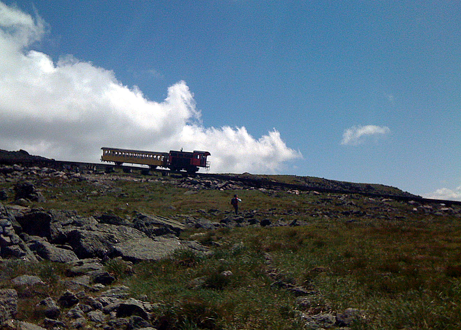
Cog Railroad

Mount Monroe from Mount Franklin

Crawford Path

Mount Eisenhower Summit

Presidential Range
Trip Report:
- On trail at 3:30am, Pierce 5:00 am, Eisenhower 5:45am, Franklin 6:25am, Monroe 6:45am, Washington 7:45am, Clay 8:35am, Jefferson 9:25am, Adams 10:30am, Madison 11:20am, Adams 12:25pm, Jefferson 1:25pm, Clay 2:15pm, Washington 3:00pm, Monroe 4:10pm, Franklin 4:30pm, Eisenhower 5:10pm, Pierce 5:50, Finished 6:15pm
- Temps were in the 60's below treeline before dawn, high 40's above treeline with high winds 30 plus mph until ascending Washington when winds died down. Temps rest of the day in 60's with light to variable wind with excellent visibility although hazy.
- Started out in t-shirt until treeline. Then put on long sleeves, wind breaker, hat and gloves from Eisenhower Loop until Clay Loop. T-shirt the rest of the day and lots of sun block.
- Thick fog and clouds until 6:30am when everything cleared off while standing on Mount Franklin.
- High winds from Eisenhower to Monroe summit but then quickly died down to nothing by mid morning.
- Passed Lakes of the Clouds Hut during breakfast, all the rocks outside the building had boots, socks, shirts, etc. laid across them to dry in the sun.
- Passed Lakes of the Clouds Hut during breakfast, all the rocks outside the building had boots, socks, shirts, etc. laid across them to dry in the sun.
- Had the summit of Mount Washington to myself, only a cat was roaming around...In case you were wondering they do not serve hot dogs in the morning!
- Ran into first hiker of the day at Mount Jefferson summit, young guy doing his first North to South Presi Traverse to Pierce, he was having a blast and was kicking ass!
- Took a nasty fall on Gulfside Trail just past Adams V summit. Broke my camera (which I always hold in my left hand while hiking), had to use "apple phone" camera rest of the way.
- Started running into hikers near Thunderstorm Junction, would see well over one hundred the rest of the day. A few that stick out was a guy who had a great hike up the Airline and loved the smell of the pine needles in the early morning below treeline and a nice lady who I met as I started my trip back south who had a nice hike up Adams and wished me luck on my Double Presi Traverse.
- Once I hit Madison Summit I had lunch and looked across to Washington, needless to say a very long walk back to my car!
- Madison Springs Hut looks very nice inside after renovations, and had free Pumpkin Pancakes!
- Once I hit Madison Summit I had lunch and looked across to Washington, needless to say a very long walk back to my car!
- Madison Springs Hut looks very nice inside after renovations, and had free Pumpkin Pancakes!
- Took Gulfside to Thunderstorm Junction and then decided to head back up to Adams and re-tag all the summits on the way out, hey you only live once! Eventhough a little longer it's much easier on the feet to head up Adams this way than up from the Airline junction.
- Nasty Swarming uber-wasps on Jefferson, Clay, Monroe, and Eisenhower on the way back out, they really liked my sun block and tried attacking me, I killed two, no stings, but had to run off Jefferson, Clay, and Monroe summit area!
- Final slog up to Washington I went along the tracks to save my feet. At summit I had a hot dog, PB&Strawberry Jamwich while chugging 32 ounces of Gatorade...got some really strange looks from the tourists.
- Amazing views all along the Southern Presidentials, especially the small hump to the almost level section just past Mount Franklin, it's pleasant on the feet, no one is ever on the trail compared to other spots, and it's beautiful in every direction!
- The section between Eisenhower and Pierce went easier than I thought it would eventhough I was dog-tired.
- The section between Eisenhower and Pierce went easier than I thought it would eventhough I was dog-tired.
- Started talking to myself the last mile and a half but still not as bad as finishing the Pemi Loop along the Lincoln Woods/Wilderness Trail!
- Back at the car I just sat down on the pavement, then laid down and stared up at the blue sky, lots of cars in the parking lot but no one around, awesome ending to an epic hike!
- For the hike I drank about 6L of water, 64 ounces of Gatorade, ate about 10 granola bars, 4 snickers bars, 2 PB&J sandwiches, and a hot dog!
- I think I'm ready for the "24 Hour H2H" (24 Hour Hut to Hut traverse!)
- I think I'm ready for the "24 Hour H2H" (24 Hour Hut to Hut traverse!)
Some hike, congrats!
ReplyDeleteYou may have passed a buddy of mine traversing with a group of AMC caretaker dudes. But then again, everyone looks the same up there after a while!
Daaayum! I wanna do this! Its so much cooler with the word double in front of it. I'm going to legally add that as a prefix to my first name, you've inspired me. Kudos for the report, sorry to hear about your camera. You should really get the panorama cam iPhone app btw.
ReplyDeleteWhat a uniquely awesome hike . . . and your photos are equally awesome!!
ReplyDeleteSorry to read that you broke your main camera when you took a tumble on the Gulfside Trail. But at least it wasn't a body part that got broken!
John
Glad you guys like the post and pics...no worries about the camera it was only a matter of time before i smashed it but luckily enough I can use the parts that work on this one and fix the other one I broke last year!
ReplyDeleteUm, wow, that was some trip! Congrats on finishing that one and thanks for sharing. My fav photos are the two different ones on Ike at very different times of day.
ReplyDeletewww.nh48.wordpress.com
"Don't be an idiot!" is a completely appropriate response from anyone who's done a Single-Presi traverse. You rock Chris!
ReplyDeleteWe did "the Double" last summer, via the same route you did, but it took us (Dan, Alan, myself) much much longer. We had been talking about it for years and finally pulled the trigger. Totally epic day, 25 miles of 360 views. Loved every mile of it. Can't wait to do it again this summer.
-Kimball