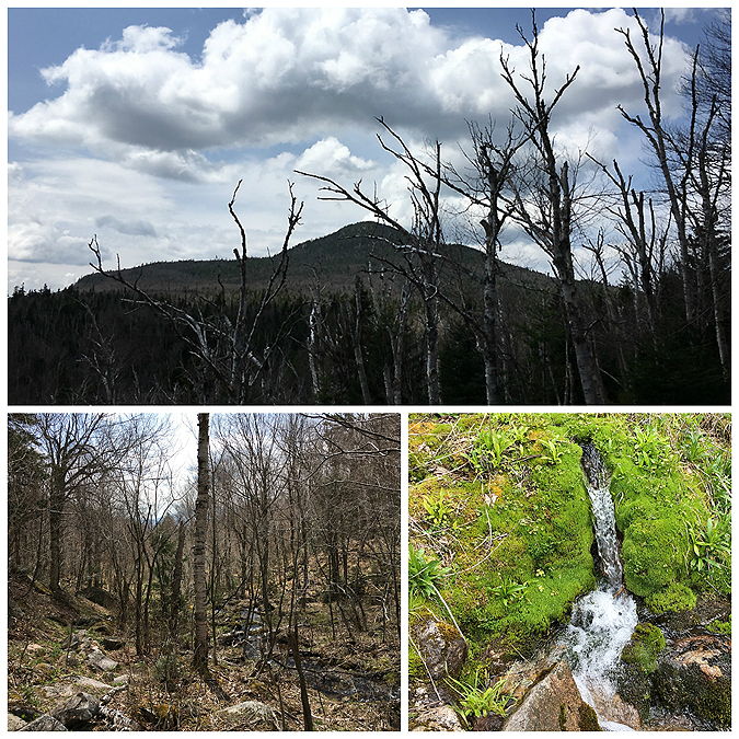
Date of Hike: 3/20/16
Herd Path: 1.0 miles / North Twin Trail & Herd Path: 1.0 miles / Mount Hale Trail (Fire Wardens) 2.2 miles / Lend-A-Hand Trail: 2.5 miles / Twinway: 6.0 miles / North Twin Spur: 1.2 miles / North Twin Trail: 4.2 miles / Herd Path: 1.0 miles
Total Miles: 19.0 (5,712 feet elevation gained)
Trip Report:
- The first day of spring brought on spectacular weather that was too perfect to pass up logging in a big mile day to finish off my March grid. I had two peaks left, Hale and Zealand and decided to do one of the more enjoyable loop hikes in the Whites along with South and North Twin. The route involves an abandoned trail, the Mount Hale Trail (AKA Fire Wardens Trail), however the trail is easy to follow and travels through some of the most beautiful Birch glades in the Whites. The only caveat is being able to locate the start of the old trail which lays between the first and second crossing of the north twin trail off a well beaten herd path, here's a hint...find a narrow lil' tree standing guard in the middle of the herd path and bang an immediate left up a small embankment onto an very well defined old road heading uphill in the direction you just came.
- From here the old trail ascends very gradually up to the summit passing by the aforementioned Birch glades, then a pine tree tunnel, followed by an old growth section where old man's beard is prevalent.
- From Mount Hale's summit I dropped down the well blazed Lend-A-Hand Trail for a couple of miles over the snow covered trails to the junction of the Twinway where I faced my steepest climb of the day. The initial burst on the Twinway to Zeacliff is steady and steep, which slows even the strongest hikers pace significantly. Luckily, you are rewarded for your struggles as the Zeacliff outlook has tremendous views. Once past Zeacliff the grades ease to the summit of Zealand, except for one short burst past the well placed ladder steps.
- I took a short break at the summit where I think I angered some Gray Jays as I refused to feed them, I was really hungry and didn't want to share my snacks! Two of them just went from tree branch to tree branch above my head practically begging for my food. I'd feel bad but I know they probably were going to be fed and fed well by several hikers coming through after me.
- Now I started the second part of my hike, the fun part, as it was time to hike to some big views. First up was cresting over North Guyot on the Twinway, one of my favorite stretches of trail, after spending miles and miles in the woods the trail pops out into a beautiful rock alpine meadow with sweet views of the Pemigewasset Wilderness. The views are short lived as after a few tenths of a mile I was back in the woods heading over to South Twin. I was shocked at the lack of snow through here, it was very low and the trail was easy to follow, even though it had been drifted over in most places after Saturday's foot traffic from Pemi Loopers. Usually, this section is buried in snow, blazes are sparse and awfully placed, and overall it's extremely hard to follow without a GPS devise.
- When I made it to the summit of South Twin I took my lunch break and enjoyed the phenomenal views while basking in the sun. It was oh so quiet and peaceful on the summit and it was one of those moments where I realized I'm very lucky to live in the mountains and explore them every week.
- From South Twin I made quick work over to North Twin and its outlook to check out the great view of more than half the 'horseshoe' that makes up the Pemi Loop (Flume through Galehead). After taking a bunch of pictures I decided it was time to push myself physically and see if I could trail run the final five miles back to the Jeep in under an hour. I caught a break with the trail being a super packed highway almost all the way down to the water crossing, which was a little sketchy but I made it across with a few leaps of faith, knowing that if I fell in I wouldn't be sucked down the river and just would have a chilly remaining twenty-five minute run to the trailhead. The run out went very well and it took me fifty-two minutes to complete, this meant I was able to catch Whitney at home before she headed off to work. A perfect start to Spring!

When Haystack Road is closed there are a few spots to park at the end of Little River Road, do not block the private drive, do not wear spikes over the bridge, and please be very respectful to local land owners that let us easily access the mountains. The herd path to the North Twin trailhead starts immediately after the bridge on the left
The herd path and the first mile of the North Twin Trail are over the old Little River Railroad grade.
Between water crossings #1 and #2 there is a herd path bypass, off this bypass is the start of the abandoned Fire Wardens Trail. Right after the little tree the trail makes a u-turn up a small embankment
Birch Glades
The old trail is still really well defined
The trail up to the summit of Mount Hale
Heading to Zealand Mountain along the Lend-A-Hand and Twinway
Carrigain Notch off in the distance from Zeacliff outlook
Whitewall Mountain
Carrigain Notch (top). Norcross Pond is the tiny little white patch in the middle of the bottom picture
Mount Hale as seen from the Twinway
Cresting over Northeast Guyot
The Slides of the Twinway, hiking in the woods, and looking back to Guyot from just below South Twin
Looking back to Guyot
Hale (top), Zealand (bottom)
Presidential Range and a zoom-in of Mount Jefferson and Adams
Looking towards North Twin
Presidential Range
Zoom-in of Mount Washington
Pemi Wilderness (Flume, Liberty, Lincoln, Lafayette, Garfield, Galehead)
Galehead and the hut
Mount Zealand and South Twin
Mount Hale with the Presidential Range rising high above in the background
Heading down the North Twin Trail and crossing the Little River
Back along the lower section of the North Twin Trail and the herd path from the North Twin trailhead and the end of Little River Road
Old Stone fireplace and shelter, filled with some junk
The bridge over the Little River and the Little River
Elevation profile for the hike