Date of Hike: 6/19/15
Bouler Loop: 3.0 miles / Church Pond Loop 2.3 miles
Total Miles: 5.3 (1,480 feet elevation gained)
Mount Hale Trail: 4.0 miles (2,370 feet elevation gained)
Trip Report:
- Whitney is working on her Red-Lining (hiking all the trails in the White Mountain Guide Book). She is just under 50% complete, with a goal to reach 75% by the end of October. What I find fascinating about red-lining, thanks to Whitney, is researching trails that for the most part I've glanced over and never even noticed on the map. Basically there are trails everywhere, some really tiny ones, too!
- On Friday morning we did two relatively easy but nice hikes. First up was the Boulder Loop Trail which is located just off the Kangamangus Highway on Passaconaway Road at the Albany covered Bridge. It's a quick loop with a steady moderate ascent over good footing to a few open ledges. There is a great view over to Chocorua, Passaconaway, and the Tripyramids to the south, to the east there is a unique view of the eastern flanks of the Moat Mountain Range.
- After the Boulder Loop we headed up the Kanc, with dozens of our favorite biker friends, it's bike week in NH, I like bike week until the last day or two of it when the noise starts getting to me.
- The Church Pond trail used to be a loop but the eastern half of it was decommissioned after beaver activity flooded it.
- There are three highlights to this hike; One, crossing the Swift River, it's a small crossing but you have to wade, not tough at all and very refreshing. Two, the bog bridges, they have been masterfully placed, in perfect shape, and go on forever. Three, Church Pond, it was a lot bigger than we expected, we'd figured it would be a muddy boggy pond but was wide and clear that looked prime for a relaxing canoe ride.
- It was tough to get a good view from Church Pond, there really is no shore to speak of but we found some herd paths and got a decent view over to Mount Potash and Hedgehog. From the pond we retraced our steps and headed as quickly back to the car as possible to avoid getting eaten alive by uber mosquitoes!
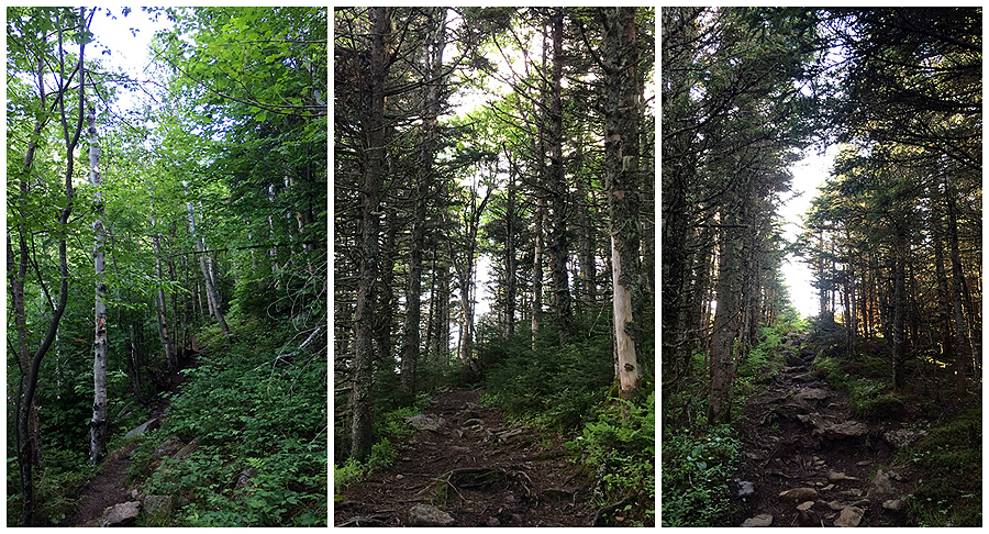
- Later in the day Whitney had to head into work for four so I decided to take a drive up through Crawford Notch to hike Mount Hale in the early evening. I decided to hike the Hale Brook Trail, it's not my favorite trail, and to be honest it's one of the most ho-hum trails that heads up a 4,000 footer. There's nothing really exciting about the trail or anything it passes. In the fall when the leaves fall you get a nice obstructed view of the Presidential Range from certain spots, but in June, all you see is tree and leaves from the bottom to the top.
- Still, getting in a late day hike on a 4,000 footer with no one else on the trail was very enjoyable and a perfect way to start off the weekend!




Bouler Loop: 3.0 miles / Church Pond Loop 2.3 miles
Total Miles: 5.3 (1,480 feet elevation gained)
Mount Hale Trail: 4.0 miles (2,370 feet elevation gained)
Trip Report:
- Whitney is working on her Red-Lining (hiking all the trails in the White Mountain Guide Book). She is just under 50% complete, with a goal to reach 75% by the end of October. What I find fascinating about red-lining, thanks to Whitney, is researching trails that for the most part I've glanced over and never even noticed on the map. Basically there are trails everywhere, some really tiny ones, too!
- On Friday morning we did two relatively easy but nice hikes. First up was the Boulder Loop Trail which is located just off the Kangamangus Highway on Passaconaway Road at the Albany covered Bridge. It's a quick loop with a steady moderate ascent over good footing to a few open ledges. There is a great view over to Chocorua, Passaconaway, and the Tripyramids to the south, to the east there is a unique view of the eastern flanks of the Moat Mountain Range.
- After the Boulder Loop we headed up the Kanc, with dozens of our favorite biker friends, it's bike week in NH, I like bike week until the last day or two of it when the noise starts getting to me.
- The Church Pond trail used to be a loop but the eastern half of it was decommissioned after beaver activity flooded it.
- There are three highlights to this hike; One, crossing the Swift River, it's a small crossing but you have to wade, not tough at all and very refreshing. Two, the bog bridges, they have been masterfully placed, in perfect shape, and go on forever. Three, Church Pond, it was a lot bigger than we expected, we'd figured it would be a muddy boggy pond but was wide and clear that looked prime for a relaxing canoe ride.
- It was tough to get a good view from Church Pond, there really is no shore to speak of but we found some herd paths and got a decent view over to Mount Potash and Hedgehog. From the pond we retraced our steps and headed as quickly back to the car as possible to avoid getting eaten alive by uber mosquitoes!
- Later in the day Whitney had to head into work for four so I decided to take a drive up through Crawford Notch to hike Mount Hale in the early evening. I decided to hike the Hale Brook Trail, it's not my favorite trail, and to be honest it's one of the most ho-hum trails that heads up a 4,000 footer. There's nothing really exciting about the trail or anything it passes. In the fall when the leaves fall you get a nice obstructed view of the Presidential Range from certain spots, but in June, all you see is tree and leaves from the bottom to the top.
- Still, getting in a late day hike on a 4,000 footer with no one else on the trail was very enjoyable and a perfect way to start off the weekend!
Boulder Loop and Church Pond Trail, click here for more info
View from one of the ledges
Nice view of Chocorua from the summit
Albany covered bridge
Signs spotted along the way
Church Pond Trailhead and signs
Whitney crosses the Swift River
Church Pond Trail
Church Pond
Mount Hale Route, click here for more info
Hale Brook Trail
The trail does pass through a nice little Birch staircase section
But for the most part the trail is kind of on the ugly side
Mount Hale summit
If you climb up on top of the summit cairn you get a partial view over to the Twin Range
Heading back down the Hale Brook Trail