Showing posts with label Galehead. Show all posts

Midnight Express . . . Flume to Willey

Date of Hike: 7/21/18

Lincoln Woods Trail: 1.4 miles  /  Osseo Trail: 4.4 miles  /  Franocnia Ridge Trail: 5.0 miles  /  Garfield Ridge Trail: 6.6 miles  /  Frost Trail: 0.8 miles  /  Twinway 0.8 miles  /  North Twin Spur: 2.6 miles  /  Twinway: 2.0 miles  /  Bondcliff Trail: 0.8 miles  /  West Bond Spur: 1.0 miles  / Bondcliff Trail: 3.0 miles  /  Twinway: 4.3 miles  /  Lend-A-Hand Trail: 5.4 miles  /  Twinway: 0.4 miles  /  Zealand Trail: 0.3 miles  /  A-Z Trail: 2.7 miles  /  Mount Tom Spur: 1.2 miles  /  Willey Range Trail: 3.5 miles  /  Ethan Pond Trail: 1.5 miles
Total Miles: 48.85 (17,210 feet elevation gained)  AMC White Mountain Guide Online

Trip Report:
- Friday night at 9:30PM I moseyed my way up to Mount Flume from Lincoln Woods.  I wanted to reach the summit just before midnight before taking off at midnight for a 100K route through the heart of the White Mountains.
- The hike up Flume went well and I was not alone as I would pass by a half dozen other hikers along the way, these would be the last people I would see until dawn!
- I reached Flume's summit around 11:50 and took a break while looking up at the stars shining brightly high above me.  After ten minutes of relaxing and organizing my gear I started my adventure.
- It was rough going during the night heading over Franconia Ridge, I wasn't moving as fast as I had planned and then the Garfield Ridge, my old nemesis, destroyed me during the wee hours of the night, needless to say it became apparent really quickly that I might have to revamp my route and mileage.
- Even with the slower than expected pace I was still having an enjoyable nighttime hike, especially above treeline where the stars and Milky Way looked spectacular.  During one of my breaks on North Lafayette, I saw a shooting star fly across the sky to the northwest.  I also spied a few planes high in the sky, flying east/northeast, maybe they where flying to Europe??!!
-  Some of the other highlights as I made my way across Garfield Ridge were the sounds of dozens of frogs as I made my way past Garfield Pond, stargazing for a few minutes from the summit of Mount Garfield, and carefully making my way down the waterfall section of the trail just below the Garfield Campsite, which luckily was easy since it's been an incredibly dry summer, still it was quite the adrenaline rush dropping down that section of trail.
- The rest of the night hiking went ok, after a few hours I started looking forward to not having to go by headlamp as the final few miles leading up to Galehead Hut and the summit weren't too exciting.  After a short stop at Galehead Hut I was able to ditch my headlamp at 5AM as I started my way up South Twin.
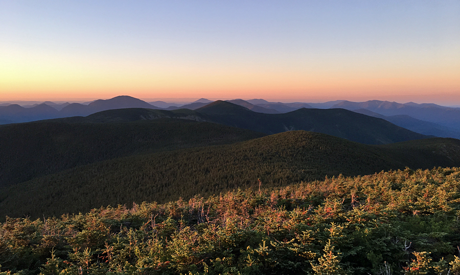
- I reached the summit of South Twin just as the sun was rising up behind the Presidential Range, another really cool sight to see.  South Twin usually has a pretty constant stream of hikers on it's open summit so it was nice to have the top to myself and enjoy the peace and quiet.
- From South Twin I made and out and back of North Twin before heading over to the Bonds.  From here on out I would be seeing more and more hikers, starting along the Twinway near Guyot and every five to ten minutes as I made my way to West Bond, Bond, and Bondcliff before turning around and heading back to the Twinway.
- It was still early in the morning when I dropped below treeline towards Mount Zealand around 9AM.  I had until 5PM to reach Ethan Pond trailhead off 302, earlier I texted Whitney for a car pickup, deviating from my intended route, so I had the whole day to make it there.
- I made good time to Zealand and then down to the hut, where I bought a piece of chocolate cake and relaxed before heading up to Mount Hale via Lend-A-Hand Trail.  This would be one of my last big climbs of the day, luckily the Lend-A-Hand Trail has mostly easy to moderate grades with good footing, there are two short steep rugged bursts over the last mile but that's it for the tough stuff.
- It was an easy out and back from the hut to Hale.  Once again, I took a break and had some food and refueled while preparing my gear for the climb out of Zealand Valley to the Willey Range along the A-Z Trail.  This would be my last big climb of the day, and just like hiking up to Hale most of it was along easy to moderate grades with great footing  before getting steeper and more rugged for the last three quarters of a mile.  The A-Z Trail between Zealand Trail and Willey Range Trail is lightly used so I had this 2.7 miles all to myself.  However, once I gained the ridge it was a totally different story, hikers everywhere!
- I was a bit perplexed as to why so many hikers were out on this viewless range on a perfect above treeline day.  I must have see 50 hikers between Tom-Field-Willey, no wonder why the trail is severely eroded in a few spots, none worse than just below Mount Willey, it's a disaster!  I carefully picked my way down this eroded mess, I was over forty miles in so it was a minor miracle I didn't slip and fall back on my butt at least once, victory!
- Once past the steep eroded part, the trail finally moderates and the footing quickly gets much better as the Willey Range Trail terminates at the junction with the Ethan Pond Trail (A.T.).  From here I slow jogged down to the trailhead where trail magic was going on for thru-hikers.  The smell of food on the grille was too overbearing and made me very hungry, so instead of waiting for Whitney there I headed to down the road to the 302 junction.  Since I finished at 3:15PM, I had a long wait before my ride would come, I spent the time stretching for a good twenty minutes, telling SoBo hikers there's trail magic right up the road, and almost dozing off while I sat on the side of the road.
- Whitney and Sarge came by around 4:45PM and we then retrieved my Jeep at Lincoln Woods before heading back to Gorham where I stuffed my face with food!
- It was a great 17 hour and 45 minute adventure in the heart of the White Mountains, and with some minor tweeking (start at dawn from Flume), I'll come back in the future and complete my intended 100K route 24 hour route. :)

 Map of my route for the night/morning/day

 Elevation over distance profile

View from Frost Trail Outlook, the hut, and heading up the Twinway

Sunrise from South Twin :) 

South Twin Summit at daybreak

Looking towards Guyout and the Bonds

Pemi Wilderness as seen from North Twin.  Shadows quickly retreating as the sun rises

Mount Bond and West Bond as seen from Mount Guyot

Redrock Ravine as seen from West Bond

Bondcliff

West Bond, Owl's Head, and the Franconia Ridge as seen from Mount Bond

Bondcliff Ridge

Bondcliff and Hellgate Ravine

Slides of Hellgate Ravine, close up of the new slide!

Mount Guyot

Hiking along the Twinway

Lend-A-Hand Trail, summer vs. winter!

Hiking near Zealand Pond

Mount Tom Spur

Hiking along the Willey Range Trail

Webster Cliff as seen from Mount Willey

The eroded Willey Range Trail

Sweet Views Saturday . . . Galehead, South Twin, & North Twin

Date of Hike: 2/17/18

Beaver Brook X-Country Ski Trail * Gale River Road: 1.2 miles  /  Gale River Trail: 4.2 Miles  /  Garfield Ride Trail: 0.6 miles  /  Frost Trail: 0.8 miles  /  Twinway: 0.8 miles  /  North Twin Spur  /  2.6 miles  /  Twinway: 0.8 miles  /  Garfield Ridge Trail: 0.6 miles  /  Gale River Trail: 4.2 miles  /  Gale River Road & Beaver Brook X-Country Ski Trails: 1.2 miles
Total Miles: 16.2 (4,711 feet elevation gained)  Garmin Forerunner 920XT

Trip Report:
- Saturday was a beautiful day for some big views in the White Mountains.  I decided to head to South Twin to take in the close up views into the Pemi Wilderness, along with excellent views of the Presidential Range and a majority of the 4,000 foot peaks, as well as far off views of the Green Mountains lining the horizon to the west.
- Todd joined me for the hike, we started at 8am from the Beaver Brook Picnic area and hooked onto the Beaver Loop cross country ski trail taking it counter clockwise until the large campsite (#3) on Gale River Road, from here we had a short few tenths of a mile road walk to the Gale River Trail.
- The Gale River Trail is mostly known for being a time warp, meaning it seems to go on forever to nowhere!  It's not too exciting, the first couple of miles are relatively flat, then it starts easily gaining elevation, before finally becoming steep over the last half mile until it gains the Garfield Ridge.  The highlight of the trail used to be two water crossings along the relatively flat stretch, but these were beat up during the 2011 storm and the trail was eventually re-routed.  The good news about this re-route is the jumping off point for Hawthorne Falls along Garfield Stream is easily distinguished.
- We made quick work of the Gale River Trail and the short stretch of Garfield Ridge Trail to the Galehead Hut, where we took a break in the sun on the hut's porch before making a short out and back to Galehead's Peak.  The sun was out in full force, and even though the temperatures were in the teens it was easy to stay warm since the wind was non-existent.
- Next up was the steep 0.8 mile 1,150' ascent up too South Twin, one of my favorite climbs and a top ten huffing & puffing heart-rate-pounding bursts to a peak.  Luckily, in the winter the odd sized rocks and roots are all buried so it's almost easier, but the extra winter gear in the pack cancels that out.  The good news, all the extra effort to get up to South Twin's summit is well worth it.  We were greeted with excellent views in every direction.  (see images below).
- After admiring the views, Todd and I headed over to North Twin for some more good views and an extended break to put on dry layers and eat some food.  At the summit of North Twin we met a man who just completed his Winter 48 - 4,000 footers, congrats to him, he picked a perfect day for a finish!
- After our break we headed back over to South Twin to enjoy some more views before starting the long hike back down to Beaver Brook Picnic Area.  Along the way we ran into Franco, it was great to bump into him again on the trails and catch up, I'm sure I'll see you again on the trails in the future, Franco!
- We finished around 2PM and by 3PM I was playing Frisbee with Sarge in the yard. :)

 Galehead Hut and South Twin from the Frost Trail Outlook

Galehead Hut

 Mount Garfield and Franconia Ridge as seen from South Twin

Presidential Range 

Looking out to North Twin

On South Twin looking at the bare summit of the Guyot's

 Zoom in of the Presidential Range

Galehead, Garfield, Lafayette, Lincoln, Liberty, Flume, and Owl's Head from the North Twin outlook

View from the North Twin Spur

 Heading back to South Twin

Mount Zealand

Looking over to West Bond

 Frisbee fun with Sarge!

Sticks...yum!

Closing in on the Grid & NH 4K #1000

July 3rd: North Twin Trail: 1.0 miles  /  Mount Hale Trail: 4.5 miles  /  North Twin Trail: 1.0 miles
Total Miles: 6.5 (2,231 feet elevation gained)

July 4th: Unknown Pond Trail: 3.2 miles  /  Kilkenny Ridge Trail: 13.3 miles  /  Starr King Trail: 3.5 miles
Total Miles 20.0 (6,717 elevation gained)

July 5th: Stony Brook Trail: 3.7 miles  /  Carter-Moriah Trail: 2.6 miles  /  Stony Brook Trail: 2.6 miles  /  Logging Road & Mount Carter Drive: 0.9 miles
Total Miles: 9.8 (3,117 feet elevation gained)

July 6th: Gale River Trail: 3.6 miles  /  Garfield Ridge Trail: 0.6 miles  /  Frost Trail: 0.8 miles  /  Garfield Ridge Trail: 0.6 miles  /  3.6 miles
Total Miles: 9.3 (2,536 feet elevation gained)

July 6th:  XC Ski Trail: 0.6 miles  /  Greeley Ponds Trail: 0.6 miles  /  Mount Osceola Trail: 4.8 miles  /  Greeley Ponds Trail: 1.2 miles
Total Miles: 7.2 (3,112 feet elevation gained)

July 9th:  Crawford Path: 6.1 miles (2,450 feet elevation gained)

July 11th:  Caps Ridge Trail: 4.7 miles (2,651 feet elevation gained)

July 12th:  Tuckerman Ravine Trail: 4.0 miles  /  Crawford Path: 1.5 miles  /  Monroe Loop Trail:  0.5 miles  /  Crawford Path:  0.3 miles  /  Camel Trail: 0.7 miles  /  Davis Path: 0.5 miles  /  Boott Spur Trail: 0.8 miles  /  Boott Spur Link: 0.5 miles  /  Tuckerman Ravine Trail: 2.0 miles
Total Miles: 11.8 miles (5,258 feet elevation gained)

July 13th: Old Bridle Path: 2.9 miles  /  Greenleaf Trail: 1.1 miles  /  Franconia Ridge Trail: 5.0 miles  /  Flume Slid Trail: 3.3 miles  /  Liberty Spring Trail & Basin Bushwhack: 0.5 miles  /  Pemi Bike Path: 2.3 miles
Total Miles: 15.0 (4,945 feet elevation gained)

July 16th: Crawford Path: 1.7 miles  /  Mizpah Cutoff: 0.7 miles  /  Mount Clinton Trail: 0.5 miles  /  Dry River Cutoff: 1.7 miles  /  Mount Eisenhower Trail: 0.3 miles  /  Dry River Trail: 0.3 miles  /  Isolation Trail - West: 2.4 miles  /  Davis Path: 2.6 miles  /  Camel Trail: 0.7 miles  /  Crawford Path: 2.0 miles  /  Eisenhower Loop Trail: 0.8 miles  /  Crawford Path: 4.0 miles
Total Miles: 17.6 (6,121 feet elevation gained)

Trip Report:
Sunday, July 3rd
-  July started out a little flat, I'm not talking about hiking, I'm talking about my Jeep!  On the way to meet my friend Kelsey, her boyfriend Ben, and their dog Chewbacca for a Sunday hike up Moosilauke, my air pressure warning went off a half mile from the Moosilauke Carriage Road Trailhead, my right front tire was losing air.  If you have ever been on that road it's dirt and uphill, not the place to get a flat, so I immediately turned around and luckily made it to a gas station in Warren and changed out the flat.  Good news with the Jeep is the spare is a full size so I wasn't too worried.  Unfortunately this put me way behind and I wouldn't be able to catch up with Kelsey, Ben, and Chewie so I decided to start heading north towards home and hike something small to save the day.
- I decided on Mount Hale via the Mount Hale Trail (AKA Fire Warden's Trail).  It was a very pleasant hike as I haven't been on this abandoned trail without snow in a few years.  It was even breezy and cool which made for a comfortable summer hike, and to top it off I didn't see another hiker on the old trail or at the summit while making good time up and down.
-  Unfortunately my day was far from over, as soon as I turned off Haystack Road onto Route 3 my air pressure light went off again, another flat, this one was the front left tire and the air was leaking out fast so I was in a bit of a pinch.  I quickly texted my friend Kyle, who was up hiking and staying at my place in Gorham to come get me at the Zealand Road winter lot off Route 302.  I chose this lot because I wouldn't have to worry about my Jeep if I had to leave it overnight.
- Kyle picked me up and I loaded the first flat into his car and we headed to the closest place that could plug a flat.  Time was of the essence as it was Sunday afternoon and Monday was a holiday.  Luckily we found a place twenty minutes before it closed and got the first flat plugged and headed back to Zealand Road winter lot and switched flat number two with plugged flat number one...What a day!!

Monday, July 4th
- On Independence Day, Kyle and I did a modified Kilkenny Range Traverse, instead of starting at South Pond we started up the Unknown Pond Trail.  The Kilkenny Ridge Trail between the Terrace and Weeks Range is filled with lush green oak fern which completely blankets the floor of the forest only leaving a narrow gap where the trail snakes through.
- There are only a couple of views throughout this route, The Horn, Bunnell Rock, Mount Waumbek Outlook, and Starr King.  It ended up being a great morning and early afternoon hike as Kyle and I had a fun time traveling through the woods from the Berlin Fish Hatchery and finishing at the Starr King Trailhead.

Tuesday, July 5th
- I woke up very early and headed across the street to hike Mount Moriah, I decided to do a little off trail exploration, I found a semi-deep gorge but soon ended up very close to private property so I had to head back to the trail before I scared some unsuspecting family.  The rest of the hike went as expected, I had great views from the Moriah ledges on the Carter-Moriah Trail, saw a bear dash off in the woods, and stumbled upon a forest service car about a quarter mile up the old logging road which I use as a shortcut, they were doing trail work at the water crossing a mile into the Stony Brook Trail.

Wednesday, July 6th
- It was going to be a hot one so I got up early and ran Galehead Mountain as part of my RUN NH48 project.  I beat the heat and had a really fast run up and down the summit as Galehead is one of the easier 4K's to run with fantastic footing and grades for most of its length.  After my run I headed into Lincoln and worked from McDonald's and D&D for the day before heading up the Kanc to hike the Osceola's
- Unfortunately it was now very hot and humid and within minutes I was sweating bullets.  The Greeley Ponds parking lot was full so I took the old lower link of the Greeley Ponds XC Ski Trail, I wanted to take the marked XC Ski Trail but there were signs saying no foot travel.  I don't know if that meant winter or all year but I didn't want to take a chance, anyway the old lower link was a mixed bag, half was great for hiking while the other half was filled with Adirondack type mud.
-  Even though it was hot and humid I had a great time hiking both peaks and came across a dozen or so happy hikers and a few dogs who were holding up well in the heat.

Saturday, July 9th
- I was going to take off from hiking with rain and wind forecasted, but Kelsey was going to get in a quick hike while her boyfriend biked.  I was dying to meet her dog Chewbacca so I decided to tag along for a morning hike up Mount Pierce. Chewie is a Chocolate Lab - Poodle mix and was very well behaved and did a great job hiking his second 4K peak.  The weather was cloudy and misty but overall it wasn't too bad and I had fun catching up as I hadn't seen Kelsey in almost two years.

Monday, July 11th
- I headed to Jefferson Notch after work for a hike up the Caps Ridge Trail.  The weather was great and so were conditions as all the boulders were dry making it very easy to scramble up the caps and rock hop up the summit cone.  Views were great and there was a nice breeze as I stayed on the summit for about ten minutes enjoying the views before hopping back down to the trailhead.  I was also pleased as my Jeep's tires held up well driving up the narrow dirt, and rough in spots Jefferson Notch Road and nothing sprung any leaks, meaning I must have been unlucky and ran over screws last week and there was not something horribly wrong with my tires!

Tuesday, July 12th
- I made my yearly trek up the 'Express Way' to Mount Washington, the Tuckerman Ravine Trail.  Since this route is usually a mob scene I waited until 4PM to start hiking, I ran into a few dozen people on the way up to Hermit Lake but from here until the floor of the ravine and then skirting up the headwall to the lip I only saw a couple of hikers and basically had the whole trail to myself.  Once reaching Tuckerman Junction I saw a handful of stragglers inching there way down the mountain as I reached the top.  I arrived just before 6PM and watched the last three cog trains descend from the observatory deck.
-  After relaxing and taking in the views I headed down to Lakes of the Clouds where I could smell the food from dinner being served at the hut, which made my granola bars and gummies seem very inadequate as I motored past and up to Monroe's summit.  On the summit there was one other hiker who told me it was his first time on Mount Monroe, I told him he couldn't have picked a better day to be up here!
-  From the summit of Monroe I headed back to the hut and then made my way back to Pinkham Notch via the Camel, Davis Path, Boott Spur, Boott Spur Link, and Tuckerman Ravine trails.  Other than a naked guy washing himself in the water at Lakes of the Clouds I saw no one until the last mile of the Tuckerman Ravine Trail.  Some other highlights of the hike back to Pinkham was stopping by the site of the old emergency shelter along the Camel Trail, enjoying the magnificent cairn work along the Davis Path, taking in the huge views below the Boott Spur, and watching the sun sink behind the lip of Tuckerman Ravine as I descended the ridiculously steep Boot Spur Link.
- I made it back to the Jeep just as the sun was setting and within ten minutes I was back at home, it's nice to have the mountains in your back yard! :)

Wednesday, July 13th  
- As you can tell, my first summer living in the mountains has gotten off to a great start, the weather has been excellent and not too humid so there really have been no threats of afternoon thunderstorms above treeline.  However, Wednesday the humidity came rolling in with a vengeance but the clouds didn't look too menacing as I made my way towards Franconia Notch so I decided to push myself and hike the whole Franconia Ridge.
- I started up the Old Bridle Path towards the Greenleaf Hut around 4PM and by the time I reached the hut I had sweated through my whole shirt.  Once breaking above treeline for good I welcomed the light breeze and warm temps as I watched in caution the clouds building up from the west over the Kinsman Ridge, luckily none of them looked threatening so I was good to go.
- For the third straight day the trails were mostly empty in the late afternoon hours as the sun started to slowly lower to the west.
- The section between Lafayette to Little Haystack becomes an instant classic for every hiker that gets to travels along the ridge on a clear day with 360 degree views.  While most hikers drop off Franconia Ridge at Little Haystack via the Falling Waters Trail, the ridge continues another three miles to the summit of Mount Flume, however unlike the first section that is above treeline this section is almost completely in the woods except for the summit ledges of Mount Liberty and Flume.  Even without the views the trail is very attractive and the footing and grades are mellow for much of its length.
- From the summit of Flume I made the steep descent down the Flume Slide which now has well beaten herd paths on each side of the slide in the woods.  Even though this doesn't bother me that much I do find it a little puzzling as a hiker doesn't need to summit Flume from this trail, so if you're not up to scrambling up a difficult trail you can take the Osseo Trail from Lincoln Woods or do an out and back from Liberty rather than tearing up the woods off trail.  As for the slide it was pretty greasy with the humidity so I had to be careful heading down it but it wasn't too difficult to descend.
- Once I reached the bottom of the slide I started trail running as the next 2.5 miles to the Liberty Spring Trail junction is over a mostly dirt trail with gentle grades.  From Liberty Spring Trail I took the Basin Bushwhack and then enjoyed a nice walk back to the car as the sun was setting over the White Mountains. :)

Saturday, July 16th
- One last hike before the big dual finale hike (Grid & 4K #1000).  I decided to check out part of my finish route that I was unfamiliar with, the Dry River Cutoff and Isolation West Trail.  These trails travel to and from the ridges that sit high above the Dry River Wilderness.  Both trails are lightly used and sections of each trail are under sub par conditions.  The Dry River Cutoff has muddy and narrow sections on the upper half, while Isolation West is eroded and washed out from Tropical Storm Irene for it's lower half.  However both trails are pretty easy to follow as long as you're paying attention, especially at the river crossings.
- The rest of the hike was mostly above treeline but the cloud deck was low ruining any chance for good views.  However, there was a nice breeze and the temperature was in the low to mid 50's from Boott Spur to Mount Eisenhower which made for a nice escape from temps in the valley that were hot and humid.
- Lakes of the Clouds was jamming as I passed by it around 1PM, I had never seen it that busy inside during the day, usually most hikers are milling around outside everywhere.  Once past Lakes I had the trail to myself for the most part until after Mount Eisenhower where I started to run into dozens of people as I made my way back to Crawford Notch.
-  It ended up being a good recon hike for my finish...now I wait for a clear and dry weather window!

Hiking up Mount Hale's Fire Warden's Trail

Hiking along the Kilkenny Range

Unknown Pond

The beautiful Birch Oak (I think) that blankets the forest

Looking out towards the Presi's from the Waumbek outlook

Route for the day

Elevation over distance graph

Stony Brook Trail

Pine Mountain, it's a little but just north of Mount Madison

The Carter Range

Shelburne Moriah

Galehead Mountain Run

Lower link of the Greeley Ponds X-Country ski trail

Looking down to Greeley Ponds

The eroded Mount Osceola Trail leading up to East Peak

Mount Osceola

Looking over to the Tripyramids

The Chimney

A hiker scrambles up the chimney

The Pemi Wilderness off in the distance

Tripyramids

East Peak Osceola

Heading down the slide

Looking up the slide

Kelsey and Chewie on Mount Pierce

Fist cap on the Caps Ridge Trail

Caps Ridge Trail about a half mile from the summit

Mount Clay, Washington, and Monroe

Mount Adams

Tuckerman Ravine Waterfall

Lip of Tuckerman Ravine

Boott Spur

Choo Choo! Jefferson, Adams, and Madison in view

The last cog train heads down for the day

Lakes of the Clouds and Mount Washington

Looking over to the Camel and Boott Spur

Heading back to Lakes of the Clouds

Trough!

Lighthouse Cairn on the Davis Path

Davis Path, beautiful cairn work!

Sun dipping behind the ravine headwall

Greenleaf Hut and Mount Lafayette

Eagle Lake and Mount Lafayette

Mount Lafayette

Descending to Lil' Haystack with Liberty and Flume

Flume Slide

Franconia Notch Bike Path

Dry River Cutoff, looks so pretty until your foot sinks a half foot in!

Dry River Cutoff, just a little muddy!

Heading up to the Lighthouse Cairn

Haunted Hut!