
Date of Hike: 5/25/18
Route 302: 1.2 miles / Nancy Pond Trail: 7.0 miles / Carrigain Notch Trail: 1.6 miles / Wilderness Trail: 2.6 miles / Thoreau Falls Trail: 5.1 miles / Ethan Pond Trail: 0.5 miles / Shoal Pond Trail: 4.0 miles / Carrigain Notch Trail: .08 miles / Desolation Trail: 1.9 miles / Signal Ridge Trail: 5.0 miles / Sawyer River Road: 2.0 miles
Total Miles: 31.6 miles (6,950 feet elevation gained) AMC White Mountain Guide Online & 27th edition guidebook
Trip Report:
- Detailed report below, the first set of pictures below the write up shows the current situation at the Thoreau Falls Bridge, which will be removed this summer (click here for more info).
- Work had been slow this week so I decided to take Friday off and spend the day in the Pemigewasset Wilderness. I started off from the parking lot at the bottom of Sawyer River Road on Route 302 and ran the road 1.2 miles to the Nancy Pond Trail. The first couple of mile along the Nancy Pond Trail is easy going as it follows old logging roads until reaching the beautiful Nancy Cascade. From here the trail steepens by way of switchbacks for a few tenths of a mile as it parallels the cascade before leveling out and passing through a picturesque spruce section as it makes its way to Nancy and Norcross Ponds.
- Norcross Pond is a real gem that sits on the edge of the Pemi Wilderness, with a commanding view of the valley below and the Bond and Twin range off in the distance.
- At the edge of the pond I dropped down deep into the Pemi where the trail takes on a very secluded feeling. Along the way the trail crosses Anderson, Norcross and Notch brooks, connects with a couple of railroad grades, and passes by and old camp clearing.
- The Nancy Pond Trail ends at the Carrigian Notch Trail, and unlike the previous seven miles of easy travel with very few blowdowns the following mile and a half to Stillwater Junction was littered with blowdowns. What a mess, a lot of step overs, many climb overs, and quite a few walk arounds. There is an incredible uprooted scene of trees at the site of the old Desolation lean-to.
- Luckily, conditions improved dramatically once on the Wilderness Trail straight through to the Thoreau Falls Trail.
- Once on the Thoreau Falls Trail I was greeted with the partial removal of the Thoreau Falls Bridge, as it has been decommissioned and will be totally removed this summer. This bridge was the last man made bridge still standing in the Pemi, as the Black Brook Bridge and Wilderness Trail Suspension Bridge had been removed at the beginning of this decade.
- With the water levels being normal I was able to easily rock hop across using the big boulders near the bridge, with only once submerged foot. If rock hopping is not your thing then head downstream as the river widens and the current eases, you'll have to wade but it's not too deep and quite refreshing this time of year.
- At the bridge I took a ten minute break to filter water and refuel before I made the scenic run/hike along the North Fork up to Thoreau Falls, the trail was in relatively good shape, one major washout and a few blowdowns. From the falls I soon turned onto the Ethan Pond Trail (A.T.) and made the short run over to the Shoal Pond Trail where conditions changed dramatically.
- The Shoal Pond Trail is known for a few things, a spectacular pond with an amazing view of Mount Carrigian, an old railroad grade that has an ancient forest feeling to it, a cool little pool of water with a great spot to camp nearby, and of course blowdowns, mud, and lots of rotted bog bridges.
- Last October I got lucky and had the driest and best conditions along the trail, which was a rarity. This year it was wet as ever and filled with hundreds of blowdowns, most laying flat on the ground or easy step overs, there were a few nasty ones and mini hurdle ones too, all of this slowed my progress down quite a bit. Even with the sub-par conditions the trail is always a joy to travel, although I do prefer the Thoreau Falls Trail just a little bit more.
- After four miles of mostly mud and blowdowns I arrived at Stillwater Junction and took a ten minute break to filter water and refuel. Next, I hooked onto the Carrigain Notch Trail and navigated more blowdowns as I headed to the Desolation Trail junction.
- It was now past noon and the heat and humidity was ramping at full force, to make things worse I had one of the steepest ascents in the White Mountains to deal with after already running/hiking over twenty two miles. It was a grind and wasn't pretty to say the least, as it took almost an hour to hike the two miles to the summit. Half way up Desolation and twenty-three miles into my run/hike I finally saw the first hiker of the day. I would see about a dozen from here on out but still it was a very quiet day overall.
- Once I made the summit I sat my butt for a few minutes, I was exhausted. If I was smart I would have done this run/hike in the opposite direction, leaving a nice easy ramp like ascent up to Norcross Pond at the back end of the route instead of the Desolation haymaker.
- After my mini-break I made the rugged two mile descent back to the valley before a nice and easy two miles out to Sawyer River Road. The road, which was damaged by the October 30th 2017 storm is still not open, this made for an easy run back to route 302 as I didn't have to worry about cars zooming by and kicking up clouds of dust.
- I finished at 2:30PM, 7 hours and 31 minutes after I started. I took off my smelly shoes and shirt and relaxed for a bit and talked to fellow hiker friend, Jason, as he pulled in while I was sitting off the back of the Jeep. He was heading in the notch for the night to sleep under the stars. As for me, I was heading home for the night to sleep like a baby after a whirlwind day in the Pemigewasset Wilderness. :)
Approaching the Thoreau Falls Bridge is this sign. There was also one at the Nancy Pond trailhead and Signal Ridge trailhead
The wooden ramp has been removed from the concrete abutment
Taking a closer look shows that the wooden boards and rails have been removed from the first fifteen or so feet. Also, there has been wooden boards nailed across making it difficult/dangerous to cross over if you venture out there
Pano view from just upstream
What was removed is piled on the side of the river just off trail
Wood just bundled up on the side of the river, kind of an eyesore
This one gives the best look at the bridge, very sad looking
The other side
I'm happy I was able to cross this bridge numerous times over the years, I am going to miss it. :(
Elevation over distance profile
Nancy Cascade
Above the cascade the trail levels out, this bog bridge has seen better days
Nancy Pond
Entering the Pemi Wilderness
I was pretty surprised to see this big rotting snow drift right before Norcross Pond, it must have been a monster during mid winter
Norcross Pond, what a beauty!
Norcross Pond pano
View down into the Pemi from Norcross Pond outlet
Camp 19 clearing along the Nancy Pond Trail
Nancy Pond Trail
You never know what you'll see laying next to the trail deep in the Pemi!
Final segment of the Nancy Pond Trail
Carrigain Notch Trail
There were a lot of blowdowns along the Carrigain Notch Trail
Wilderness Trail
Camp 18 clearing along the Wilderness Trail
Trestle 18 remnants
Thoreau Falls / Wilderness Trail junction
Start of the Thoreau Falls Trail, this is always a middy mess!
Camp 22 Clearing
The Oct 30th 2017 storm finished off what Tropical Storm Irene started in 2011
North Fork
Thoreau Falls Trail
Thoreau Falls pano
Mont Bond as seen from Thoreau Falls
Mount Carrigain from Shoal Pond
Shoal Pond pano
Shoal Pond Trail, hard to see but this is a section of bog bridges, they look ancient!
Believe it or not, this section of bog bridges were in the best shape along the whole Shoal Pond Trail
A very nice pool along the Shoal Pond Trail
Camp 21 Clearing along the Shoal Pond Trail
Final section of the Shoal Pond Trail
Stillwater Junction
View of Signal Ridge. The observation tower at Carrigain's summit is damaged and closed.
Vose Spur and Mount Lowell
Pano from Signal Ridge
Mount Carrigian as seen from Signal Ridge
Sawyer River Road. This washout from the OCT 30th storm is about 100 yards up the road from the 2011 washout
It's always a good idea to keep your eyes on the lookout off trail when traveling the Pemi, you'll never know what you might
spot!
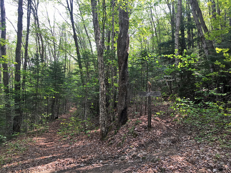
Trail signs spotted along the way
Chris, great report and pictures as usual. I am happy that I was able to cross the bridge last year and the start of Thoreau Falls was definitely a muddy mess. Nancy Pond and Shoal Pond Trail looks like a nice walk in the woods, hopefully will get to them this year along with Desolation Trail to Carrigain. I love how beautiful and quiet that area is. I was finally able to get up there this past weekend. I hiked Davis Path to Stairs and Crawford, sadly not many views on Saturday but great day out in the woods.
ReplyDeleteHi Matt, glad you were able to get in a nice hike this past weekend. Have fun when you get over to Shoal Pond and Desolation, you are going to love it!
Delete