
Date of Hike: 6/16/13
Caps Ridge Trail: 2.5 miles
|
Jefferson Loop: 0.3 miles
|
Gulfside Trail: 0.7 miles
|
Clay Loop: 1.2 miles
|
Gulfside Trail: 1.1 miles
|
Crawford Path: 1.6 miles
|
Monroe Loop: 0.7 miles
|
Crawford Path: 1.4 miles
|
Eisenhower Loop: 0.8 miles
|
Crawford Path: 1.2 miles
|
Webster Cliff Trail: 4.0 miles
|
Webster-Jackson Trail: 2.5 miles
|
Mount Clinton Road: 3.6 miles
|
Jefferson Notch Road: 3.4 miles
|
25.0 miles (7,000 elevation gain)
|
- It was finally time to start doing some really long and exhausting hikes again. The forecast called for increasing cloudy skies with afternoon showers so my plan was to hike above the trees until the rain and wind came then drop back down into the valley and road walk back to my car.
- The fastest way to get above treeline in the White Mountains is the Caps Ridge Trail. It is a fun trail with a few minor rock scrambles as you make your way up to the summit cone of Mount Jefferson. Views above treeline are pretty spectacular and I was on the trail early enough that I had them all to myself. Anyone interested in hiking the Caps Ridge should now it's a real popular weekend trail, so expect swarms of hikers on it on a clear day, so get there early to beat the crowds heading up.
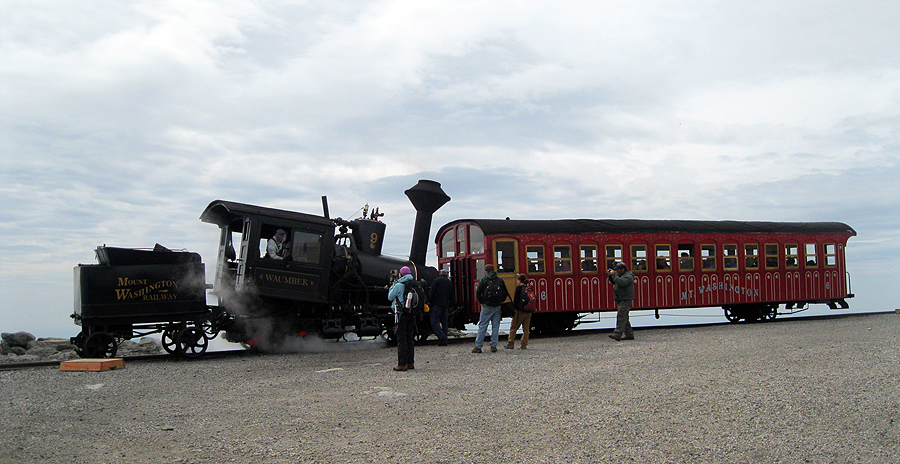
- I finally saw another hiker on the summit of Jefferson where I took a quick break before heading south. Once on the Gulfside Trail I dropped down to Sphinx Col, then hooked onto the Mount Clay Loop Trail, once again having the whole trail to myself while enjoying the tremendous views of the Great Gulf below me. I watched the Cog Train chug up the tracks as I dropped down from Mount Clay and caught it again on the way up to Mount Washington, where I finally started running into more hikers just before crossing the tracks.
- It got a little chilly so I put on my long sleeve and then made my way the last half mile to the summit. The rock pile was crowded with the usual mix of hikers, bikers, and cog passengers so I took a picture of the sign and headed into the observatory building for a nice break.
- I was surprised that it was not crowded in the dining area so I grabbed a seat and relaxed while refueling before heading down to the pack room to change into clean layers.
- Next I stopped in at the museum to say hi to my friend Samantha, we chatted about hiking and she was nice enough to give me a tour of the meteorologist room and let me climb up to the weather observation tower where it was pretty windy but had amazing 360 degree views. I have been to the summit close to three dozen times but never had a chance to see these things so it was a pretty thrilling experience. Thanks Samantha!
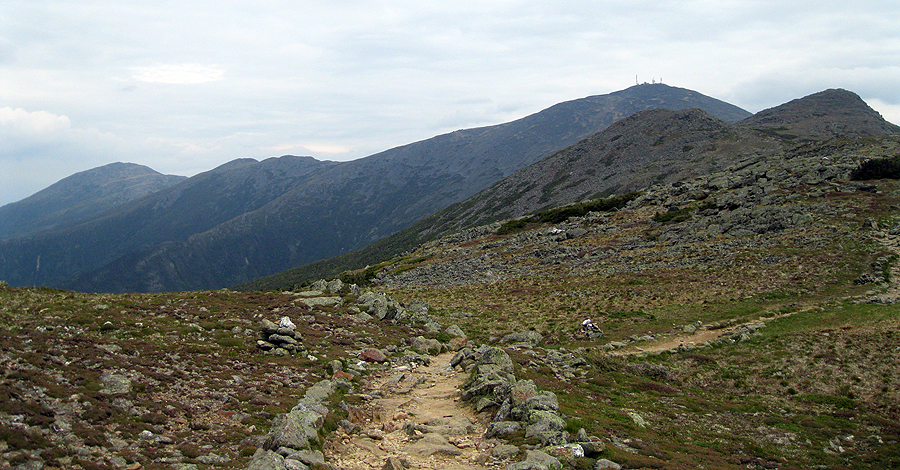
- Now it was time for part two of my hike, hiking southbound until the weather came rolling in. I was well relaxed having spent an hour on the summit so I rocked hopped down to Lakes of the Clouds and then up to Mount Monroe.
- The bad clouds were holding off so I decided to keep on going and I hiked and trail ran over to Mount Franklin and over to Mount Eisenhower. I didn't run into many hikers between Monroe and Eisenhower, maybe five or six, a couple of which seemed concerned about my well being. I think they see the bumble bee colored LaSportiva Raptor sneakers, don't know they're for hiking/running and assume I'm lost or just derranged!
- The weather was still holding off as I hiked over my favorite stretch in the Southern Presidential Range. It's a small rounded field just south of Mount Franklin, the trail is lined with rocks and views are phenomenal, it's Crawford Path at it's best!
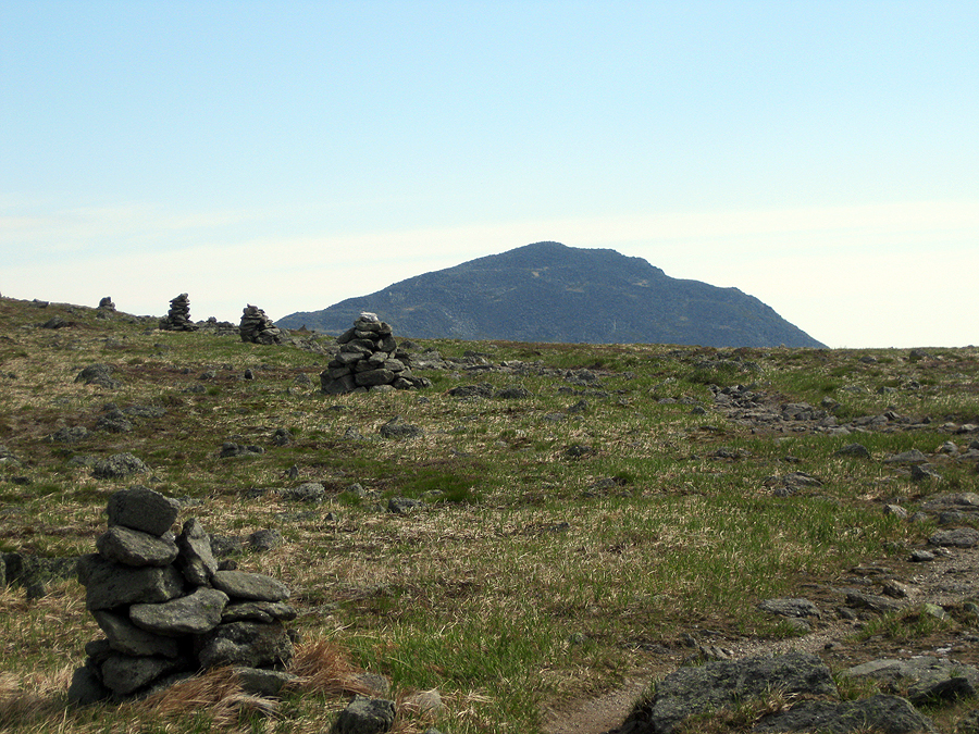
- Once I made it to the the Eisenhower Loop Trail I quickly hiked up to the top where I was sad to see that the magnificent summit cairn had been reduced in size by almost half of what it used to be. Hopefully it will get built back up over the summer so you can see it clearly again from other far off peaks.
- I was pretty much in the clear from hear on out to head all the way to Mount Webster, by the look of the clouds I knew I had about two hours before the heavy rain came.
- The hike over to Pierce was fast as the trail heads in and out of the scrub. Along the way I made sure to stop and take pictures when I'd pop back up into the open.
- When I reached Mount Pierce's summit I took a break to enjoy the big views one last time before heading into the woods for good. I was happy the weather held out for all of my hike above treeline and the summits stayed in the clear.
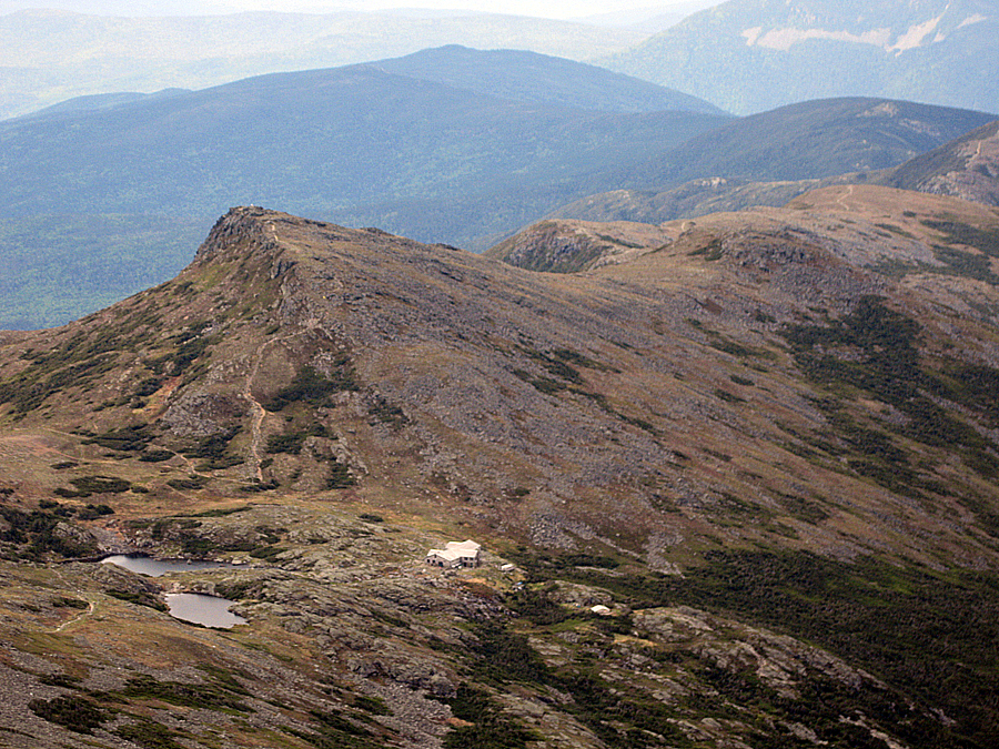
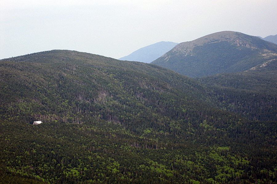
- The drop down from Mount Pierce to Mizpah Spring Hut gets steep with some bad footing for the last half mile. Luckily, I have done it before and remember where to step and what trees to hug so I made it down to the hut in no time.
- Mizpah Spring Hut is the weirdest looking of all the huts, it looks like a tee pee and from the outside it looks big but really isn't once you go inside and walk through the hall where the bunks are. Still, it's very cozy and a great place to stop and grab some baked goods for a buck! I had a glass of lemonade and a magic cookie bar which hit the spot. I had only been drinking water all day so the lemonade was very refreshing.
- After a nice fifteen minute break it was off to Mount Jackson and then over to Mount Webster. There's nothing really too exciting about the Webster Cliff Trail between the hut and these two peaks. There is an alpine meadow just north of Mount Jackson's summit which is beautiful and had some flowers blooming. Views from both summits are great; from Jackson you get one last clear view of the Southern Presidential Range, and from Webster there is a view straight down into Crawford Notch and across to the Willey Range. I haden't been on Webster in almost three years so it was nice to be back up there.
- By the time I made it to Mount Webster the wind picked up which was great because it got rid of the pesky non-biting bugs that stick to you. I contemplated bushwhacking to the start of the Webster Slide but figured after all the miles I had hiked it was best to stay on the trails. I made a good choice as it started to rain on my way down the Webster-Jackson Trail. By the time I reached Route 302 it was a steady moderate rain shower.
- Now was for part three of my hike, seven miles of road walking back to my car. The good thing about this was after about five minutes I was off the main road and back on old backwoods roads, Mount Clinton and Jefferson Notch Road. The bad news was that the Highland Center, near were I came off the trail is at 1,900 feet and my car was at Jefferson Notch which is at 3,000 feet. So over seven miles I gained another 1,100 feet at the back end of the hike. It was like walking on a treadmill with a slight incline, nothing to it!
- I only saw three cars, one biker, and three other people on my road walk. There was a couple out for a stroll in the rain walking under an umbrella. I also ran into a hiker who I saw on the Mount Esienhower Loop Trail, she was soaked but had her rain gear on and was having a fun hike back to her car.
- I didn't mid the hike back to the car, it took just over two hours and the temperatures held just enough that a long sleeve layer with a hoody did the trick and I never got too cold.
- Back at my car I changed out of my soaked clothes and relaxed for a good thirty minutes. As I relaxed two hikers popped out of the the woods having just descended the Caps Ridge Trail in the rain and wind. They said it became very difficult and scary, which is what happens above treeline when the weather turns, which makes the Whites a very challenging and great mountain range!
Started: 7:45 a.m. / Jefferson: 9 a.m. / Clay: 9:45 a.m. / Washington: 10:30 a.m. / Monroe: 12 p.m. / Eisenhower: 12:40 p.m. / Pierce 1:10 p.m. / Jackson 2:05 p.m. / Webster: 2:40 p.m. / Route 302: 3:35 p.m. / Finished 5:45 p.m.

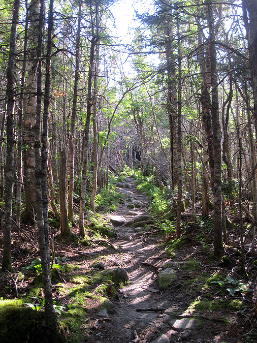
Caps Ridge Trail
Pencil trees on the Caps Ridge Trail

The Ridge of the Caps
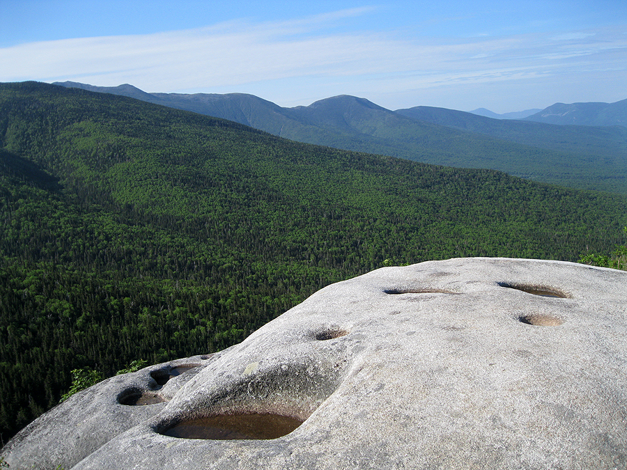
Glacial Potholes

Sun shining bright above the ridge

Caps Ridge Trail Junction with The Link, have fun with that trail!

Outlook along the Caps Ridge Trail

First Cap

Second Cap

Looking down at the Caps

Castellated Ridge

Caps Ridge / Cornice Trail Junction

Mount Clay, Washington, and Monroe

Morning in the Presidential Range

Caps Ridge Trail

Mount Clay, Washington, and Monroe

On the summit of Mount Jefferson

Mount Jefferson Summit Area

Monticello Lawn, Mount Clay and Washington

Monticello Lawn
Mount Adams peaking out above Monticello Lawn

Gulfside Trail to Mount Clay

Gulfside Trail

Sphinx Col

Mount Jefferson and Adams

Mount Clay Loop Trail

Turtle Cloud floating over Mount Washington

Mount Clay Loop Trail

Mount Clay Loop Trail

The Great Gulf Headwall

Mount Clay Loop Trail

Mount Clay Loop Trail

Cog Tracks and Mount Monroe

Cog Tracks and Mount Monroe

Northern Presidential Range

The Great Gulf Wilderness

Mount Adams

The Cog Trail

The Cog Train

Lizzie Bourne Memorial

The Cog Train

Cog Train

Mount Adams

Northern Presidential Range
'Waumbek'

Observatory

Mount Jefferson and Adams

View above from the Observatory Tower!

Summit

Tip Top House

Southern Presidential Range

Mount Monroe
Lakes of the Clouds and Mount Monroe

Southern Presidential Range

Crawford Path

Mount Monroe

Lakes of the Clods Hut and Mount Monroe

Crawford Path

Lakes of the Clouds and Mount Washington

Lakes of the Clouds

Lakes of the Clouds and Mount Washington

Mount Washington from Mount Monroe

Crawford Path as seen from Mount Monroe's Summit

Mount Franklin, Eisenhower, Pierce with Tom, Field, and Willey behind them

Crawford Path, Little and Regular Monroe!

Mount Monroe from Mount Franklin

Crawford Path, my favorite section!
Presidential Range

Presidential Range

Mount Eisenhower

Red Pond

Maze of paths

Mount Eisenhower

Mount Franklin, Monroe, and Washington

Mount Eisenhower Loop Trail

Crawford Path

Crawford Path

Mount Eisenhower

Summit of Mount Pierce

Aliens Bots!

Mizpah Spring Hut Info

Alpine Meadow along the Webster Cliff Trail
Mizpah Hut, Mount Pierce, and Eisenhower

Tom , Field, Willey, and Avalon below (right to left)

Presidential Range from Mount Jackson

Presidential Range

Summit of Jackson

View from Mount Webster

Mount Willey

Crawford Notch

Mount Willard

Some serious Rock Slab!

Mount Willey

Silver Spring Cascade

Silver Spring Cascade

Webster-Jackson Trailhead

Sacco Lake

Along Route 302

Crawford Path parking

Walking in the rain

Mount Clinton Road

Base Station Road

Base Station Road

Jefferson Notch Road

Jefferson Notch Road

It never ends...Jefferson Notch Road

Boundary Line Trailhead

The Ridge of the Caps buried in rain clouds above Jefferson Notch Road

This always cracks me up!

Almost there...Jefferson Notch Road

Jefferson Notch
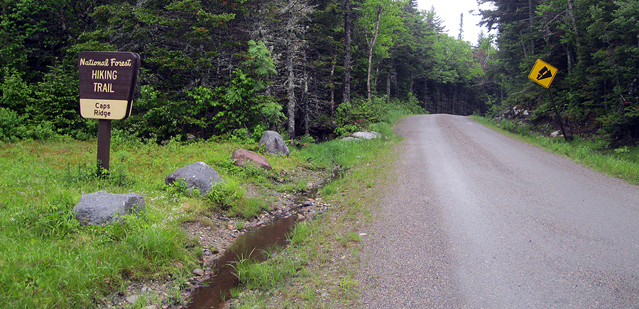
Caps Ridge Trailhead

Caps Ridge Parking Lot

Finished!
Wow, wow, wow. So basically you did 25 miles in nine hours since you stopped at Washington for an hour. Incredible, and you still get all the great pics and write a nice report!
ReplyDeleteThanks anonymous, when I hike solo I like to push myself but still take a bunch of pictures so I can relive the hike over and over again!
Delete2nd the amazing pace! What are you using for a camera Chris? Shots are always great!
ReplyDeleteGlad you like the pics! I just use a digital Cannon powershot.
DeleteWow- Great report and pics as ususal Chris -Les
ReplyDeleteThanks Les!
DeleteGreat trip report and pics! It looks like someone partially dismantled the cairn on top of Ike.
ReplyDeleteWill
Yeah, hopefully they'll build it back up!
Delete