
"More and More Difficult"
Date of Hike: 7/30/11
Trail | Miles | . | . | . | . | . | . |
Dolly Copp Road | 0.5 | Route 16 | 1.0 | North Imp | 3.1 | North Carter | 1.2 |
Carter-Moriah | 5.5 | Wildcat Ridge | 2.5 | Pole Cat Ski Trail | 2.5 | Crew Cut | 0.5 |
Liebeskind's Loop | 0.5 | George's Gorge | 0.3 | Old Jackson Road | 0.8 | Tuckerman Ravine | 2.2 |
Lion Head | 1.6 | Tuckerman Ravine | 0.4 | Gulfside | 1.1 | Clay Loop | 1.2 |
Gulfside | 0.7 | Jefferson Loop | 0.7 | Gulfside | 1.4 | Isreal Ridge | 0.3 |
Star Lake | 1.0 | Osgood | 1.1 | Daniel Webster-Scout | 3.5 | Road Walk | 1.0 |
Total Miles: Around 34.5 | Elevation Gain: 14,000 feet |
Trip Report:
- Last year I read a trip report about a trail run in the White Mountains called MMD and thought it was one of the coolest runs I've ever heard of. Basically it was a Pinkham Notch Loop and I figured this year I'd go and hike it on my own on a nice summer day. However about a month ago I received an email from Alton asking if I'd want to do MMD 2011, I said count me in eventhough I would just be hiking and not running it.
- This was actually the ninth year for MMD and it stands for more and more difficult, meaning each year the course gets tougher. This year the run started at 12:01am from Barnes Field and was over 50K. The fastest runners do it in twelve to fourteen hours so I figured it would take me seventeen hours if I could average 2 mph hiking.
- I was excited the whole day leading up to the race but unfortunately the weather was really awful as it was rainy and humid. The rain did stop about a half hour before the start but everything was soaking wet, luckily the temps were still warm so that was a plus. Usually MMD has around two dozen people but this year there were only ten participating. The race director told us because of all the rain we would be heading up Lion Head and not Huntington Ravine Trail on our way up Mount Washington to avoid the dangerous rock slabs.
- The race was about to start and I was dressed in my usual gear; Under Armour tshirt, North Face hiking pants with close to a dozen rips sewn up, my $75 timberland hiking boots with about 500 miles on them, and my REI Lookout 40 oz day pack filled with 100 ounces of water, 32 ounces of Gatorade, extra shirts, windbreaker, first aid kit, hat, gloves, etc, weighing in at about 15 lbs...like I said the usual! Now everyone else around me had shorts, kick ass trail runner sneakers, and cool looking ultra-light packs so they were built for speed!
- 12:01 am and we're off! Hold on a second where is Alton...she's in the bathroom! 12:03am - now we're off! I mentioned earlier I would not be running however to catch up we did run the mile and a half down the Dolly Copp Road and Route 16 to the North Imp Trailhead to catch up. From here we would be hiking at our usual quick pace. It was very odd hiking at this hour knowing we would be on the trail for the next seventeen hours.
- It was very warm and I kept drinking lots of water and eating banana chips to stay energized. We made great time up to The Carter-Moriah Trail making it there in two hours. At the junction we ran into Rob and two other young guys taking a break before they went back to running over the Carters.
- On the ridge we were blanketed in the fog making visibility very low at about ten feet at times. We made sure on the descents over any rock slabs to be careful and booked it on the flat and ascent sections blitzing through Middle Carter and South Carter to Zeta Pass. I was able to find South Carter's summit marker but could not find Middle Carter's, maybe because it was so dark out!
- We hit Zeta Pass at 3am and were off to Mount Hight, I hit a wall up the steep section of Mount Hight but with Alton leading the way it made me suck it up and continue hiking. Winds on top of Mount Hight were whipping up pretty good and with the low visibility it took us a few minutes to find the cairns leading to the right into the woods off the summit.
- Next stop was the easy hike over to Carter Dome, we arrived there at 3:45am and took another quick break before heading down to Carter Notch. The hike to Carter Notch starts off gradual but then gets very steep over awful footing as it gets drops to Carter Notch Lake. Those awesome views from the rocks on the side of the trail down to Carter Notch and across to Wildcat "A" Peak during the day are pitch black scary drop-offs at 4am!
- We made it to Carter Notch at 4:20 am and headed over to the hut to refill on water, where I fell into the water trying to rock hop but I kept my trusty camera dry! At the hut there were two guys sleeping on the benches, I figure they must be A.T. thru-hikers.
- Next up...the relentless 0.7 mile 1,000 foot plus elevation gain up to Wildcat A Peak. Trust me it's just as awful at 4:30 am as is it during the day! Along the way we passed a lady doing her sixth MMD, we had been leap-frogging her ever since the Carter-Moriah Trail junction, everytime we'd stop she's motor past us and we'd then see her later on down the trail.
- We reached Wildcat "A" at 5am and then booked it over B-C-D Peaks as day broke making it to Wildcat "D" at 5:50am. Views across to the Presi's were in and out of the clouds making for a promising day, or so we thought!
- We headed down the easy grades of the Polecat Ski Trail. I told Alton it should take us around an hour to get to the parking lot, however she convinced me to jog/run down (which I would regret later)...it took us twenty-five minutes to get to the parking lot where the race directors and Alton's friend Luis were hanging out making breakfast for all the participants. I had some yummy French Toast and we took a about a ten minute break. It was around 6:30 and the first two guys and Rob came through around 5:30!
- Now it was part two of the hike up to Mount Washington and the Northern Presidential Range but before we'd start up Washington we had to go up to Lila's Ledge then hook onto Old Jackson Road via Crew Cut, Liebeskind's Loop, and George's Gorge trails. The view from Lila's ledge over to Wildcat and Pinkham Notch was fantastic in the early morning however Alton did not share in my enthusiasm as she hit her first mini breaking point "Why would we go this way, why not just run the road back to Pinkham!!!!"
- When we reached PNVC (7:30am) we changed out of our soaked clothes and shoes into dry ones before heading up Tuckerman's to the Lion Head Trail. It was a zoo at PNVC with hundreds of people getting ready to head up Washington so we made sure to get ahead of them to avoid the traffic on the trail.
- Joining us on our hike up to Washington was Alton's friend Luis who is an ultra-runner having just ran the VT 100 mile run two weeks ago.
- It was a slog to say the least getting up Washington and to make thing worse clouds came in and blanketed all views above treeline and there was a steady 30mph plus wind all the way up to the summit where gusts were between 40-55mph on the observation deck.
- We made it to the summit of Washington at 10:05am and took a 45 minute break in the cafeteria to get warm as we were all soaked and cold. In the caff were Rob and the two young guys contemplating whether they should continue on or not. They made it to the summit at 8:30am and were cold and trying to dry off and get warm. They decided at 10:30 to continue on although Rob would be the only one to finish as the two younger guys had to bail out.
- I was cold to but lucky for me I had one last change of dry clothes for the trip over the northern presi's which I know like the back of my hand. Alton was shivering so I was concerned, I gave her my neck warmer and a long sleeve t-shirt and a nice lady gave her a fleece to warm herself up before we continued on.
- We set off for Mount Clay in hat, gloves windbreaker, etc. at 10:50am, the wind beat us up pretty good down to the junction for the Mount Clay Loop but from here until heading up Adams we weren't battered from the winds to bad and actually were able to hike in just long sleeves. Heading up Mount Clay the ligaments around my left knee were starting to get strained/stresses but I dealt with the pain and just sucked it up.
- We arrived on Mount Clay at 11:30am with no views and just kept trudging along, we still had a long way to go and knew the footing until the lower part of the Daniel Webster-Scout Trail was just going to be awful.
- On our way up Mount Jefferson we passed the lady who we had been leap frogging over the Carter and Moriah earlier. She was smart she didn't stop at the summit of Washington so she didn't get chilled.
- We hit Mount Jefferson at 12:15pm, it's now the afternoon and no views, just clouds and wind!
- The hike between Jefferson and Adams was business as usual other than Alton almost going off trail up to the Adams V summit, visibility was low and I was out in front, I disappeared and she had to call out my name so I went and found her and then we continued on.
- At 1:30pm we were on the top of Mount Adams and getting beat up by the wind. At the time I was happy to go down the Star Lake Trail because it would be out of the wind until the final 0.2 miles between Star Lake and Madison Springs Hut. However this is where our progress would slow to a crawl. I felt a pain in my right ankle which hurt every step, it wasn't a sprain just overuse and stresses. We both reached our breaking points soon enough coming of Adams. For me there is a mini scramble where some shaggy looking guy planted himself right at the bottom of the steep part in the middle of the trail reading a book and would not move so we had to go around him. For Alton she lost it a little past that and cursed the trail out, I was going to joke that if she didn't stop I was going to put her in a "time out" then send her down the Valley Way Trail but I think she would have pushed me off the mountain if I said a word!
- We finally made it to the hut and took a five minute break so we wouldn't get chilled but I did get chilled so I put on my hats gloves, wind breaker, pulled to hood over my face, people must have thought I was a nut case! One guy said "Looks like you're getting ready for snow"
- Finally it was off to our last summit of the day, Mount Madison, 0.5 miles via Osgood Trail. I was in pain left knee - right ankle, the ankle was worse so the knee was the foot to put the pressure on and we made it to the summit at 2:40pm. No views just wind so we kept on slogging.
- Now it was all down hill, 0.6 miles on the Osgood Trail, 3.5 on the Daniel Webster-Scout Trail, and a 1.0 mile road walk out of Dolly Copp Campground to Barnes Field Campground.
- The descent was worse on my ankle and knee than the ascents. Luckily views opened up on the Daniel Webster-Scout Trail above treeline across to the Carter-Moriah Range making the slow-going enjoyable.
- I stayed with Alton until below treeline but not being able to rock hop at my usual pace made me slower than I have ever been. Below treeline I stopped to refuel and finally get back into a tshirt and Alton sped ahead of me. I slowly made my way down the trail until the grades and footing eased up and finally I was able to get back to a 2mph pace and made it to the trailhead at 4:50 pm and back to the start of the course at 5:07 pm. It took me 17 hours just I had thought it would!
- I was beat up but other than the annoying knee and ankle pain I felt great and was thrilled to have finished. Eventhough the weather was sub-par making for some slow going it was a kick-A$$ adventure and so much fun. I can't wait to do it again next year but will definitely be walking the whole thing, no running or jogging so I can be able to finish the final stretch at my usual pace without pain!

Shortly after midnight on the North Imp Trail

Early morning view of the Northern Presi's from the Wildcat Ridge Trail

Heading down the Polecat Ski Trail

Wildcat Ski Area from Lila's Ledge

Heading up Tuckerman Ravine Trail

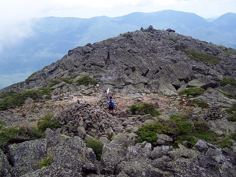
Hiking down the Jefferson Loop Trail
Osgood Junction
Chris, that sounds like an incredible trip! Maybe you could convince my brother to join you next year :)!
ReplyDeleteAwesome job super-hiker! Hope your ankle is ok, can't wait to see what else you hike over the rest of the summer!!!!!
ReplyDeleteMMD, no joke! That was some hike. Good for you for finishing it. I'm not sure I'd tackle that one, at least not in one 24hr. period. I think I'd need two or three days. It looks like it is harder than a Pemi-loop, if not a little bit longer.
ReplyDeleteHow did this hike compare with the double presi, Great Range Traverse, and the Pemi Loop???
ReplyDeleteI'll say this, the double presi was tougher than the Pemi and the GR Traverse....The MMD made the double presi feel like a cake walk! Granted I jogged/ran 4 miles without proper footwear which was foolish and ended up hurting me plus the conditions were sub-par where everything was wet and slippery but even if everything was dry and I didn't run it would still have been more brutal than any of those hikes by far!! =)
ReplyDelete