
Date of Hike: 11/29/13
Crawford Path: 3.1 miles / Webster Cliff Trail: 2.6 miles / Webster-Jackson Trail: 2.6 miles
Total Miles: 8.3 (2,700 feet elevation gained)
Trip Report:
- My original plan for Black Friday was to get up really early and head up and roam around the southern Presidential Range from Jackson to Monroe. However, I saw that cloud cover was going to swamp the higher elevations most of the morning so I decided to stay below the clouds and hike Mount Pierce and Jackson.
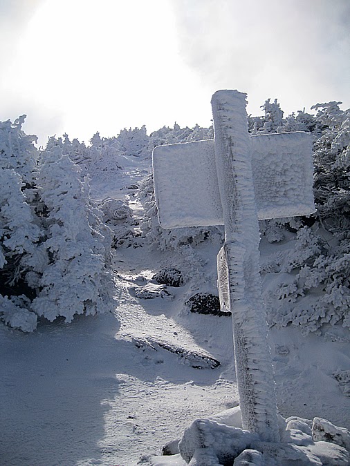
- The Crawford Path was a mix of snow and ice so I put on my microspikes and headed up the 'ramp' to treeline. Temps were in the single digits so it was a chilly but beautiful hike up to Mount Pierce. From now until late April, early May the trees and trails will be covered in snow! However, there still needs to be one more good snowfall before all the ice is hidden.
- Just as I expected I saw Mount Eisenhower covered in clouds so I headed over Pierce and then dropped down to Mizpah Spring Hut on my way to Mount Jackson.
- There is a really beautiful alpine meadow with bog bridges just before heading up the tiny summit cone of Mount Jackson. It's quite the sight to see, because before and after it you are totally in the woods then all of a sudden comes this patch of open space with terrific views!
- Mount Jackson was really cold, I have found that it's always one of the more windier summits and the cold really bites through you. I didn't stay long until heading down the icy Webster-Jackson Trail where I encountered a lot of ice everywhere. It's not easy to descend on ice but it sure doesn't make the trail look pretty.
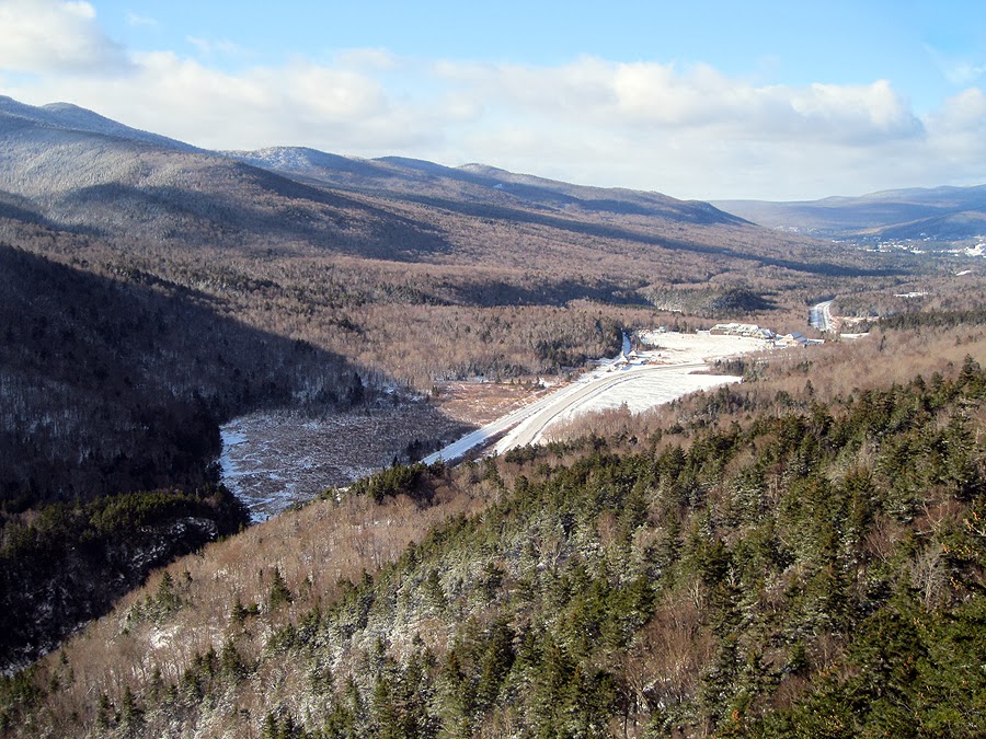
- Along the way I started running into quite a few other hikers along the way. They all times it perfectly as the views were starting to open up big time around 1 p.m. just as I finished!






Crawford Path: 3.1 miles / Webster Cliff Trail: 2.6 miles / Webster-Jackson Trail: 2.6 miles
Total Miles: 8.3 (2,700 feet elevation gained)
Trip Report:
- My original plan for Black Friday was to get up really early and head up and roam around the southern Presidential Range from Jackson to Monroe. However, I saw that cloud cover was going to swamp the higher elevations most of the morning so I decided to stay below the clouds and hike Mount Pierce and Jackson.
- The Crawford Path was a mix of snow and ice so I put on my microspikes and headed up the 'ramp' to treeline. Temps were in the single digits so it was a chilly but beautiful hike up to Mount Pierce. From now until late April, early May the trees and trails will be covered in snow! However, there still needs to be one more good snowfall before all the ice is hidden.
- Just as I expected I saw Mount Eisenhower covered in clouds so I headed over Pierce and then dropped down to Mizpah Spring Hut on my way to Mount Jackson.
- There is a really beautiful alpine meadow with bog bridges just before heading up the tiny summit cone of Mount Jackson. It's quite the sight to see, because before and after it you are totally in the woods then all of a sudden comes this patch of open space with terrific views!
- Mount Jackson was really cold, I have found that it's always one of the more windier summits and the cold really bites through you. I didn't stay long until heading down the icy Webster-Jackson Trail where I encountered a lot of ice everywhere. It's not easy to descend on ice but it sure doesn't make the trail look pretty.
- Along the way I started running into quite a few other hikers along the way. They all times it perfectly as the views were starting to open up big time around 1 p.m. just as I finished!
Gibbs Brook Dam
The Crawford Path
Small blowdown up the trail
Grayjay!
Snow blanketed Crawford Path
Reaching treeline on the Crawford Path
Crawford Path / Webster Cliff Trail Junction
Heading up to Mount Pierce
Frosted cairn on Mount Pierce
Mount Pierce's summit in view
Sun trying to burn through the clouds above Mount Pierce
Mount Pierce Summit
Christmas Trees!
Hiking along the Webster Cliff Trail
Ladder steps, these will be buried soon!
Mizpah Spring Hut
Closed until the spring!
Mount Jackson in view
Alpine Meadow
Alpine meadow bog bridges
The beautiful alpine meadow of Mount Jackson's northern shoulder
Heading up to Mount Jackosn's summit ledges
Steep final push up to Mount Jackson
View north to Mount Pierce from Mount Jackson
Mount Jackson Summit
Dry River Wilderness
Mount Isolation (I think)
Mount Jackson Summit Cairn
Webster Cliff / Webster-Jackson Trail Junction
Mount Avalon
Frozen staircase on the Webster-Jackson Trail
Silver Cascade Brook
Top of Crawford Notch
Highland Center
Mount Tom
Webster-Jackson Trail
Approaching Route 302
Sacco Lake
Sacco Lake and Mount Webster
The Red Sox Shoe Car!


