
Date of Hike: 7/17/21
Castle Trail: 5.0 miles / Mount Jefferson Loop: 0.4 / Gulfside Trail: 1.5 miles / Israel Ridge Trail: 0.1 miles / Lowe's Path: 0.2 miles / Airline: 0.6 miles / Gulfside Trail: 0.3 miles / Osgood Trail: 0.8 miles / Howker Ridge Trail: 4.2 miles / Pinkham B, Durand East, Druand Road: 0.5 miles / Wood Path: 0.6 miles / Diagonal: 0.4 miles / Will's Way: 0.1 miles / Randolph Hill Road: 0.2 miles / Ice Gulch Path: 2.0 miles / Peboamauk Loop: 0.5 miles / Ice Gulch Path: 0.9 miles / Cook Path: 1.7 miles / Peak Path: 0.4 miles / Mount Crescent Trail: 0.4 miles / Crescent Ridge Trail: 3.5 miles / Vyron D. Lowe Trail: 1.6 miles / Durand & Durand West Road: 0.5 miles / Presi Rail Trail: 0.7 miles / Rollo Fall Trail: 0.5 miles / Presi Rail Trail: 0.2 miles
Total Miles: 27.8 (10,030' elevation gained)
Trip Report:
- It had been awhile since I pieced together a route over a wide variety of terrain with some unique points of interest along the way. As luck would have it, I was able to come up with a creative loop just around the corner in the town of Randolph.
- I started at the Castle Trailhead in Bowman, the site of the Bowman Station from the old days of the Boston & Maine Railroad (photo).
- The Castle Trail, which was constructed in 1884, starts off very mello for the first two miles over forgiving terrain and easy grades. This all changes around two miles in as the trail passes by a huge boulder where steep, rocky, and slippery conditions come into play for the next half mile. Knowing that I had a big day ahead of me I kept an easy to moderate pace up the steep stuff to save energy for the backend of the day.
- The steep grade levels off after half a mile where the trail passes around a wooded knoll near the summit of Mount Bowman. However, the reprieve is short lived as the rough and steep terrain comes back, thankfully treeline is reached in short order and views become plentiful.
- The highlight of the trail is the "castles" the trail traverses over, a series of jagged pillars that make up the Castellated Ridge. From each castle, views down into the King Ravine, across to Durand Ridge, and up to the summit of Mount Adams are tremendous.
- After scrambling up and around the castles, the ridge blends into the summit mass of Mount Jefferson where rock hopping over odd sized boulders that is common of the northern Presidential Range starts.
- I had the summit of Mount Jefferson myself and took a quick break to to refuel and relax before heading down to Edmands Col. The weather was holding steady for the moment, high clouds and light winds but knowing that showers were forecasted for later in the morning I couldn't stay too long relaxing and taking pictures. I jogged down to the col where I saw the first people of the day. Over the next three miles to the summit of Mount Madison I would see over fifty people, the other twenty-five miles I would see only seven!
- Edmands Col, which at one point had an emergency shelter (photo), was removed in the late 1970's due to overuse and hikers using it as a regular shelter. (Source hikethewhites.com).
- As I headed over Adams and Madison I passed by all sorts of people; hikers, backpackers, trail runners, weeble wobbles, and a dude in jeans.
- Descending the summit of Madison got me back to totally quiet and peaceful trails, although the footing of the Howker Ridge Trail is anything but peaceful. The trail travels over the "Howks,' four knobs, some have pretty sweet views from their open ledges where I could spy my second half destination of the day, the Crescent Range.
- Once past the last Howk, the trail drops down through Blueberry ledge, by the Bear Den, which is an open space in a rock ledge that forms a box, crosses Bumpus Brook where Hitchcock Fall is, then parallels the brook passing two more waterfalls, Coosauk & Stairs, and a dark rocky gorge called the Devil's Kitchen before ending at Randolph East, site of the old Randolph Station (photo). (Image from North Country Chronicle Blog).
- 10:30AM, time to start part two of the loop, a little ramblin' in Randolph, which started off with a half mile road walk, one mile of easy hiking on the Wood Path and Diagonal, and another short road walk passing by some beautiful homes with incredible views of King Ravine from their yards.
- At the Sky Meadow Farm sign the Ice Gulch Paths heads past the barn into the woods. The path for the first two miles is over good footing with some minor up and downs and makes for quick work to the 'Marked Birch" at the junction with the Peboamauk Loop trail. I could not find any history as to the significance of this tree but it's days are numbered, it stands about fifteen feet high with no branches, it's a dead rotting tree at this point.
- I jumped off Ice Gulch Path onto the loop trail to check out the impressive Peboamauk Waterfall before steeply climbing the rest of the loop to the start of the Ice Gulch.
- Hiking the Ice Gulch feels like walking through a walk-in freezer at times, it is broken up into a few sections, all of it very rugged. The two parts through the open talus with large boulders to go around and over is fun since it's in the open the rocks are dry and grippy, the parts between these two talus fields are in the woods over mossy and wet boulders which are treacherous to say the least, it's slow going and foot and hand placement is important to not slip and have a nasty fall.
- The highlight of the Ice Gulch is the ice which sticks around under the huge boulders, there was plenty of it seen along the way, probably a half dozen decent sized pieces. For a some scientific data on there being perennial ice at such a low elevation of 2000 feet click here.
- After crawling up a narrow and slippery gorge called the Vestibule, the Ice Gulch mercifully ends at the junction with Cooks Path and the footing and grade instantly changes to easy. I quickly made my way over Cook and Peek Path to the last climb of the day up Mount Crescent.
- Ascending Mount Crescent was not too bad, even the top part which has some steep bursts at times has good footing which makes it a little easier to deal with. Once gaining the ridge I made my way over the easy ups and downs to Mount Randolph before dropping down for good with a short side trip to Lookout Ledge which has a great view of where I was in the morning. From Lookout Ledge I descend the nicely dirt cushioned Vyron D. Lowe Trail to Durand Road as it started to rain.
- With just a mile to go to the Jeep and the rain picking up intensity I jogged past the old Lowe's Cabins and across the street where I made a short side trip to the decrepit Bowman Base Camp, now under contract! (view property details). Bowman Base Camp has been closed for decades, the Randolph Mountaineering Club assembled a committee to view it and see if it was worth the investment but it was in such bad shape for the price that the RMC passed on it, more information here in a RMC 2003 Summer Newsletter.
- Behind the base camp I hooked onto the overgrown access road to the Presi Rail Trail where I made a short side trip to Rollo Fall before making it back to the Jeep as the rainfall fell all around me.
- Back at the Jeep I changed into a dry shirt and downed some fluids before making the ten minute drive home where I jumped in the Peabody with Sarge to cool down and clean off after a pretty awesome trek in the northern Presi's and the Crescent Range. :)

Elevation over Distance Profile

Map of route

Trails taken, Bowman to Randolph East

Trails taken, Randolph & Crescent Range


Signs spotted, Randolph & Crescent Range

Presi Rail Trail

Castle Trail crosses the Israel River early in the hike then has easy grades with good footing for the two miles

At two mile sin the trail passes by a large boulder and the footing gets nasty and steep for a half mile

The rugged Castle Trail

Approaching the first "Castle" along the Castellated Ridge
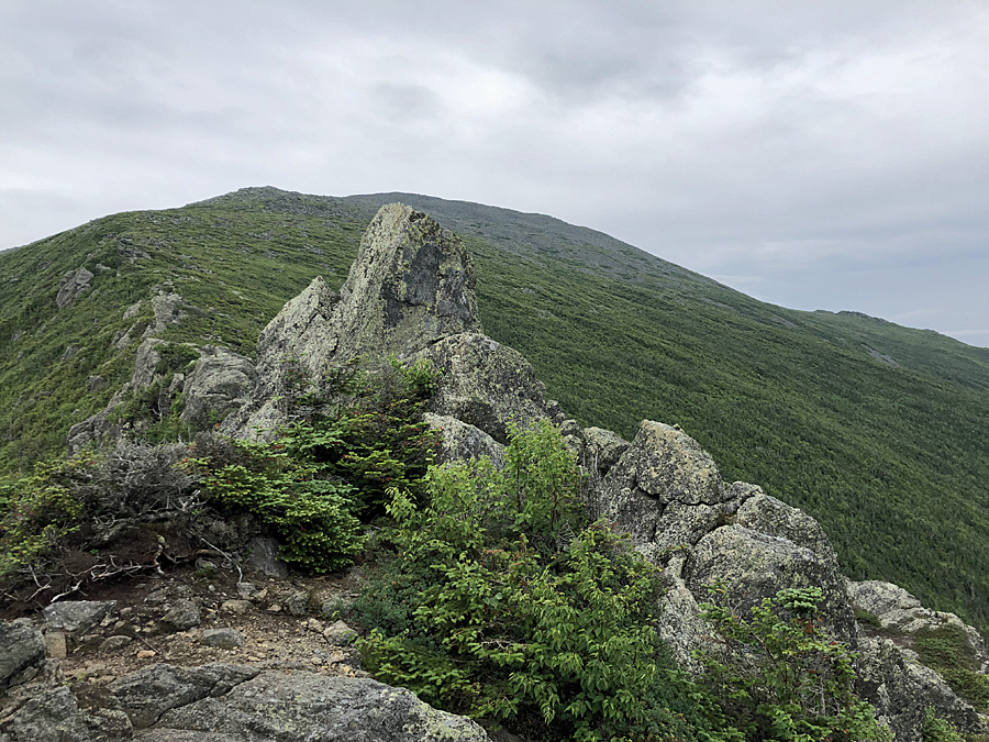
Standing on the ridge near the first castle

Looking down at the Castles

King Ravine

Well above treeline on the Castle Trail

Rock Hopping garden up to the summit

Mount Washington being overtaken by clouds

Mount Adams as seen from Mount Jefferson

Looking back at the Castellated Ridge from the Gulfside Trail

Hiking along the Gulfside Trail on the way to Mount Adams

Mount Jefferson from just north of Thunderstorm Junction

Hikers milling around Thunderstorm Junction. Some recent rock work being done too to keep hikers from wandering off trail

Very light cloud floating over Mount Madison

Mount Jefferson about to be taken over by some light clouds

Madison Spring Hut and Mount Madison's summit cone

JQ Adams and Adams

Star Lake and Mount Adams

Howker Ridge

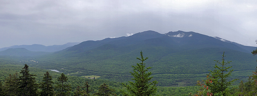
Looking north to the Crescent Range

Looking back up Howker Ridge to Mount Madison from the lowest Howk

Howker Ridge Trail

Bear Den

Hitchcock Fall

Coosauk Fall
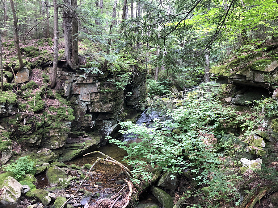
Devil's Kitchen

Stairs Fall

Randolph East, Howker Ridge and Randolph Path trailheads

Broadacres Farm along Durand and Randolph Hill

Some active logging going on along Wood Path

The cushiony footing of Wood Path and the Diagonal
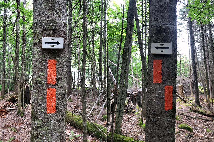
Cool little trail markings


The owners of Will's Way, have a beautiful flower garden at the beginning of the path

picturesque hike along Randolph Hill Road

Ice Gulch Path at Sky Meadow Farm

The Marked Birch

Peboamauk Fall

About to head into Ice Gulch at Fairy Spring

The first talus field in the Ice Gulch

A jumble mess of boulders, pretty fun to climb over and around

Plenty of ice to go around!

In between chambers of the gulch is some pretty nasty and slippery stuff

One last open and fun section of the Ice Gulch

The final push up to the top of the gulch is quite the slog!

View from Mount Crescent north Lookout, in the middle right you can see a light color, this is the talus field of the Ice Gulch

Lafayette viewpoint, looking at Mount Randolph and the Northern Presidential Range

The lush green path of the Crescent Range Trail

Mount Randolph summit
View of Madison, Adams, and Jefferson from Lookout Ledge

Vyron D. Lowe Trail

Randolph Spring

The old Lowe's Cabins

The cabins haven't been used in decades and are slowly being overtaken by vegetation

Duck pond at Lowe's

Lowe's General Store, it's been closed since the start of the pandemic, hopefully it will reopen next summer

Bowman Base Camp

It has definitely seen better days.

Shitter shed, well, and one pretty gross looking couch

Presi Rail Trail

Rollo Fall

Castle Trailhead at Bowman
No comments:
Post a Comment