
Date of Hikes: 1/4/14
Avalon / Field / Tom
Avalon Trail: 2.8 miles / Willey Range Trail: 1.0 miles / Mount Tom Spur: 1.2 miles / A-Z Trail: 1.0 miles / Avalon Trail: 1.3 miles (Total Miles: 7.3 / 3,000 feet elevation gained)
Click here for trail descriptions
Trip Report:
- Until I head back to the Adirondacks, I am a hiking orphan and looking to be adopted for hikes! Over the past week and a half I was invited by Kelsey to hike with her, Kristina, and Jane on Lafayette, Whitney invited me to hike Isolation and Hale with Denise, Matt, and Kyle, and this weekend I tagged along with Bob&Geri, Steven, Kelsey, Tony, and Nicole to hike Avalon, Field, and Tom on Saturday and Isolation on Sunday. Yes, Isolation, again!
- The weather on Saturday was in the negatives as the sun rose so we didn't start our hike until eleven in the morning. By then temperatures were in the mid to high teens as we met up at the Highland Center to start our hike.
- Conditions were great for snowshoes as we headed up the Avalon Trail to the A-Z spilt. The Avalon Trail starts across the train tracks at the Crawford Scenic Railroad Depot. The trail has moderate grades until it reaches the split, along the way it crosses the Crawford Brook twice, which were solidly snowbridged, then angles up through a dense forest.
- Once at the split we banged a left and headed up to Mount Avalon, the trail becomes excessively steep and we all put the televators up on our snowshoes, except for Tony who didn't have any on his, ouch! Steven had never used the televators before so he was thrilled with the difference it made and was thankful. The reward for the steep ascent up Mount Avalon is fantastic views from it's tiny summit ledge. there are excellent views across the notch of the Presidential Range and down into the notch.
- From here we motored up to the Willey Range Trail to the summit of Mount Field. Before gaining the ridge we ran into Chris Lawrie doing a Tom, Field, Willey, Avalon hike. It was good to see Chris, who I last saw on Flags of the 48 in the Liberty / Flume Col.
- Mount Field's summit is wooded but it has an incredible downlook just below it. Just like Avalon it has great views of the Presidential Range, it also has views over to Mount Tom and to the west into Vermont and northwest into Canada. I thought I could see the Adirondack High Peaks since the views were endless but Bob pointed out to me I was looking northwest toward the Canadian border.
- From Field, Kelsey, Dusty, Bob, and I ran down to the A-Z / Mount Tom Spur junction. There are no views along this one mile stretch but it is one of the more picturesque 'In the Woods' winter scenes in the White Mountains.
- Once the rest of the gang caught up we headed on up the easy grade to the summit of Mount Tom and checked out it's views over to Zealand Notch, the Twin / Guyot / Bond Range on one side of the summit, then headed over to the other side for more great views of the Presidential Range, Willey Range, the backside of Carrigain Notch, etc.
- After a couple of minutes and several pictures we started our descent down the Mount Tom Spur, A-Z, and Avalon Trails. Except for a steep few tenths of a mile after hooking onto the A-Z Trail below Mount Tom it's an easy hike out over moderate grades, located deep in the woods, and is shielded from all of the wind.
- It was a great hike and the weather was exceptional for crystal clear views with cool clouds and pretty awesome jet condensation trails left high in the sky!
Kelsey heading up the Avalon Trail
Geri leads the way up the steeps below Mount Avalon
Dusty approaching the summit of Mount Avalon
Presidential Range
Mount Eisenhower, Monroe, Washington
Mount Washignton
Mount Jefferson
Mount Jefferson, Clay, Washington, Monroe, Eisenhower
Looking up to Mount Field from Mount Avalon
Mount Tom
Beautiful wave of clouds above Mount Willey
Steven charging down the Avalon Summit Spur
Geri leads the way to Mount Field
Kelsey gaining the ridge of the Willey Range
Avalon Trail
Snow covered trees, clouds, and bright blue skies
Geri and Steven hike through a blast of wind shaking snow from the trees
Looking off toward the Twin Range from Mount Field
North and South Twin (right to left)
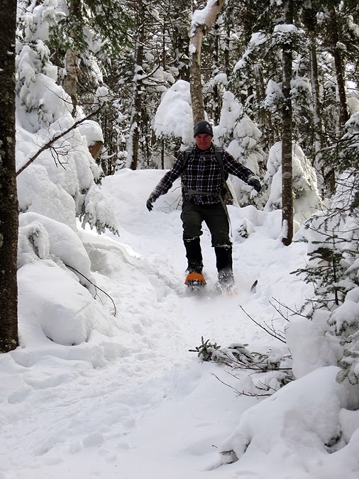
Tony makes his way to the summit
Mount Lafayette and Lincoln rising above the Twinway
Mount Tom
Mount Jefferson, Clay, and Washington
Mount Washington Hotel
Willy Range Trail - Winter Wonderland
Kelsey, Bob, and Dusty running down the Willey Range Trail
A bright afternoon sun, jet condensation, and puff clouds above the Bonds and Twin Range
Mount Tom Summit
Carrigain Notch to Mount Bond
Mount Field
Bursting sun over Mount Bond
View toward the Pemigewasset Wilderness
Carrigain Notch
puff clouds, funnel clouds, jet condensation, and bright sunshine
A beautiful afternoon in the White Mountains
Looking toward the Hancock Mountain Range
U.F.O. clouds above Mount Tom
Kelsey sprinting down the A-Z Trail
Mount Washington Hotel with Mount Jefferson, Clay, and Washington
Mount Washington
Get along little doggies!
Mount Jefferson, Clay, and Washington
Dog Sledding through the golf course
Mush, Mush!
Mount Washington

Great pictures Chris. Liked the catch on the dog team.
ReplyDeleteThanks, Marvin. Hope you are having a good winter hiking!
DeleteAwesome picture Chris!
ReplyDeleteThanks, Anonymous!
Deletegreat pictures chris!!- I wish your blog had "like" buttons for the pictures and captions- enjoyed the read-thanks!
ReplyDeleteThanks Kelsey! And thanks for starting up the group message on Facebook for this weekend, I would have stayed home and missed out on the views and the fun time with you all!
Delete