
Date of Hike: 10/13/13
Tuckerman Ravine Trail: 4.2 miles / Crawfors Path: 0.1 miles / Davis Path: 7.5 miles / Glen Boulder Trail: 2.8 miles / Direttissima: 1.0 miles
Total Miles: 16.1 miles (6,500 feet elevation gained)
Trip Report:
- Every year I try to make a trip up the Tuckerman Ravine Trail. On Sunday, I brushed up on my French and set off for Mount Washington with hundreds of my closest friends, most of which were from north of the border.
- Tuckerman Ravine Trail is by far the most popular trail up to Mount Washington, it's often referred to as I-93, I-95, or the highway.
- I 'super-hiked' up Mount Washington, taking just over an hour and a half. Along the way I started counting hikers, by the time I hit the Hermit Lake Shelter I had count over 130 hikers, by the time I reached the top of trail at the auto road, the number topped out at 208 hikers! Everyone was enjoying the nice fall weather along with the incredible undercast at 4,000 feet, which for the second straight day made for some amazing views.
- I don't mind the crowds, there are always ways to escape them, and just like hikers, 99% are very nice. At the top I grabbed a Gatorade and escaped to the silence of the pack room before hopping on the Crawford Path for a little bit until banging a left onto the Davis Path.
- I love the Davis Path above treeline, as beautifully crafted cairns line the trail from the Crawford Path Junction until treeline heading towards North Isolation. The path is flat in spots, gradual descents in other, and super cool views of the backside of Mount Monroe and the southern Presidential Range.
- I ran into a handful of hikers along the way but most of the time I had the trail to myself. A nice change from my ascent up the 'highway'.
- Once I dropped below treeline it was full speed ahead to Mount Isolation. I love hiking over to Mount Isolation then back out the same way to treeline. It's not the easiest hike, kind of a butt kicker but the views from Isolation are well worth the effort. Unfortunately, the cloud cover was just hovering over the summit so I was socked in, it was actually the first time I had no views from the mountain.
- After relaxing for a few minutes at the summit I headed back up the Davis Path through the woods and eventually back above treeline where I hooked onto the Glen Boulder Trail.
- If you haven't been on the Glen Boulder Trail put it on your list. The section from the Davis Path Junction above the Gulf of Slides to the boulder itself is a great hike with big views!
- Below Glen Boulder the trail is like most others, rocks, roots, some mud and running water. On this day the bottom of the trail was in the clouds and fog so everything was slippery.
- Towards the bottom of the trail I split off onto the Direttissima which lead me back to the overflow lot at the Pinkham Notch Visitor Center.
- It was a really cool kind of loop hike which I do in different variations each year. I really enjoy the section of trails between the Boot Spur and Lakes of the Clouds and Tuckerman Junction. The Davis Path, Lawn Cut-off, Tuckerman Crossover, and the Camel Trail are really cool to just wander around and take in the phenomenal views. Definitely worth checking out!
Tuckerman Ravine Trail
Hermit Lakes Ranger Station
AKA 'HO-JO'
Entering the Alpine Zone
First aid cache at the floor of the ravine
The bowl that makes up Tuckerman Ravine
Water cascading down the headwall
Lip Falls
Tuckerman Ravine Trail travels up to the right of the wall
Looking up at the cascading water
Tuckerman Ravine Falls
Lion Head and a thick undercast blanketing Pinkham Notch
Southern Presidential Range
Mount Monroe
Tuckerman Ravine terminus at the auto road
The dreaded steps, you hike up over four miles and this is the worst part!
Davis Path / Crawford Path junction
Fields of golden grass and well placed cairns along the Davis Path
Looking back toward Mount Washington
Southern Presidential Range
Hiking towards the Boot Spur
Davis Path southbound
North Isolation and Mount Isolation being overtaken by the clouds
The Davis Path gets thrashed in the winter through this sections
Leaner's and widow makers on the Davis Path
Mount Isolation Summit
Isolation summit marker
Davis Path and some rotted bog bridges
Breaking above treeline along the Davis Path
Southern Presidential Range
Looking up to the Boot Spur
Presidential Range Dry River Wilderness Boundary
Wildcat and Carter Range in a sea of clouds
Wildcat 'D' Peak
Glen Boulder Trail
Slide Peak
Gulf of Slides
The undercast moving into the Gulf of Slides Ravine
Clouds flowing into the ravine
Glen Boulder, he's just hanging out!
Lower section of the Glen Boulder Trail
Direttissima Trail Junction
The Diretissimma
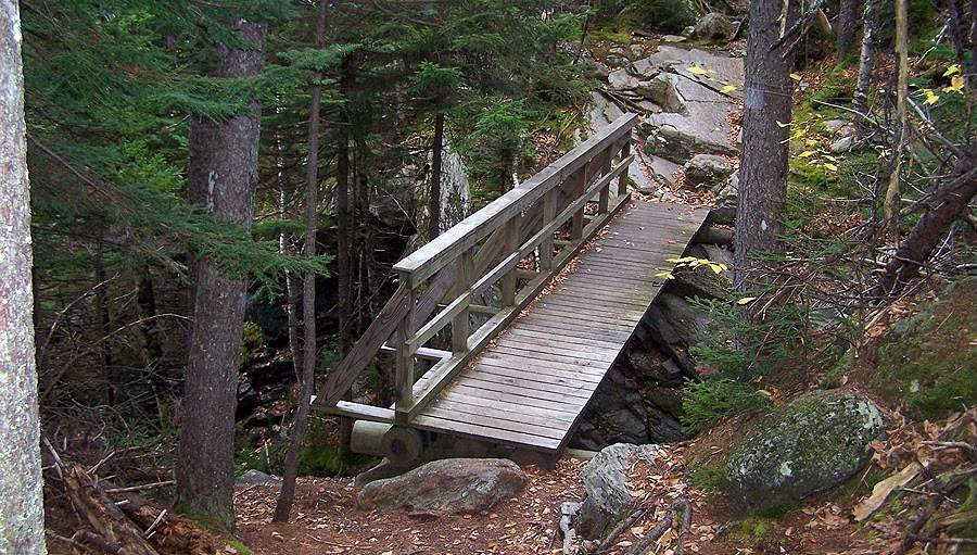
A nice little footbridge on the Diretissimma
Overflow lot at Pinkham Notch
Pinkham Notch Visitor Center
No comments:
Post a Comment