
Date of Hike: 6/23/13
Avalon Trail: 1.3 miles
|
A-Z Trail: 1.0 miles
|
Mount Tom Spur: 1.2 miles
|
Willey Range Trail: 3.4 miles
|
Ethan Pond Trail: 0.3 miles
|
Kendron Flume Trail: 0.9 miles
|
Railroad Track: 3.0 miles
|
11.1 Miles
|
2,850 elevation gain
|
- Sunday's weather window was much smaller for a good hike, in fact it was pouring when I woke up and I had no idea what I was going to hike. I thought about the Osceola's or Zealand but had already been up there recently. As I drove toward Crawford Notch the weather was better so I decided on a quick loop hike of the Willey Range with a walk along the tracks back to my car.
- Conditions were as to be expected; wet, muddy, humid, cloudy. To gain the ridge of the Willey Range you hike up the Avalon and A-Z Trails. There has been a recent trail relocation of a tenth of a mile on the lower end of the Avalon Trail. It's a nice relocation but after heavy rain it's a slippery and muddy mess, reminds me of an Adirondack Trail! Outside of that the Avalon and A-Z trails up the the ridge have pretty good footing and only a few short steep bursts here and there. The trails are in the woods with no outlooks so there's nothing too exciting.
- I made good time up to the Mount Tom Spur Trail and then on up to the summit which was buried in the clouds. The Willey Range has never been kind to me for views, I'm about one for six when hiking the range. I was hoping to see Mount Tom Pine Martin but he wasn't around so I headed back down to the col where I ran into the first hikers of the day. A group of about six youngsters who weren't thrilled about the rain coming their way.
- Next up was the easy hike up to Mount Field. Between the Tom / Field col is a great stretch of hiking through the woods. The sun always shines through the trees and makes for a nice enchanted forest look. The trail is in decent shape, with a gradual grade and above average footing making the hike to Field and easy one. Once again I had no views from the summit so I just kept trucking.
- The hike between Field and Willey is not as fun as the section between Tom and Field. If the weather was better there's be views but there were none in the morning. The trail is a little steeper and rougher with a blowdown area. There's a nice little herd path that goes around the blowdowns so there's no need to go over, under, and through the downed trees.
- When I reached Mount Willey I took a short break with a few dozen of my closest friends (annoying flying bugs). I then quickly descended the relentlessly steep section of the Willey Range Trail down to the Ethan Pond Trail junction. This section of trail loses a lot of elevation quickly and has rough and rugged footing, there is one heavily eroded and super steep section that there have been well placed ladder steps to assist hikers.
- There were lots of hikers ascending as I quickly made my way down the mountain. All were in great spirits, lots of people working on their 4,000 footer list. The weather actually started getting better, the sun came out and hazy but better views opened up.
- I hooked onto the Ethan Pond trail the banged a left after 0.3 miles onto the Kendron Flume Trail and made my way to the railroad tracks.
- The railroad tracks are part of the Crawford Notch Scenic Railway, The train takes tourists for a nice little ride from North Conway to the Highland Center located at the top of Crawford Notch.
- Now, you are not supposed to hike along the tracks but I did anyway. I figured if I walked the road back it would start pouring like on my previous two hikes with road walks. Plus, the tracks are flat and Route 302 is uphill!
- Walking along the tracks was nice, the weather was beautiful and the train never came by so I didn't have to run and hide. The highlight of the walk along the tracks is the big trestle that is about seventy five yards in length. It's a little eerie walking above a big drop, and I'm always reminded of the scene from the movie Stand By Me. I even put my hand on the track before starting across the bridge, luckily if a train came it would be going about five miles and hour so I wouldn't have to 'train dodge'.
- Just past the trestle is the old site of the Mount Willard Section House, there is part of a foundation, a water pipe or furnace of some sort, a memorial, and a beautiful rock flower garden.
- From here it's about a mile or so back to the Highland Center. The weather turned out much better than expected and I was happy with my choice to hike in the Willey Range. I changed into dry clothes and headed off looking back behind me as some serious weather came rolling in, I had made it out just in time before heavy rain came zooming through the notch, perfect timing and ending to two days in the Whites!
Started: 8:40 a.m. / Mount Tom: 9:55 a.m. / Mount Field: 10:30 a.m. / Mount Willey 11:05 a.m. / Finished: 12:45 p.m.

Crawford Notch Scenic Railway

Crawford Station

Crawford Brook on the Avalon trail

A-Z Trail

Mount Tom Spur
Mount tom Summit

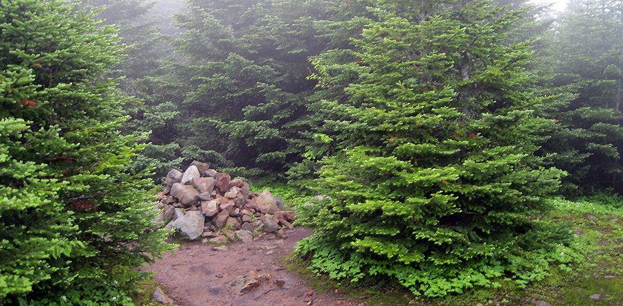
Willey Range Trail

Willey Range Trail

Mount Field Summit

Willey Range Trail

Mount Willey Summit

Ladder Steps on the Willey Range Trail

Willey Range Trail

Mount Webster from the Kendron Flume

Crawford Notch Scenic Railroad

Mount Webster

RR Tracks

RR Tracks
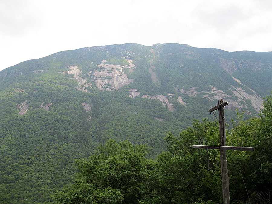
Mount Webster

Rock slabs of Mount Webster

Mount Webster Slide

Mount WIllard

Trestle and Mount Willard

Crawford Notch Trestle

Trestle

Crawford Notch Trestle

Mount Willard Section House Memorial

Crawford Notch

Mount Webster from below Mount Willard

Mount Willard marker

Hattie's Flower Garden
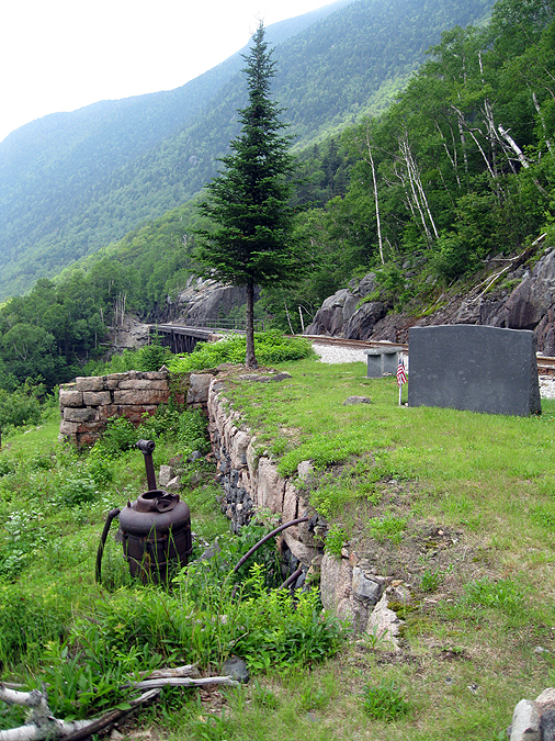
Site of old Willard House

Water pump or furnace of some sorts?

Birdy House!

Hattie's Garden

Hattie's Garden

Bird Houses

Crawford Notch

Mount Willey

Cascade

Silver Cascade

Crawford Notch Scenic Railroad

Crawford Notch Scenic Railroad

Top of Crawford Notch

Storm's coming!
No comments:
Post a Comment