Date of Hike: 12/1/18
Zealand Road: 2.6 miles / Hale Brook Trail: 2.2 miles / Lend-A-Hand Trail: 2.6 miles / Twinway: 4.2 miles / Bondcliff Trail: 0.6 miles / West Bond Spur: 1.0 miles / Bondcliff Trail: 8.2 miles / Lincoln woods Trail: 3.0 miles
Total Miles: 24.2 miles (6,063 feet elevation gained) Garmin Forerunner 920XT
Trip Report:
- On Saturday morning I joined a super strong group of hikers to tackle breaking out a majority of the Hale-Zealand-Bonds Traverse. The group was made up of Jason, Leah, Nate and his dog Piper, and Todd.
- We started just after 7am and happily hiked the broken out Zealand Road and Hale Brook Trail to Mount Hale's summit. From here we would be breaking trail for the next eight hours over thirteen miles through one to two feet of snow with higher drifts in spots.
- While breaking trail is nothing new for any of us, what made the day extra challenging and exhausting were the several miles of trees that were so heavy with snow that they were bent over across the trail. To navigate through these sections we spent a lot of time knocking ice and snow off of trees, then snaking around the trees slowing our progress considerably.
- However, we were rewarded handsomely with some of the most incredible undercast I have ever seen, second only to a Presi Traverse from December of 2014 (Trip Report).
- Views from Guyot, West Bond, and Bond were incredible. We caught sunset from Bond and hiked in the twilight along the Bondcliff Ridge while a sea of clouds floated everywhere below 4,000 feet as far as the eye could see.
- We all took turns breaking trail and knocking the stunted growth pines free of snow and ice. It was a total team effort and impressive to watch everyone break trail and route find in places where the trail corridor would basically disappear in a maze of bent over trees.
- We finally hit a broken trail at the last water crossing of the Bondcliff Trail, a much welcome sight, we still had seven miles to the car but at least we wouldn't have to route find in the dark. This made hiking much easier and we were able to cover the last seven miles in under two and a half hours finishing just after 8PM .
- What an incredible day, spent with an easy going, strong, and energetic group!
Near Zeacliff on the Twinway. From here Leah did a great job route finding through a section were many start going the wrong way
Jason heads up the Twinway
Leah with Hale behind her
Hiking towards Zealand
Breaking above treeline on North Guyot
Looking at the undercast surrounding Mount Carrigain
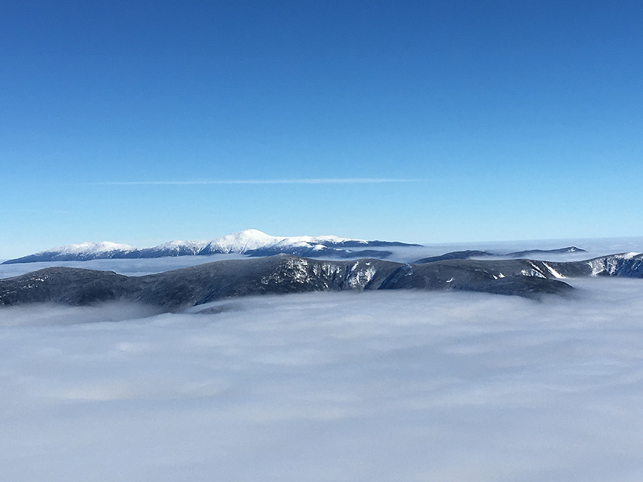
Presidential Range
Guyot and West Bond
Todd taking it all in
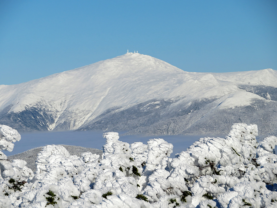
Mount Washington, Monroe, and Eisenhower
Mount Carrigain
West Bond
Jason taking in the incredible views
Southwest Twin and Garfield
Piper!
Todd hikes to the almost buried Bondcliff Trail junction
South Twin
Bondcliff slowly emerging from the undercast
Bondcliff as seen from West Bond
Franconia Ridge and Mount Garfield
Mount Garfield
Taking pics from West Bond
The group enjoys the views from West Bond
Looking to the north
Presidential Range
Presidential Range
Looking back towards Zealand Mountain
Bondcliff Ridge
Hancock Range
West Bond and Franconia Ridge
Sea of undercast in the Pemi Widlerness
Heading to Bondcliff
Bondcliff Ridge
Hancock Range
Twilight hike to Bondcliff
Bondcliff Ridge
Goodnight Pemi!