Date of Hike: 3/10/18
Avalon Trail: 1.2 miles / A-Z Trail: 1.0 miles / Mount Tom Spur: 1.2 miles / Willey Range Trail: 3.8 miles / Avalon Trail: 2.8 miles
Total Miles: 10.0 (3,749 feet elevation gained)
Trip Report:
- Another Saturday, another "Quadrathlon," my fourth this winter. I started the day with a one mile swim. I improved my 100 yard pace, dropping down from 2:08 to 2:05, finishing strong by swimming the last 400 yards under a 2:00 pace.
- After my swim I headed downstairs and jumped on the stationary bike for 35 minutes of rolling hills, which turns out is just 35 minutes of going up one hill, no reprieve, I guess this is what happens with old equipment, but it's clean and works which I'm grateful for.
- Next up was a quick 5K on the treadmill of death, there was a slight equipment malfunction with the treadmill this morning, as every couple of minutes the treadmill would go up to a 2% incline and stay there for several minutes, what a bunch of BS! Anyway, 2% of incline is nothing but it was slightly annoying, especially at the end. Twenty-one minutes later my deathmill 5K was over, mile splits were 7:30, 6:45, 6:15.
- With the athletic club portion of the day complete I headed home for a quick breakfast and to hang out with Sarge and Whitney for an hour before heading to Crawford Notch for a hike of Tom, Field, and Willey. They're not the most exciting 4K's but after a Thursday's 18+ inch snowstorm they transformed into a winter wonderland!
- I started my hike at 10:30am, vulturing up the trails (vulturing = letting early morning hikers break out the trail making my hiking much easier). I made quick work up to the Field/Tom col, passing by Rachel and her Shiba Inu, Isis along the way. I had not seen Rachel and Isis in years so it was nice to see them again. click here for Rachel's blog.
- There were no views along the Willey Range today but that was fine as all the trees were blanketed in white while it snowed throughout the day too. There were plenty of hikers out and about, I counted thirty-two, thirty of which were wearing snowshoes and two barebooters who were trashing up the trail as I headed up to Willey, luckily there were still several hikers in snowshoes so their mess was stomped out and hopefully everything has a nice snowshoe track for the immediate future.
- After a big snowstorm there are a few spots along this hike that stick out, a small buried water crossing on the A-Z trail, the path becomes very steep at this point but this little lull in the trail has a secluded feeling to it eventhough it's a well traveled trail. Next, I enjoy a section of narrow pine trees along the Mount Tom Spur, very unique looking grouping. From here as I head across the Willey Range, there is a beautiful part of the trail that snakes its way up to Mount Field, followed by a small open blowdown section further along the trail as it heads up to Mount Willey. Last but not least is heading down the Avalon Trail just before the spur to Avalon's summit, there is a flat section of woods that have some strange looking trees that have grown in every sort of direction to get to the sun.
- It was a fun late morning / early afternoon hike in Crawford Notch, I finished a few minutes after 2PM and headed home and I was able to see Whitney before she headed to work, while spending the rest of the day relaxing with Sarge :)
Starting off on the Avalon Trail
Buried small water crossing before the trail gets steep, I like this spot a lot.
Mount Tom summit
Beautiful buried Willey Range Trail
Willey Range Trail
Winter wonderland!
Heading down from Mount Field in a thick cloud deck
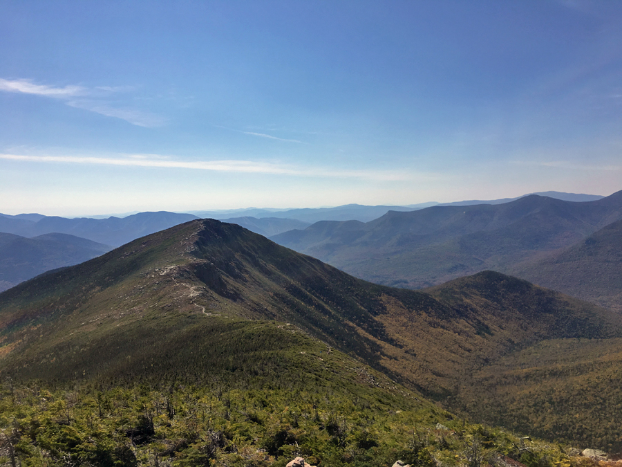
Mount Tom summit area (top left), Mount Field Summit (bottom left), Mount Willey summit (right )
Trail signs spotted along the way
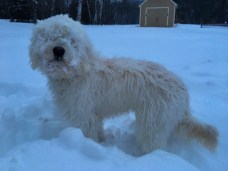
Sarge loves the snow, and the snow loves him too, as it sticks to him in seconds of being outside :)