
Date of Hikes September 23-25
9/23 Black Cat & South Branch Mountain - Pogey Notch Trail: 1.8 miles / South Branch Mountain Trail: 4.7 (Total Miles 6.5 / 2,060 feet elevation gained)
9/24 Mount Katahdin & The Owl - Tote Road: 1.2 miles / Abol Trail: 3.2 miles / Hunt Trail: 1.0 miles / Saddle Trail: 0.5 miles / Baxter Peak Cutoff: 0.9 miles / Hunt Trail: 3.4 miles / Owl Trail: 4.8 miles / Hunt Trail 1.1 miles (Total Miles: 16.2 miles / 6,470 feet elevation gained)
9/25 All by Ourselves 50K - Wadleigh Brook Trail: 1.4 miles / Frost Pond Trail: 6.7 miles / Freeze Out Trail: 13.0 miles / Wadleigh Brook Trail: 9.9 miles (Total Miles 31.7 / 2,956 feet elevation gained)
Trip Report:
- Whitney and I spent a few days in Baxter State Park, staying in the northern end of the park at the South Branch Pond Campground. We were even lucky enough to snag the most coveted lean-to at the campground, for those of you who have stayed or hiked around here before you definitely know which one we stayed in!
- We drove up from New Hampshire on Sunday and got in a quick afternoon hike around the pond and up and over two small mountains, Black Cat and South Branch. Views from Black Cat were great, South Branch not so much, the guide book said it had views but it was in the woods!
- When we got back to our lean-to we got a fire going and had dinner before retiring to our double sleeping bags as temps quickly plummeted into the low twenties.
- Monday we woke up and made the long drive up the Tote Road to Katahdin Stream Campground. From here we road walked to the Abol Trail and started up Mount Katahdin.
- The Abol Trail used to head up a slide but was rerouted a few years ago because the slide slid again and became unstable. The reroute makes the trail much easier to hike, although it's kind of a bummer since you're in the woods longer, but you do hook onto the original route higher up and the last half mile to the junction with the A.T. is a lot of fun with some scrambling up big boulders.
- When we reached the A.T. we joined that to the summit and ran into a half dozen or so thru-hikers finishing their journey. Whitney got a little emotional as she finished her thru-hike almost four years ago to the day.
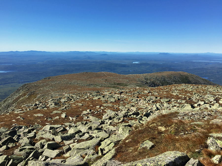
- The weather was perfect for late September, mid 30's and no wind, and very easy to stay warm. From the summit we wandered above treeline for a little bit before descending the A.T. to The Owl trail junction, where we headed up to the summit of the Owl.
- The trail is easy going until the last half mile, then it takes on the feel of ascending Wildcat E Peak from Glen Ellis Falls, steep and rugged! The steep ascent is worth it as there are great views from the Owl of Baxter Peak.
- After taking in the views we booked it down to Katahdin Stream, hopped in the car and drove back to our Lean-to where we made a fire, had dinner, and went to bed. It was in the low thirties the second night so it was another comfortable night sleeping snugged up in our double sleeping bags.
- Tuesday the weather warmed up into the 50's and we decided to get in some big miles on lightly used trails. We made a 30 miles loop hiking the Wadleigh Brook, Frost, and Freeze Out trails. We hiked for just over 10 hours and never saw another person the whole day. The trails weren't the most exciting ones in the park or the most difficult ones, but they definitely are some of the most secluded ones.
- We really timed this hike perfectly as it looks like there had been some major blowdown removal recently throughout the thirty miles. There were well over fifty removed making our progress and navigation much easier than expected.
- This loop ended up being a great hike, I don't think we'd ever go back to Wadleigh or the Frost trails again but the Freeze Out Trail is definitely worth revisiting.
- Once we completed our hike we made the short drive back to the campground, the wind was whipping but we got a good fire going and made dinner and just relaxed before retiring to a fitful night of sleeping as the wind and the rain came right off the pond into the lean-to, it felt like a mini hurricane! Still, the wind and rain couldn't put a damper in our stay in Baxter State Park as we had a great time. :)


9/23 Black Cat & South Branch Mountain - Pogey Notch Trail: 1.8 miles / South Branch Mountain Trail: 4.7 (Total Miles 6.5 / 2,060 feet elevation gained)
9/24 Mount Katahdin & The Owl - Tote Road: 1.2 miles / Abol Trail: 3.2 miles / Hunt Trail: 1.0 miles / Saddle Trail: 0.5 miles / Baxter Peak Cutoff: 0.9 miles / Hunt Trail: 3.4 miles / Owl Trail: 4.8 miles / Hunt Trail 1.1 miles (Total Miles: 16.2 miles / 6,470 feet elevation gained)
9/25 All by Ourselves 50K - Wadleigh Brook Trail: 1.4 miles / Frost Pond Trail: 6.7 miles / Freeze Out Trail: 13.0 miles / Wadleigh Brook Trail: 9.9 miles (Total Miles 31.7 / 2,956 feet elevation gained)
Trip Report:
- Whitney and I spent a few days in Baxter State Park, staying in the northern end of the park at the South Branch Pond Campground. We were even lucky enough to snag the most coveted lean-to at the campground, for those of you who have stayed or hiked around here before you definitely know which one we stayed in!
- We drove up from New Hampshire on Sunday and got in a quick afternoon hike around the pond and up and over two small mountains, Black Cat and South Branch. Views from Black Cat were great, South Branch not so much, the guide book said it had views but it was in the woods!
- When we got back to our lean-to we got a fire going and had dinner before retiring to our double sleeping bags as temps quickly plummeted into the low twenties.
- Monday we woke up and made the long drive up the Tote Road to Katahdin Stream Campground. From here we road walked to the Abol Trail and started up Mount Katahdin.
- The Abol Trail used to head up a slide but was rerouted a few years ago because the slide slid again and became unstable. The reroute makes the trail much easier to hike, although it's kind of a bummer since you're in the woods longer, but you do hook onto the original route higher up and the last half mile to the junction with the A.T. is a lot of fun with some scrambling up big boulders.
- When we reached the A.T. we joined that to the summit and ran into a half dozen or so thru-hikers finishing their journey. Whitney got a little emotional as she finished her thru-hike almost four years ago to the day.
- The weather was perfect for late September, mid 30's and no wind, and very easy to stay warm. From the summit we wandered above treeline for a little bit before descending the A.T. to The Owl trail junction, where we headed up to the summit of the Owl.
- The trail is easy going until the last half mile, then it takes on the feel of ascending Wildcat E Peak from Glen Ellis Falls, steep and rugged! The steep ascent is worth it as there are great views from the Owl of Baxter Peak.
- After taking in the views we booked it down to Katahdin Stream, hopped in the car and drove back to our Lean-to where we made a fire, had dinner, and went to bed. It was in the low thirties the second night so it was another comfortable night sleeping snugged up in our double sleeping bags.
- Tuesday the weather warmed up into the 50's and we decided to get in some big miles on lightly used trails. We made a 30 miles loop hiking the Wadleigh Brook, Frost, and Freeze Out trails. We hiked for just over 10 hours and never saw another person the whole day. The trails weren't the most exciting ones in the park or the most difficult ones, but they definitely are some of the most secluded ones.
- We really timed this hike perfectly as it looks like there had been some major blowdown removal recently throughout the thirty miles. There were well over fifty removed making our progress and navigation much easier than expected.
- This loop ended up being a great hike, I don't think we'd ever go back to Wadleigh or the Frost trails again but the Freeze Out Trail is definitely worth revisiting.
- Once we completed our hike we made the short drive back to the campground, the wind was whipping but we got a good fire going and made dinner and just relaxed before retiring to a fitful night of sleeping as the wind and the rain came right off the pond into the lean-to, it felt like a mini hurricane! Still, the wind and rain couldn't put a damper in our stay in Baxter State Park as we had a great time. :)
Pano of South Branch Pond
Looking over to the cliffs of Center Ridge
View from Black Cat Mountain of the Peaks of the Ridges
South Branch Pond
Dawn at South Branch Pond
Looking down Abol Slide. The reroute comes in right around here, skipping the slide shown down below.
Hiking along the A.T. to the summit
Looking down the Hunt Trail toward the Gateway. The Gateway is where you pop up onto the vast plateau.
Tip-Toe back at her A.T. finish spot!
South Basin and Chimney Pond
Pamola and Chimney Peak
Chimney Pond
The Knife Edge
Tablelands
Hamlin Peak
Looking across to The Owl, with Doubletop OJI, Coe, and the Borthers behind it
Baxter Peak
Whitney on The Owl
Taking in the views
Coe, the Brothers, and Fort
Frost Pond

Old logging road that is now the Freeze Out Trail
Second Matagamon Lake. The lake has been drained for damn work
Webster Brook and East Branch Penobscot River confluence
Sunken logging boom anchor
Hiking through a pretty pine knoll
Old logging relics
Mossy bog bridges
Trail was a little obscure in spots
More mossy bog bridges
Wadleigh Bog
Colors starting to change fast up in northern Maine!
No comments:
Post a Comment