
Date of Hike: 9/30/17
Signal Ridge Trail: 2.0 miles / Carrigain Notch Trail: 5.3 miles / Shoal Pond Trail: 4.0 miles / Ethan Pond Trail: 0.5 miles / Thoreau Falls Trail: 5.1 miles / Wilderness Trail: 1.5 miles / Cedar Brook Trail: 5.5 miles / Hancock Notch Trail: 5.1 miles / Sawyer River Trail: 1.2 miles / sawyer River Road: 2.0 miles
Total Miles: 32.2 miles (4,900 feet elevation gained) A.M.C. White Mountain Guide Online & Guide Book
Trip Report:
- Another Saturday - another 50K in the White Mountains! After three straight weeks of mostly rugged trails, I decided to still get in the miles but this time over very forgiving terrain and easy grades. The weather was cold and raw above 3,000 feet so I decided to stay in the valleys and notches making for a comfortable day in the mountains.
- My route for the day included Carrigain and Hancock Notches, along with Shoal Pond, Thoreau Falls, and Cedar Brook areas. Most of this quick hike/run was over old railroad grades through very lightly used trails that are quite picturesque. I was hoping to catch some great foliage, and it was pretty good in spots, while other areas were still green. It has been an odd foliage season as colors started turning quickly up here last month on some trees, while others stayed green. The colors also seem to now be muted compared to the previous few years.
- For 99% of my hike I would barely see any other hikers, two on Carrigain Notch Trail, zero on Shoal and Ethan pond trails, two on Thoreau Falls Trail, zero on Wilderness Trail, two on Cedar Brook, except for 0.8 mile section that leads to the Hancock Loop where I saw ten! And finally just one hiker on Hancock Notch Trail, Philip, who I saw early in the morning at the Desolation junction. Philip (Section Hiker), has one of the most well respected websites for hiking and gear reviews, click here for his overnight Hancock Lollipop Loop hike he was finishing up on Saturday.
- Some of the highlights from my day including scoping out future off trail adventures to take Kyle and Whitney on via old railroad spurs. Two are along the Carrigain Notch Trail and another at the start of the Shoal Pond Trail, which used to have a grade that connected to the present day Nancy Pond Trail near Camp 19 clearing. I also checked out more of Camp 24 along Cedar Brook Trail, Camp 24 was one of the biggest camps during the J.E. Henry & Sons Railroad logging days of the early twentieth century. I found some interesting relics to snap pictures of off in the woods that I hadn't seen the previous two times through here.
- Overall, it was a great adventure in the Whites and I was happy to get home early enough so that Sarge was only in his crate for a half hour after Whitney left for work. :)
Elevation over distance profile
Route for the day
Hiking the Signal Ridge Trail and passing by the old junction with the Carrigain Notch Trail
Some decent colors while hiking through Carrigain Notch
Beautiful spot to run on the Carrigain Notch Trail over the old railroad grade
Stillwater Junction, as you can see the East Branch is really low (left). The remains of the old Stillwater Dam (upper right). A campsite located at the beginning of the spur that should head all the way to the Nancy Pond Trail (lower right)
Hiking along the Shoal Pond Trail, it's starts off scratchy for about fifty yards then opens up and straight shoots over a railroad grade
Camp 21 clearing and some rails
"The Pool"
Shoal Pond Brook was really low, making for simple water crossings
Old threads starting to rot away (left), and heading through another short narrow tunnel section (right).
The Shoal Pond Trail is known for its rotting bog bridges, mud, and standing water as it approaches Shoal Pond. Luckily the dry spell has made navigating the mud easier and the bog bridges are water free at the moment.
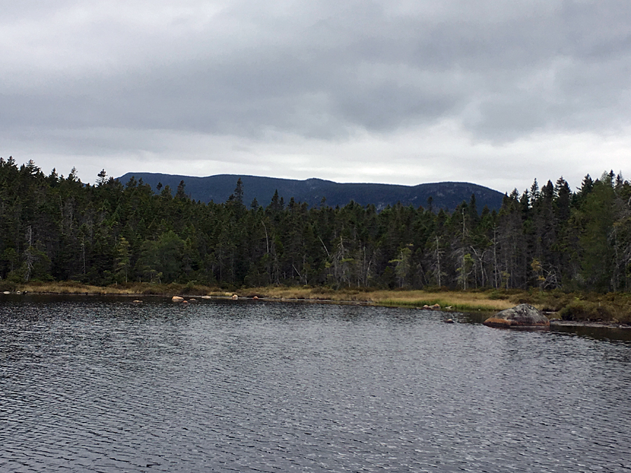
Mount Carrigain as seen from Shoal Pond
Zealand Notch as seen from the pond
Pano of Shoal Pond
Thoreau Falls
The foliage is still very good on the Thoreau Falls Trail, probably will be for another week
North Fork
The famous bucket tree and Camp 22 clearing
Thoreau Falls Trail and the old bridge
Cedar Brook Trail, another beautiful spot to run
Camp 24 Clearing
Old relics
Some pretty cool items spotted uphill from the clearing
Old wooden storage and an iron stand
The destruction to the Cedar Brook from the 2011 tropical storm
Cedar Brook Trail, it's a really pretty trail for most of its length
Hancock Notch Trail
Sawyer River destruction from the 2011 storm
Hancock Notch Trail
Sawyer River Trail and Sawyer River Road
Trail signs spotted along the way
The following day I took Sarge over to Randolph for a short stroll to enjoy the views :)
Great trip report. You really know how to cover some ground! Nice to run into you as always. I probably see you more than any other WM regular when I'm out an about. I'm impressed by the amount of artifacts you found on Cedar Brook. I just walked through there recently and noted that the old buckets I saw a few years ago weren't there anymore...of course maybe the tread changed. But I didn't root around off trail much. Perhaps I should have. Cheers.
ReplyDeleteGreat to see you again in the woods, Philip!
DeleteI thought the same thing as I went by the camp on Cedar Brook Trail, but I'm still not sure as my old pictures from previous trips can't confirm if there are fewer artifacts. Anyway, next time you head by there go up into the woods along the clearing, there's quite a bit laying around. It was a big campsite so there's probably a lot more than I found too if you spend some time wandering around!