
Date of Hike: 2/19/16
Glencliff & Moosilauke Carriage Road: 8 miles (3,339 Feet elevation gained) Garmin Forerunner 910XT
Trip Report:
- On Friday morning I met Kyle at the Glencliff trailhead for a hike up Moosilauke to try and catch some big time views before the clouds came rolling in.
- The snow was sporadic at best over the first mile and a half, mostly it was a combination of ice and some crusty snow with ice flows, all of which were easily hiked up with my newly sharp microspikes.
- The Glencliff Trail ascends at a steady grade for the first two-and-a-half miles, then becomes very steep as it gains the ridge just below the southern summit of Mount Moosilauke. Kyle set a very solid pace and didn't lift his foot off the throttle even through the steep burst over the last half mile to the junction with Moosilauke Carriage Road. Just like two weeks ago, I felt like and old lion trying to keep up with a cub, but it felt great to have him keep pushing the pace.
- From the junction, we made our way over the old chopped up and packed down snow drifts to the summit. The trail between south peak and the summit is a relatively easy walk, although usually it's very windy and can be rough through the exposed sections. However, today was a rarity as there was abundant sunshine and almost no wind.
- At the summit we relaxed for about fifteen minutes taking in the 360 degree views. It was so crystal clear out we could see the Great Range and Mount Whiteface in New York's Adirondack Mountains. This was by far the best view I ever had of the Adirondacks from this far east. To the south we could see to Monadnock, Lake Winnipesaukee, and various ski areas. To the east and north was the Franconia Ridge, Bondcliff and Guyot Range, Presidential Range, Maine, and Canada. To the west the Green Mountains with various ski areas were in full view, too. Absolute perfect viewing conditions early in the morning!
- On the way out we made the short trip to the south summit to take in the views one more time. This couple of minute side trip is well worth the minimal effort on a day with clear views. After visiting south peak we trail ran back down the mountain stopping and talking to hikers who were on their way up, all happy to be gifted a rare windless day up on the Moose.
- This hike was also my February and Mount Moosilauke grid finish. I couldn't have asked for a better hike to finish off a month and a mountain. 535 peaks down, 41 to go over the next five months!
The old gated farm road at the Glencliff trailhead
Ice was the theme of the day at lower elevations
Unheard of ground conditions for winter!
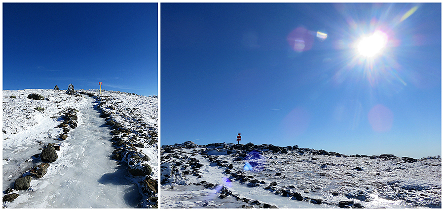
Icy ascent
Finally some snow pack, although choppy on Moosilauke Carriage Road
This picture captures why I hike. What a great walk up to a summit!
Moosilauke summit cone
Abundant sun shining over the White Mountains
Easy and pretty walk up to the summit today
The final approach
Old foundations can be found on the summit, usually they're used to get out of the wind, today they were not needed!
Franconia Ridge, Bonds, Guyot, Twin , and the Presidential Range
Mount Washington and the Presidential Range looming high above everything else
Franconia Ridge, Lafayette-Truman-Lincoln-Little Haystack section
Loon Mountain rises above the town of Lincoln
Camel's Hump in Vermont
Adirondack's Mount Whiteface, its ski area and slides pictured behind Mount Ellen and it's ski area
Same picture zoomed-in. Never thought I'd be able to get this great of a picture of Mount Whiteface from almost a hundred miles away
The Great Range lines the horizon
Once again, I can't believe I was able to get this picture with a hand held digital camera!
One last shot of the Great Range from Mount Moosilauke's summit. Dix Mountain to the far left and Giant to the far right with Algonquin the White peak rising above the Wolfjaws in the center of the photo. Thanks to Steve and Ed for the assist on picking out the peaks!
(Dix, Skylight, Haystack, Marcy, Basin, Saddleback, Gothics, Armstrong, Upper & Lower Wolfjaw, Algonquin, Giant) Sawtooth might be visible too, (kind of in front of Gothics) but not 100% sure
(Dix, Skylight, Haystack, Marcy, Basin, Saddleback, Gothics, Armstrong, Upper & Lower Wolfjaw, Algonquin, Giant) Sawtooth might be visible too, (kind of in front of Gothics) but not 100% sure
Killington Mountain its ski area and Pico Peak
Lake Winnipesaukee
Descending from Mount Moosilauke. The trail is now well marked. Unfortunately last year some low-life stole the signs and thru-hikers started roaming around in different directions up here
Heading back over the Moosilauke Carriage Road
Kyle running down the trail!
Mud Pond and Mount Clough
View of Moosilauke from its southern peak
Lower Great Range and Giant from the south summit
Great Range and Giant
Zoom-in down to Glencliff, our next stop
Early May conditions, incredible!
Old farming field near the trailhead.
Signs spotted along the way
Plaques and trail junk
No comments:
Post a Comment