
Date of Hike: 7/6/14
Phelps Trail: 10.3 miles / State Range Trail: 0.5 miles / Haystack Trail 1.2 miles / State Range Trail 2.9 miles / ADK Range Trail: 3.4 miles / W.A.White Trail: 3.5 miles / Rooster Comb Trail: 3.0 miles
Total Miles: 25.0 (8,600 feet elevation gained - guidebook) / 23.2 miles (9,340 feet elevation gained - GPS)
Trip Report...in Pictures!
Early morning at the Garden parking lot. On the weekends it usually fills up fast so arrive early to secure a spot. If full, you can park at the overnight municipal lot in Keene Valley and walk up the road two miles, or park at Marcy Field and take the shuttle to the trailhead.
The Garden trailhead kiosk. I start off hiking the Phelps Trail 9.0 miles to the summit of Mount Marcy
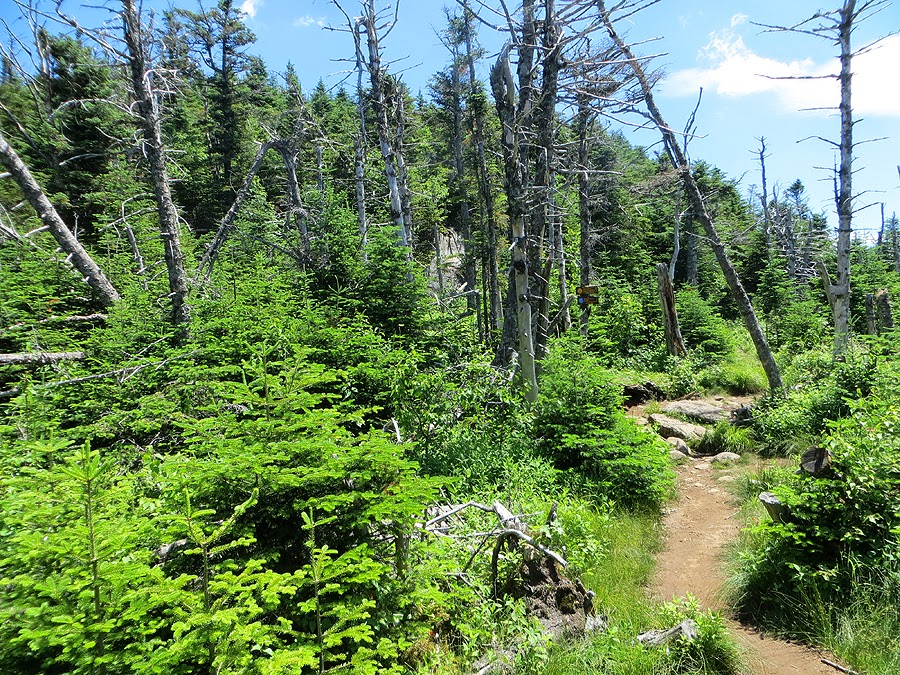
Hiking along the Phelps Trail. The fist several miles has easy grades with dirt and some rocks, great footing for hiking, backpacking, and trail running.
Early morning on the Phelps Trail. I saw two deer around here, which makes sense since I was near the Deer Lean-to!
Interior outpost register and kiosk. From here you can head across Johns Brook for direct access to the Great Range to the Wolfjaws and Gothics. I kept on going along the Phelps Trail.
Bridge over Johns Brook that takes you to a lean-to or two.
The Phelps Trail enters property of the Adirondack Mountain Club
Johns Brook Lodge, where you can get snacks, talk to a ranger, get mountain info, etc,.
Johns Brook along the Phelps Trail. The trail travels along the edge of the brook for a hundred feet or so, no big deal when the water is running low like it was on this day.
The Phelps Trail. Over four miles in and still a nice dirt path over gentle grades.
Five miles in, near Bushnell Falls Lean-to. Hopkins Trail junction, this heads two miles over to the Van Hovenburg Trail. I kept on truckin along the Phelps Trail.
The Phelps Trail gets a little steeper and rockier but still easy going on the way to Slant Rock.
A gem pool near slant rock around six miles along the Phelps Trail.
Weather warning sign around 3,500 feet. This is also the start of camping at designated sites only.
Nice place for a trail marker! Finally the terrain gets more rugged; bigger rocks to deal with, roots, old dead remnants of tree trunks, and some mud.
Now this is more like it! Over the next dozen miles footing would only get worse. Welcome to the Adirondacks!
First mud pit of the day, luckily there aren't many along the Great Range Traverse. The Adirondacks is known for it's world famous mud pits, shin deep drops into gooey mud is the norm!
Made it to the junction of the State Range Trail. Almost eight miles into the hike at the Haystack / Marcy col.
Entering the Alpine Zone below the summit of Mount Marcy. Plants are stunted and fragile, one step on the vegetation and it damages the plants and it takes several years to regrow.
Alpine Meadow on the approach to Mount Marcy. These bog bridges keep the feet dry from the water below. However, there are a few that sink as you walk across so you'll get wet anyway!
A nice little short and easy scramble up to a minor bump below the true summit.
Ascending the summit cone of Mount Marcy. The trail is blazed in yellow and marked with cairns.
Close to the summit there are rocks outlining where to stay on the path. Some places are roped off and have signs like these as a reminder.
The Summit of Mount Marcy.
Summit info.
Mount Colden, shaded, and the Macintyre Range, glowing, in the early morning sun.
Looking north to Whiteface Mountain and Lake Placid.
Skylight and Redfield Mountain, and I think McDonnel and Allen are visible, too.
Moss Pond and Mount Redfield.
Hmm, I can't recall what direction I was looking in here. Unsure but that might be the Santononi Range to the southwest.
View to the south towards the Boreas Mountains and ponds.
Summit area of Mount Marcy.
Descending the Phelps Trail.
The Great Range. I'll be heading over this throughout the day.
Haystack Mountain rising above Panther Gorge.
Lil' Haystack and Haystack.
Alpine Meadow of Mount Marcy.
Next up, Haystack Mountain!
Ascending the Haystack Trail. The trail goes over Lil' Haystack (which is where this picture was taken), then has a short steep drop before steeply ascending up to Haystack.
Mount Marcy as seen from Haystack
The scarred walls of Mount Marcy.
The Great Range; Basin Mountain, the top of Saddleback, Gothics in view, and I think tiny partial views of the Wolfjaws.
Gothics and Pyramid Peak.
Gothics.
Basin Mountain.
Looking east towards the Dix Range. Colvin, Blake, Nippletop, Macomb, South Dix, Hough, and Dix all visible in this picture
Mount Skylight and I think McDonnell and Allen, too.
Mount Marcy and Skylight above Panther Gorge
On the summit of Mount Haystack.
Big Slide, with Cascade and Porter behind it.
Descending Haystack to Lil' Haystack, with Basin Mountain to the right.
Pinnacle Ridge (The Colvin Range) and Upper Ausable Lake. Blake Peak is on the left, part of the Dix Range is rising above it.
Descending the State Range Trail to the Haystack / Basin Col. It's a steep drop with gnarly footing. Down the trail is the only section to fill up on water up on the Great Range between Marcy and Rooster Comb.
The steep approach to the summit of Basin Mountain. If this ladder wasn't here you'd have to pull yourself up through the shrubs and slab on the right.
View from Basin. Mount Colden and the Macintyre Range is off in the distance. I think the shoulder of Little Marcy, with Phelps and Tebletop Mountains are in view.
Looking back to mount Haystack and Marcy. Mount Skylight can be seen behind them.
The trail used to travel through here but it fell off the side of the mountain! Saddleback, Gothics, Pyramid, Armstrong, and Wolfjaws can be seen in this picture.
These little white flowers were everywhere along the hike. They blanketed the sides of the trail. they thrive next to the mud!
Nest up, Saddleback.
The Cliffs of Saddleback, a steep wall of scrambling below the summit.
The only flat section along the State Range Trail!
Bottom of the rock scrambling section. Somehow I froze for about three minutes around here. I have no idea why, maybe because I was alone. I have been on this before and don't remember having any issues. My teenage self which hauled a Golden Retriever up Huntington Ravine a handful of times would be shaking his head!
Looking back to Basin Mountain from the Saddleback Cliffs.
Heading up the Saddleback cliffs.
Looking down the cliffs.
Basin Mountain and its slides.
Zoom in of Wright and Algonquin Peaks.
Upper Ausable Lake.
Next up, Gothics! You can see the trail winding its way up to the summit. It's steep and a lot of fun!
Gothics from the north shoulder of Saddleback.
State Range Trail. As you can see the vegetation is sitting on top of slab. This is why there are a lot of slides, the vegetation can't hold its ground on the steeper parts.
Starting up the steep ascent to Gothics on the ADK Range Trail.
The cable section of the south face of Gothics. I usually try and head up with out ever touching it, I almost made it the whole way but with my camera in hand I needed to grab hold for a few feet.
Looking down the cable section with Saddleback Mountain in view.
Looking up to the top of Gothics, above the cable section.
Looking back at where I just came from: Saddleback, Basin, Haystack, and Marcy.
Summit area of Gothics! I think I look good in the picture but I was actually tired from having to ration my water and Gatorade. I only brought two liters of water and sixteen ounces of Gatorade. Next time I'm bringing my filter to refill in the Haystack / Basin col.
Looking back south to the Great Range; Saddleback, Basin, and Marcy in view.
Next up, Armstrong. the only easy in-between summit hike along the range.
The ADK Range Trail near a tail junction with a trail that leads east and descends to Lake Road.
Looking back to Gothics, Saddleback, Basin, Haystack, and Marcy from Armstrong Mountain.
The slides of Saddleback
An old slide above the Orbed Brook leading up to Gooseberry Mountain.
On the summit of Armstrong
The hellish descent off Armstrong has a much needed ladder spot. Honestly, it's a root, rock, mud, slab, knee-hammering descent to the Armstrong / Upper Wolfjaw col.
Next Up, Upper Wolfjaw
The ADK Range Trail through the Jaws of the Wolf.
Upper Wolfjaw summit. Not much of a view, from here on out there aren't anymore big views.
ADK Range Trail to WolfJaw Col.
The Wolfjaw Col. From here you can go east and descend to Lake Road, west and descend to Johns Brook Valley and out to the Garden, north to the Upper Wolfjaw, or in my case south up to Lower Wolfjaw.
Approaching Lower Wolfjaw summit. It's a short but steep half mile up to the summit, a real kick in the balls!
Lower Wolfjaw summit. My guess is a molar! There are some obstructed views of the range from the rocks around the summit area.
W.A. White Trail descending off Lower Wolfjaw. The trail descends a nasty steep section for a few tenths of a mile, it's a doozy. Then, almost instantly, it becomes a nice dirt path for the most part.
Looking back up, one last awful section of footing.
Finally, back to a nice trail near Hedgehog's Summit. I call this section the W.A. White - Rooster Comb Connector trail.
Descending under 3,000 feet between Hedgehog and Rooster Comb.
Rooster Comb Trail about a half mile below the summit.
The Rooster Comb Trail is almost all dirt, the grades are moderate and the footing is great.
One last up!
The last view of the day from Rooster Comb's summit. the Great Range in view, it doesn't look that spectacular from here but it definitely is!
Giant of the Valley rising high above Keene Valley and Saint Huberts.
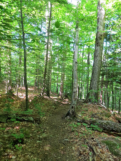
Running down the Rooster Comb trail through a mix of pine, birch, and I think maple.
Pine needle blanketed trail, a great way to end a long day of hiking / running.
Rooster Comb Pond, I want to say Big Slide and Yard is in view but it could be Cascade and Porter.
Last hundred feet!
Finished! It was a 'great' hike of the Great Range. I ended up hiking seventeen miles and jogging / running six. It's such a beautiful and rugged hike. Your body will take a physical beating that is hardly matched by any other endurance hike/run in the northeast. The steep ascents and descents between Haystack, Basin, Saddleback, and Gothics take a toll especially in humid weather. The nasty trail conditions below Armstrong, and the Wolfjaws are hellish and pack a brutal punch because the views become less and less and it's an in-the-woods sufferfest. However, the phenomenal views and the dramatic looking slides make the tough parts worth it! What a hike, and a perfect way to spend the day before my 35th birthday!
Route for the day, click here to view Garmin data, click here for Strava
Very nice hike and report! It's nice to see pics that don't have that Photoshopped look. That range trail is as rugged as all get out! I did a portion of the range later in the day on Sunday too. We started with Sawteeth-Upper Lake-Hay and dropped off the range after Gothics. Not a bad day to out huh? Hardly saw any people all day and noticed none in your pics. I think by Sunday people were all hiked out and heaed home after a long weekend.
ReplyDelete-Neil
Thanks Neil, glad you like the pictures. I do edit them a little in photoshop for the blog, but I don't add filters, I just sharpen them so they're clearer. Sounds like you guys had a great hike, I hope to head up Haystack from that direction one day, I've yet to explore that Panther Gorge area!
DeleteHave a great summer hiking!
-Chris
Best report on the GRT I've seen. Great pics also.
ReplyDeleteThanks, anonymous. I just edited some of the captions, to make it flow a little better. Plus, there were some really bad spelling errors!
DeleteGreat timing - I was need an Adirondack fix. Heading out there for a five day backpack trip in a couple of weeks.
ReplyDeleteMichael
That is great, Michael. Five days in the woods of the ADK's sounds awesome. Enjoy the solitude, I'll keep my eye out for your pictures!
DeleteGreat report, Chris! Your excellent photos really capture the flavor of the Great Range. One or two of those peaks was enough for me in a day!
ReplyDeleteSteve
Thanks, Steve! I lucked out with great weather and was able to enjoy/suffer through the crazy up and downs of the Great Range. What a special place!
DeleteThanks for the report, what fantastic weather you lucked out with! I have yet to hike in the ADK and the 46 are calling me! The GRT looks epic.
ReplyDeleteKyle, you would love it! I hope you are able to get out there this summer and the fall. It's a beautiful place to hike during late September and early October!
DeleteThis is a fantastic and well documented report! Definitely a great hiking resource for sure. What Garmin do you use/recommend?
ReplyDeleteThanks, Phil! Glad you like the report and pics. I use a Garmin Forerunner 910XT. It has about twenty hours of battery life with each charge and I love it!
DeleteAwesome report and pics. Looks like you had a great day. Thanks
ReplyDeleteHi Anonymous! The weather could not have been any better and it was an awesome day for a long hike in the rugged and beautiful Great Range
DeleteExcellent travelogue!
ReplyDeleteThanks, Anonymous!!
DeleteWow, you had a beautiful weather day. Really nice pictures. That view from Basin looking back toward Marcy is my favorite in the mountains. I finished the 46 in 1994, and when I hiked Tecumseh in NH 3 years ago, I was just getting back in to hiking. I know I was out of shape. When I told a group of older hikers on top of Tecumseh that I was a 46er, they looked at me and said to each other, "well, the Adirondacks are easier."
ReplyDeleteSo, Chris, I don't think they are easier.
Hi Mike! Glad you like the pics, yeah I could stare at Marcy and Haystack from Basin for hours, it's such a great view. I think my favorite would be Basin from Pyramid, I love that view of the scarred wall and slide of Basin, it looks like a behemoth!
DeleteAs far as what mountain range is easier or tougher, I figure everyone hikes differently so it's hiker by hiker. 90% of NH hikers will say the Whites, while 90% of NY hikers will say the ADK's. For me they're both the same, I find the Daks' approaches to the 46 much steeper than the approaches for the 48, HOWEVER, there's nothing quite like the weather system of the Presidential Range, that's a huge wildcard! At the end of the day I love them both! :)
Hope you get in some nice hikes this summer!
Nice report beautiful pictures. One of my favorite high peaks is mount haystack, looks like you didn't bump into a lot of people.
ReplyDeleteHi Anonymous. Glad you liked the report and pictures, thanks! Haystack is a favorite of mine, too. I was pleasantly surprised that I did not run into many people while doing the traverse, had all but one of the peaks to myself!
DeleteHi Chris Great photos and trip report! I'm 46R #5311, and I haven't been able to go to the Daks yet this year. I sure did love looking at your pics, almost (almost) as good as being there! And yes, looking southwest from Marcy you were looking at the Santononi's, Santa on the left, Panther on the right, Henderson in front, Couchie can't be seen behind Thanks for a great report! Walter B
ReplyDeleteThank you Walter for letting me know That I was looking out to the Santa's! I'm glad you liked the report and pictures and hope you're able to get out for a hike in the high peaks soon.. Have a great summer!
DeleteThis was really a great TR to read! Makes me want to travel to NY right now.
ReplyDeleteThanks, Jan! Glad you like it and I hope you get out there soon to enjoy the ADK's. It's such a special place!
DeleteYou really know how to sell a hike! It's now on my list. Thank You!
ReplyDeleteThanks, JPritch! Hope you enjoy the GRT when you get a chance to do it! :)
Delete