Date of Hike: 5/19/15
South Kaibab Trail: 4.7 miles / Tonto Trail & Bushwhack: 6.3 miles / Bright Angel Trail: 5.0 miles / Rim Trail: 8.0 miles
Total Miles: 24.0 miles (4,341 feet elevation gained)
Trip Report:
- After taking a much needed day off from driving 2,500 miles and then hiking 25 miles I headed back to the canyon to hike more miles along the Tonto Platform between the Tipoff on the South Kaibab Trail and Indian Garden on the Bright Angel Trail.
- Just like on Sunday I lucked out with the weather which was unseasonably cooler than usual, high of 80 in the sun and more cloud cover than usual as well.
- I parked the Jeep at the Backcountry lot and hopped on the express shuttle over to the South Kaibab Trailhead and started my hike around 7:30 in the morning.
- The hike to Tipoff was great as usual. I have been on this trail three times before today and knew it well. I took a bunch of pictures and enjoyed the amazing views. When I reached the Tonto West junction I took a break and watched the mule train ascend up to a spot where they all took a break. I'm not going to lie, those mules are kind of goofy looking..and they smell like hot garbage!
- After a few minutes I made my way onto the Tonto Trail and curved along the platform into Pipe Creek drainage. Unlike most of the creeks I passed on Sunday this one had some water and a little oasis with trees and grass.
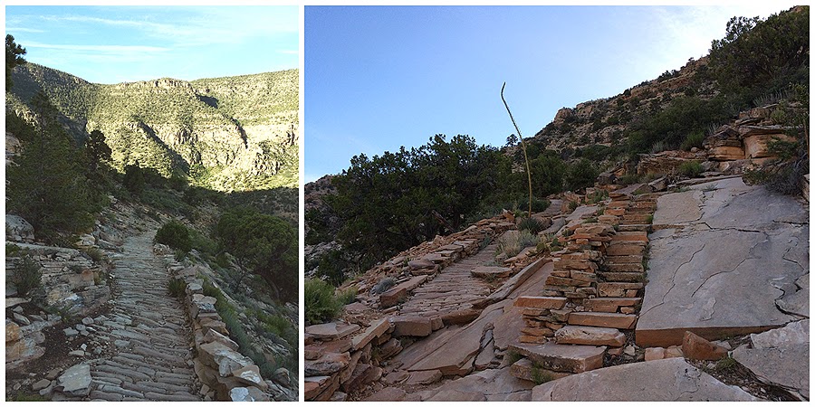
- Once past Pipe Creek I did a little exploring when the trail entered back onto the exposed platform. I ventured off trail through the shrubs and cacti to a ledge that looked down to the Bright Angel Trail and the Colorado River. I took another detour on a small butte that was above the Bright Angel Trail to the left of me. What was cool about this spot was below me to the right was an old section of the Bright Angel Trail, which except for a few washouts was still clearly visible.
- After my off trail romp, I headed back on trail and quickly reached Indian Garden where I took a break before motoring it up to the rim. I made it up to the rim by early afternoon so I decided to hike the Rim Trail to Hermits Rest. It is a mostly level eight mile walk over paved then dirt trails. The first two miles and the last mile were filled with tourists but the five miles in between hardly had anybody on it. The cool thing about this rim walk was I got to look down a few thousand feet to the Tonto Platform, the same part of the platform that I traversed across on Sunday. It was great to have a birds eye view of the trail and see how it curves in and out of the canyon walls.
- Once I made it to Hermits Rest I jumped on the free shuttle back to the Jeep and then drove back to Flagstaff for a yummy dinner. Perfect way to end the day!


South Kaibab Trail: 4.7 miles / Tonto Trail & Bushwhack: 6.3 miles / Bright Angel Trail: 5.0 miles / Rim Trail: 8.0 miles
Total Miles: 24.0 miles (4,341 feet elevation gained)
Trip Report:
- After taking a much needed day off from driving 2,500 miles and then hiking 25 miles I headed back to the canyon to hike more miles along the Tonto Platform between the Tipoff on the South Kaibab Trail and Indian Garden on the Bright Angel Trail.
- Just like on Sunday I lucked out with the weather which was unseasonably cooler than usual, high of 80 in the sun and more cloud cover than usual as well.
- I parked the Jeep at the Backcountry lot and hopped on the express shuttle over to the South Kaibab Trailhead and started my hike around 7:30 in the morning.
- The hike to Tipoff was great as usual. I have been on this trail three times before today and knew it well. I took a bunch of pictures and enjoyed the amazing views. When I reached the Tonto West junction I took a break and watched the mule train ascend up to a spot where they all took a break. I'm not going to lie, those mules are kind of goofy looking..and they smell like hot garbage!
- After a few minutes I made my way onto the Tonto Trail and curved along the platform into Pipe Creek drainage. Unlike most of the creeks I passed on Sunday this one had some water and a little oasis with trees and grass.
- Once past Pipe Creek I did a little exploring when the trail entered back onto the exposed platform. I ventured off trail through the shrubs and cacti to a ledge that looked down to the Bright Angel Trail and the Colorado River. I took another detour on a small butte that was above the Bright Angel Trail to the left of me. What was cool about this spot was below me to the right was an old section of the Bright Angel Trail, which except for a few washouts was still clearly visible.
- After my off trail romp, I headed back on trail and quickly reached Indian Garden where I took a break before motoring it up to the rim. I made it up to the rim by early afternoon so I decided to hike the Rim Trail to Hermits Rest. It is a mostly level eight mile walk over paved then dirt trails. The first two miles and the last mile were filled with tourists but the five miles in between hardly had anybody on it. The cool thing about this rim walk was I got to look down a few thousand feet to the Tonto Platform, the same part of the platform that I traversed across on Sunday. It was great to have a birds eye view of the trail and see how it curves in and out of the canyon walls.
- Once I made it to Hermits Rest I jumped on the free shuttle back to the Jeep and then drove back to Flagstaff for a yummy dinner. Perfect way to end the day!
Heading down the South Kaibab Trail surrounded by the high rising inner canyon walls
Looking north across the canyon and looking back up at the switchbacks
Great view of O'Neill Butte from Ooh Ahh Point
Descending to O'Neill Butte over soft red clay footing
Looking down to where I will be later, the Pipe Creek Drainage and the Tonto Platform
The switchbacks of the South Kaibab Trail just south of the Natural Arch
Beautiful views from a very nice and soft trail
One of my favorite spots is Skeleton Point, you get your first view of the Colorado River and then get to descend through the coolest switchbacks around!
The Switchbacks!
Colorado River comes into view
Zoroaster Temple. To this day I vividly remember this from the first time I saw this when I was a child and was totally in aww!
The Tonto Platform
The Natural Arch
Looking back up towards the Natural Arch
Mule Train!
Next stop, the Tonto Trail!
Looking down towards Phantom Ranch
Looking west and east on the Tonto Trail
Heading into the Pipe Creek drainage
A little oasis and the Pipe Creek campsite
Looking up at a natural amphitheater and trying not to get too close to the edge of the Pipe Creek Canyon
The super huge views from the Tonto Platform
Meandering my way around Pipe Creek
Views down to the Bright Angel Trail from the ledge I 'bushwhacked' to
Great spot to take a picture!
Heading along the Tonto Platform towards Indian Garden
But first I make another off trail stop to take in some more killer views
View down to Bright Angel Creek
Looking down at Bright Angel Trail from my second 'whack' of the day
Making my way to Indian Garden
Warm and comfortable day in the canyon
Heading back up and the views from the upper Bright Angel Trail
Reaching the rim
View towards the Battleship
Plateau Point
Rim Trail
Markers along the trail
Powell Point
Horn Creek Canyon
Salt Creek Canyon
Tower of Set (I think)
High Above Salt Creek
Monument Creek
Different view of Monument Creek from the Abyss
Cope Butte and the Hermits Rest Trail
Route for the day with elevation profile, click here for more info