Showing posts with label Mount Cabot. Show all posts

Swim / Bike / Run / Hike . . . Mount Cabot

Date of Hike: 4/7/18

York Pond Trail: 0.2 miles  /  Bunnell Notch Trail: 2.8 miles  /  KilKenny Ridge Trail: 3.6 miles  /  Bunnell Notch Trail: 2.8 miles  /  York Pond Trail: 0.2 miles
Total Miles: 9.6 (3,082 feet elevation gained)  A.M.C. White Mountain Guide Online

Trip Report:
- Spring has sprung...but not in the White Mountains quite yet!  The last part of the week brought in cold temps and high winds with a Friday night snowstorm.  Saturday's forecast called for clearing skies and lowering winds, so I decided to do another indoor triathlon with a mountain chaser.
- Sarge woke me up around 5:30AM, he was hungry for breakfast, after feeding him and taking him out I headed over to the local athletic club and was in the pool by 6:15AM.  The mile swim went well, my slow and steady pace was my fastest yet, 2:01 / 100 yards, closing in on my goal for a sub 2 minute pace.
- After the pool I hopped on the  stationary bike for an uphill workout, 12.4 miles in 35 minutes.  There used to be two bikes but now there is only one as one recently broke.  The remaining bike is in rough shape and will be lucky to make it another month, which is fine as I'm looking to by a cheap hybrid bike to ride the rail trails once the snow melts out.
- Once done peddling it was onto the treadmill of death 5K, I'm not a fan of treadmill running but it's easy and I can turn my brain off for the twenty + minutes it takes to complete the final segment of my indoor tri.  Today, I clocked in at 20:52, with splits of 7:25 / 6:45 / 6:09.
- I got home around 8:30AM and stuffed my face with food, hung out with Sarge and Whitney while trying to decide what to hike.  I was contemplating Mount Hale via the Birch Glades or Mount Garfield when I received a text from my friend Todd who said he was heading up to hike Cabot if I was interested, I told him yes and he picked me up at 10AM.
- Trail conditions were pretty good for our hike up and run down, with a few inches of fresh snow over a packed trail, firm in most spots and uneven and choppy from time to time with some drifting between the Cabot Cabin and the summit.  We opted for light traction for the hike, half the people we saw were in snowshoes while half were in light traction.  If we had been first on the trail we would have put on our snowshoes for the final push between the cabin and the summit as that section usually gets drifted in and the trail corridor is not well defined.
-  The hike up went well, temperatures hovered around freezing, and even though the wind was blowing at a good clip above 3,500 feet we were shielded by the trees so it was very easy to stay warm.  On the way out we trail ran down from the cabin, picking up the pace the further down the mountain we got with an aggressive pace over the final 1.5 miles back to the trailhead.  I was happy that Todd invited me to hike and run with him as I probably would not have been pushing myself solo today, so it was great to feel pretty wiped out at the finish.
-  As much I enjoy doing this little swim/bike/run/hike challenge, I really hope that the weekend's start having prime above treeline weather so I can get on trail at first light and roam around above the trees all day. :)

Hiking up the Kilkenny Ridge Trail.  For the most part the trail is not that exciting but as it slowly makes its way up towards the cabin there are some decent obstructed views

The Cabot Cabin 

The final approach to the summit 

The hike between the cabin and summit snakes through softwoods, dense in places open in others 

Todd enjoying the views from the site of the old firetower 

Looking north into Maine from the clearing where the firetower used to be 

View from Bunnell Rock.  It's right off the side of the Kilkenny Ridge Trail and is a great little spot with a nice view to  looking south

Stick Chewin' Sarge . . . nom nom nom nom!

Cabot, The Bulge, and The Horn

Date of Hike: 5/22/16

Bunnell Notch Trail: 2.9 miles  /  Kilkenny Ridge Trail: 2.7 miles  /  The Horn Spur: 0.5 miles  /  Kilkenny Ridge Trail: 1.5 miles  /  Unknown Pond Trail: 3.3 miles
Total Miles: 10.9 Miles (3,305 feet elevation gained)  Garmin Forerunner 910XT

Trip Report: 
- Originally Sunday's forecast looked quite gloomy and I was going to take a day off from running/hiking, but as usual mountain weather tends to be unpredictable and Sunday turned out much nicer than anticipated.
- Over the past week I've driven over a thousand miles,  two trips to RI and driving the van for our Ragnar Cape Cod Relay Race, so the last thing I wanted to do was drive anywhere out of the way.  I ended up heading to the Berlin Fish Hatchery for a quiet Sunday loop hike of Mount Cabot, the Bulge, and the Horn.
- The first mile from the trailhead is very easy going over an old logging road before taking a left into the woods and heading up towards Bunnell Notch.  Last time I came through here there was snow on the ground so this time I took my time looking off trail for random stuff to come back to explore next time through.  I spotted two things, one is an old clearing off the old logging road where I saw some rusted material off in the woods, it must have been an old camp.  The second thing I spotted was an old yellow blaze about fifty feet off trail and down an embankment.  The Bunnell Notch Trail was relocated at the very bottom where it turned off the logging road, the present day trail heads a little higher, while the older trail stayed lower and closer to the brook.
-  Other than that the ascent was pretty straight forward, for those hikers unfamiliar with hiking Mount Cabot, the first mile is relatively flat, the second and third miles have moderate grades as it ascends towards Bunnell Notch where you intercept the Kilkenny Ridge Trail, the last mile and a half has a steep burst right after the junction with the no longer maintained Mount Cabot Trail until passing by a fine viewpoint at Bunnell Rock, then grades become moderate to easy again as you pass by the Cabot Cabin, the site of the old fire tower, and over to the true summit.
-  From the summit of Mount Cabot I headed north down and up a couple more times over the Bulge and out and back to the Horn.  The Horn has magnificent views, although today the skies were hazy and a minor shower was rolling in from the distance so the views were a little muted.
- After the Horn I descended to Unknown Pond and took the lovely Unknown Pond Trail back to the car.  It was the first time I had been on the Unknown Pond Trail, I highly recommend it as it's a beautiful hike through some fine open hardwoods as it funnels into a valley staying close by to the brook that drains from the Unknown Pond.
-  The skies opened up on me over the last mile but I didn't mind as it was warm out and it just added to the enjoyment.

- Remember to follow Whitney as she hikes the PCT, as of May 22nd, she is about 380 miles in!  Click here to view page (also located above along the menu tabs)

 The hike in over the old logging road

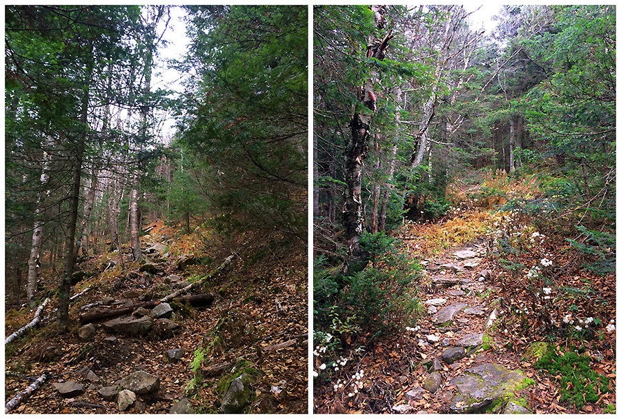
Some parts of Bunnell Notch Trail are pretty...

While other parts aren't too attractive

View from Bunnell Rock and hiking along the Kilkenny Ridge Trail

 Heading over to the Horn where I had the best view of the day

The Bulge and Cabot from the Horn

A bog bridge that has seen better days.  Several bog bridges in Kilkenny Range area are old and falling apart 

Obstructed view of Unknown Pond and the Horn

 Heading down the Unknown Pond Trail

Beautiful open woods along the Unknown Pond Trail

Unknown Pond Trail

Heading back to the trailhead next to the fish hatchery

Signs spotted along the way

Funnel into the Bunnell . . . Notch : Mount Cabot

Date of Hike: 3/13/16

Bunnell Notch Trail: 2.9 miles  /  Kilkenny Ridge Trail: 3.4 miles  /  Bunnell Notch Trail: 2.9 miles
Total Miles: 9.3 (2,855 feet elevation gained) Garmin Forerunner 910XT

Trip Report:
- After a two day trip to RI and catching the Bruins game on Saturday afternoon, a 3-1 win over the Islanders,  I wanted to take it easy on the trails Sunday morning after getting back home late Saturday night.  I looked at my maps and remaining grid peaks and Mount Cabot fit that criteria perfectly.
-  While not the most exciting mountain when it comes to 4,000 footers, I have grown to like it more and more over the past year.  The previous two times I hiked in from the closed Mount Cabot Trail, so on Sunday I decided to change it up and head in from the fish hatchery on York Pond Road.
- It's a relatively easy to moderate climb into Bunnell Notch over an old logging road for the first mile, followed by a climb through the woods next to a brook that flows down from Bunnell Notch for the following two miles.
- Conditions this time of year usually include several feet of snow from top to bottom, but since winter never really arrived up in the White Mountains the trails took on a more mid April feel with bare ground, snow, and ice for most of its length.  Good news, this might be a year with very little lingering monorail, if any at all!
-  After three miles the Bunnell Notch Trail ends at the Kilkenny Ridge Trail junction, which is about a mile and a half from the summit of Mount Cabot.  After another few tenths of a mile the trail passes by the junction with the closed Mount Cabot Trail and from here becomes steeper and rougher for about a half mile until Bunnell Rock, where there is a fine view down into the valley and all the way south to Cannon Mountain and Mount Lafayette.  Once past Bunnell Rock the trail isn't as steep but is still a little bit of a grind as you gain the ridge and arrive at the Cabot Cabin and the clearing located just above it where a fire tower used to stand.  From the clearing to the summit is an easy ten minute walk to the wooded and very quiet summit of Mount Cabot.
- Although the calendar still says it's winter it was a great mid-spring feel hike and very enjoyable.  It was also nice to run into Marvin at the summit, kudos for making the long drive back and forth from RI over these past few years in every month, I know what that is like all to well! Also it was a pleasure to run into Karine, Jeff, and Mark.  Jeff & Karine were finishing up the single season Winter NH 48 - 4,000 footers, after already completing a single season Adirondack 46ers just a few weeks back, another impressive accomplishment to add to the many hiking goals they have achieved over the past few years, excellent job you two!

 Hiking along the old logging roads of the Bunnell Notch Trail through some clearings

The trail was bare ground in spots and hard ice where the sun doesn't penetrate through consistently

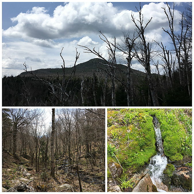
Goal for the day in sight from down below

There were some sections with snow, but still there wasn't much and most places were just icy

View from Bunnell Rock

Cabot Cabin

Signs spotted along the way, part one

Signs spotted along the way, part two

On my way back trough the town of Berlin I spotted a gang of chickens making their presence known...notice the two cats just playing it cool off to the side! #meow

All By Myself on Mount Cabot

Date of Hike: 10/23/15

Mount Cabot Trail: 7.75 miles (2,864 feet elevation gained)

Trip Report:
- On Friday I spent the early afternoon hiking up Mount Cabot from Heath's Gate.  It was a quick and very quiet hike as I would see nobody the whole way up and down.  My route for the afternoon would be over the old Mount Cabot Trail which is no longer maintained, it's a little muddy and eroded in spots but generally easy to follow.  I made sure to not stray from the easement (an old logging road that travels between private property).  It's a nice alternative from the hike on the northern side of the mountain from the Berlin Fish Hatchery, it's a little bit shorter mileage wise but pretty much has the same feel to it as they both head over old logging roads before heading through the woods into Bunnell Notch.  There are some old blazes here and there, I spotted three, and a sign that reads 'Last Water Before Summit' at the Bunnell Brook crossing.  There is a spooky feeling to the old trail, it doesn't see much use and you're just as likely to see a moose on it as you are another hiker.  I saw neither, but did hear a dog barking off in the distance, I always hear a dog barking while making my way up the old section, maybe it's a ghost dog!! #boo :)

 Starting from Heath's Gate I take the old logging road

If you're not familiar with the old trail it might be a little confusing as the easement crosses the old Kilkenny Railroad, which is now indistinguishable and a private property utility/ATV road  

Heading up the old logging road

After three quarter of a mile there is a clearing, the trail heads to the left and into the woods

Once in the woods the trail remains a nice hike over the old road but then becomes eroded

It takes on more of a 'path' as the road narrows then turns into a 'trail'

The crossing of the Bunnell Brook, if you look closely at the tree leaning over the brook there is a sign that says Last Water Before Summit.  This sign must have been placed here shortly before the trail was closed in 2000 because it is still in excellent shape

Once past the Bunnell Brook the trail finally starts to climb through open woods, in the late spring and summer it's overgrown with hobble bush through here but in the fall it's more open

Old blazes and illegally blazed painted yellow tin discs on trees

After two miles I hook onto the Kilkenny Ridge Trail and ho-humbly make my way up to the summit

View from Bunnell Rock, looking towards Lancaster

Gaining the ridge I make my way past the Cabot Cabin and it's tiny toilet in the woods

Mount Cabot summit area

Summit of Mount Cabot, last time I was here there was no summit marker.  Hope this one stays up for awhile

A frosty Mount Cabot summit

I looked in the woods behind the cabin and found some old fire warden junk

Descending back down the old Mount Cabot Trail, another blaze spotted

Flagging, around some of the muddier sections, and old pipes along the way helping with drainage

A very old blowdown just taking on a life of its own along the trail

Reaching the bottom part of the in-the-woods section of the Mount Cabot Trail

Back out into the open section along the old logging road

Heading back by the gated section and along the easement

Heath's Gate

Signs spotted along the way, nothing to see here people :)

Route for the day