Date of Hike: 7/3/19
Lincoln Woods Trail: 1.4 miles / Osseo Trail: 4.4 miles / Franocnia Ridge Trail: 5.0 miles / Garfield Ridge Trail: 6.6 miles / Frost Trail: 0.8 miles / Twinway 0.8 miles / North Twin Spur: 2.6 miles / Twinway: 2.0 miles / Bondcliff Trail: 0.8 miles / West Bond Spur: 1.0 miles / Bondcliff Trail: 3.0 miles / Twinway: 4.3 miles / Lend-A-Hand Trail: 5.4 miles / Twinway: 0.4 miles / Zealand Trail: 0.3 miles / A-Z Trail: 2.7 miles / Mount Tom Spur: 1.2 miles / Willey Range Trail: 4.9 miles / Avalon & A-Z Trail: 2.7 miles / Webster-Jackson Trail: 2.6 miles / Webster Cliff Trail: 2.7 miles / Crawford Path: 1.2 miles / Mount Eisenhower Loop: 0.8 miles / Crawford Path: 1.4 miles / Mount Monroe Loop: 0.7 miles / Crawford Path: 1.6 miles / Gulfside Trail: 2.7 miles / Mount Jefferson Loop: 0.7 miles / Gulfside Trail: 1.5 miles / Isreal Ridge & Lowe's Path: 0.3 miles / Airline: 0.6 miles / Gulfside Trail: 0.3 miles / Osgood Trail: 0.9 miles / Valley Way: 3.8 miles
Flume to Madison: 62 miles (23,150 feet elevation gained)
Total Miles: 71 miles (26,500 feet elevation gained)
Trip Report:
- Summer is in full swing in the White Mountains, it took forever to get here as we went straight from snow and cold to mud and bugs to hot and humid. Long days and warm temps mean one thing to me . . . getting to spend 24 + hours on my feet traveling through the heart of the White Mountains.
- Tuesday 9PM, Gorham, Todd arrives at my house to go over my gear, food, and fuel list. He's going to car spot me from Appalachia to Lincoln Woods. He will also be joining me for the final push through peaks #17-24 during an extended Presidential Range Traverse.
- 9:30 PM, Lincoln Woods suspension bridge over the East Branch of the Pemigewasset River. I mosey my way along the old railroad grade of the Lincoln Woods Trail before heading up to Mount Flume via the Osseo Trail reaching the summit at 11:40PM. It's a beautiful night out, very dark as there is a new moon, the stars and Milky Way look as if I could reach out and touch them. I take a break and wait until midnight while thinking about the long path ahead over the next 24 hours, knowing as long as I don't injure myself I should be able to make it to Madison's summit by 12AM the next night, I'm nervous and excited!
- 12AM, I'm off heading north along the Franconia Ridge Trail, within a minute I have an issue with my new headlamp as it went into low beam energy saver mode, so weird, but luckily I was using two headlamps and my old trusty one brightly lit the way and I booked it across to Mount Liberty passing by its open summit at 12:22 AM.
- Next two peaks, Lincoln (1:07AM) and Lafayette (1:25AM), were above treeline along the majestic ridge high above Franconia Notch and the Pemi Wilderness. There's nothing quite like traversing the ridge at night with millions of stars having the whole trail to yourself, one that is swarmed with hikers during the day.
- From Lafayette's summit I joined the Garfield Ridge Trail, the king of the PUDs in the White Mountains, six miles of mostly nothingness! However, I find that in the dark it's much more enjoyable and I easily made my way to the bare summit of Mount Garfield (2:40AM), where I chug the rest of my Gatorade and water before dropping down to Garfield Spring. The spring is the best on trail spring in the White Mountains, I chug ice cold water straight from the source, put Gatorade powder in my empty bottle and enjoy the refreshing taste before heading towards Galehead Mountain 3.63 miles away summiting at 4:08AM.
- Next up was the steep climb up to South Twin along the Twinway, but first I stopped at Galehead Hut to fill up on water and Gatorade while waking up the A.T. thru hikers who were sleeping on the floor, cock-a-doodle-do!
- South Twin is a relentless climb with a quarter mile stretch of jagged unforgiving boulders in the middle of the climb. It was still too early to switch off the headlamp making the ascent a little more interesting but I made good time up to the summit arriving at 4:51AM, headlamp turned off for the next sixteen + hours.
- First out and back of the day, North Twin, it's an easy out and back with good footing, North Twin summit 5:15AM. From the summit outlook I gaze across the Pemi, it's already hazy at such an early hour, it's going to be a hot one, time to get moving.
- I made my way back to South Twin and across the Twinway to the Bondcliff Trail junction, second out and back of the day, the three peaks of the Bonds, West Bond (6:33AM), Bond (7:01AM), Bondcliff (7:24AM). On West Bond Spur I finally see the first hikers of the day, interestingly enough the trails ended up being relatively quiet throughout the whole day.
- Views from each of the Bonds were phenomenal as always, even if it was hazy. It was also still early enough that the heat wasn't a factor yet as I traveled over the open ridge of Bondcliff.
- Now it was time to leave the ring around the Pemi and drop into an area that holds the heat like a hot box, Zealand-Hale-Willey Range. Heading to Zealand is no big deal, easy trek from Guyot, I stepped on the wooded summit at 8:40AM. I then dropped down to the Zealand Falls Hut hoping for baked goods, no dice! I filled up my water and Gatorade and started the out and back of Hale along the Lend-A-Hand Trail, the one part of the day I was dreading, especially since I was craving different food than what was in my pack. It felt like a slog but I made good time to the summit arriving at 10:33AM before backtracking to the hut and arriving just as the baked goods were put out, perfect timing! I stuffed my face with two iced cinnamon rolls, maple bread, cookies, and purchased some jerky from the hut croo.
- Feeling refreshed and energized I zoomed my way up the A-Z Trail to the Willey Range before slowing down again as afternoon hit and the heat started becoming a factor, Tom (12:44PM), Field (1:18PM), Willey (1:51PM). I throttled down across the ridge and conserved my energy, I was able to send a text out to Todd saying I'll be down to Crawford Notch at 3:15PM.
- 3:15 PM - 3:30 PM, Crawford Notch. Todd had a chair set up, a cooler with cold water and Gatorade + soda + iced coffee. Food, more specifically carb loaded foods! I stuffed my face, drank a bunch, switched from my unlta-light Osprey Rev 6 pack to my Nathan's running vest.
- 3:30PM, Webster-Jackson Trail to Mount Jackson, it's oppressively hot out, I dunk my head at the water crossing and pour water over my whole body, instantly cooling off and feeling better. Todd supplies me with salt and electrolyte tablets to be proactive about cramps and bonking, I've never taken either of them before but they must have worked because I never felt like I was going to fold like a cheap suit.
- Mount Jackson, 4:49PM, from here we travel the Webster Cliff Trail to Mizpah hut for reloading water and Gatorade before the steep climb up to Mount Pierce (5:42PM).
- Now it's above treeline the whole way, and what a later afternoon it is in the Alpine Zone, nice temps and a nice breeze. I'm on trails I consider my backyard, time to enjoy the quiet trek through the Presidential Range as the sun slowly fades.
- 6:15PM - Mount Eisenhower, 7:11PM - Mount Monroe. We make it to Lakes of the Clouds Hut and refill and refuel. Time for the last big climb up to the rock pile.
- We time the hike up and down the flanks of Mount Washington perfectly, catching the "Golden Hour" on both sides of the summit cone. As the sun drops everything around us starts glistening in gold. It's a ghost town on the summit upon our arrival at 7:59PM. Twenty one down, three to go!
- We catch an amazing sunset passing below Mount Clay on the way to Mount Jefferson, reaching the summit at 9:05PM. From the summit we can see fireworks being set off from two towns to our west, maybe Littleton and Lancaster.
- Headlamps back on for the final two peaks over the odd sized boulders of the Northern Presidential Range. Thank goodness for being lucky enough to be blessed with extremely good balance as I've now been on my feet for over 24 hours!
- 10:06PM - Mount Adams, one more down and up and almost two hours to do it in. Feeling refreshed we made great time over to Madison's summit making it there at 10:45PM (22 hours and 45 minutes since leaving Flume's summit). We turn off the headlamps and look down on Berlin and Gorham and across at the dark outline of the range, we could have stayed there forever as the weather was absolutely perfect.
- After ten minutes we head down to Madison Springs Hut, refill water and Gatorade and wake up the A.T. thru-hikers sleeping on the floor before heading down Valley Way. We made good time descending, even jogging the final two miles once the trail transitioned from rocks, roots, and mud to a nice soft dirt track. 12:24AM, Appalachia, finally off my feet after 27 hours since leaving Lincoln Woods trailhead!
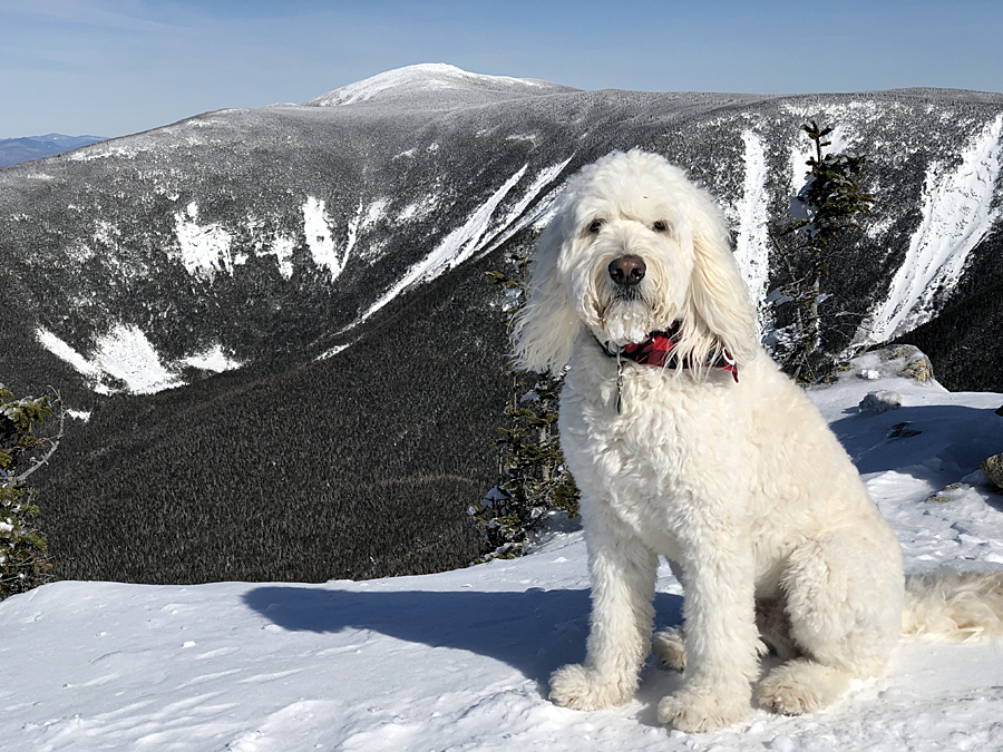
- It was an incredible night-day-night in the White Mountains. I hydrated and fueled extremely well and my body held up extremely well. Huge thanks to my small support crew, Todd on trail duty, helping pace me through the Presi's and making sure I stayed far ahead of any issues by giving me salt and electrolyte tablets, a caffeine gel, and yummy pumpkin bread and crumb cake along the way. Also, a big thanks to my friend Ashley, who house and dog-sat Sarge, taking him on a hike of North and South Twin, 4K peaks number 36 & 37 for him, YAY SARGE!!! :)
- As for how I feel about what I was able to accomplish, I feel really lucky to be able to see sunrise and sunset, to push myself physically while taking in every moment and thoroughly enjoying myself. The White Mountains are a wonderful area rich in history and I do not do these hikes/runs for FKT purposes or recognition, I just really enjoy being out on the trails all day making memories. :)
Map of Route
Elevation over distance profile
Garfield Spring
South Twin Mountain
Dawn from the Twin Range
Presidential Range
Sunrise from the North Twin Spur
Fireball in the sky, it's going to be a hot one!
Bondcliff / Twinway junction
Bondcliff
Bondcliff Ridge
West Bond and Hellgate Ravine
Twinway passing by Zeacliff
Zealand Pond
16 down 8 to go. Mount Willey summit
Presidential Range as seen from Mount Jackson
Eisenhower, Monroe, Washington
Mount Pierce from Mount Eisenhower Loop
Monroe through Jefferson as seen from Mount Eisenhower
Presidential Range
Red Pond and the intersecting trails north of Mount Eisenhower
Heading north along the oldest maintain trail in the United States, Crawford Path
Lil' Monroe and Mount Monroe with Washington looming large behind them
Shadows creeping over the Dry River Valley
Lakes of the Clouds and Mount Washington
High on the Crawford Path looking back at where I've come since midnight!
Southern Presidential Range
Todd on Washington!
The Golden Hour along the Cog Railway
Northern Presidential Range. Yes that white spot that is a snowfield lingering below Mount Jefferson along the Six Husbands Trail above Jefferson's "knee."
Heading along the tracks
Mount Washington and Monroe basking in the fading light
Sunset
Sun still trying to burn through the haze
It was really cool to watch the sunset
Another sunset pic
One last sunset pic!
Monticello Lawn
My silhouette from the summit of Mount Jefferson
Todd on Mount Adams!
Summit of Mount Madison!
Time to go home :)
Trails taken around the Pemi
Trails taken from Zealand-Hale-Willey Range
Trails taken through the Presidential Range
My support team! Trail duty - Todd, Sarge duty - Ashley :)