Showing posts with label WMNF. Show all posts

Stellar Spring So Far . . . Monroe, Washington, Jefferson

Date of Hike: 4/8/21

Ammonoosuc Ravine Trail: 3.1 miles  /   Mount Monroe Loop: 0.6 miles  /  Crawford Path: 1.5 miles   /   Gulfside Trail: 1.1 miles  /  Mount Clay Loop: 1.0 miles  /  Gulfside Trail: 0.6 miles  /  Mount Jefferson Loop: 0.3 miles   /   Caps Ridge Trail: 2.5 miles   /  Jefferson Notch Road: 1.4 miles    / Jewell/Boundary Line Trail: 1.3 miles
Total Miles: 13.5 (5,200' elevation gained)

Trip Report: 
- Not Since the spring of 2012 have the trails been this snow free and easy this early in April.  2016 had less snow but the ice was horrible through April which made for some intense hiking.  
- Todd and I took advantage of the warm weather and no wind for a loop hike of Monroe, Washington, and Jefferson.  It felt like late August above treeline, we could have worn shorts and tshirts for most of this hike today.
- Even with the low snow levels overall there is plenty left below treeline, luckily the snow was still packed down in the morning on the Ammonoosuc Ravine Trail that postholing was no issue.  Above treeline it is rock spike season as it's a mix of bare ground and snow drifts.  Caps Ridge above treeline was a little more interesting with snow drifts hiding some ankle twisting boulders so we cautiously maneuvered around those spots.  Below treeline still was holding a few feet of snow which was soft and unstable in spots over the final mile where postholing happened from time to time.  
- Once back to Jefferson Notch we ran the snow covered road to the Boundary Line Trail over to the Ammo lot.

Gem Pool holding onto quite a bit of snow

Lakes of the Clouds Hut snow drift, see it now before it melts!

The dungeon

Lakes of the Clouds and Mount Washington

Southern Presidential Range

Todd makes his way across a snowfield on the east side of Mount Monroe above Oakes Gulf

Usually this snowfield is a little dicey to cross with a no fall zone but with the low and soft snow it's fun this year in early April

Crawford Path

Next stop, Washington

Walking over Lakes of the Clouds which is buried beneath a snow drift

Mount Monroe

High up on the Crawford Path (Appalachian Trail)

The Cog, Jacob's Ladder, and Mount Monroe

Me doing some trail work.  The trail sign for my adopted trail, the Sphinx Trail, falls down every winter, I put it back up every spring!

Monticello Lawn and Mount Washington

Todd descending the lowest cap on the Caps Ridge Trail

Glacial erratic rock outlook

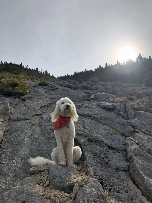
Good place to take in the view!

Jefferson Notch

Hope Springs Eternal . . . Mount Lafayette & Lincoln

Date of Hike: 3/24/21

Old Bridle Path: 2.9 miles  /  Greenleaf Trail: 1.1 miles  /  Franconia Ridge Trail: 1.7 miles  /  Falling Waters Trail: 3.0 miles 
Total Miles: 8.9 (3,900 elevation gain)

Trip Report: 
- With unseasonably warm temps overtaking the White Mountains recently I got an early start on Wednesday to get in a quick hike along Franconia Ridge before work and more importantly to get off the trails before the snow softened up too much to where post holing became an issue.
- Unlike Pinkham Notch which has been absurdly busy this week, Lafayette Place was extremely quiet with only one other car in the lot at 6:30AM
- The trails below treeline still have several feet of snow but were solid enough to make for easy passage with light traction.  Above treeline was a different story, 50/50 bare ground and old rotting snow drifts.
- There was a stiff breeze above 4000 feet but with temps rising to 40 degrees it made the trek across the ridge with a light hat and old ratty gloves easy and straightforward.
- Views were muted from the cloud cover high above blocking out the sun but they were still grand as they always are up here when it's in the clear. I've been lucky enough to have been up here well over fifty times and I never take the views for granted, especially this time since I have been mourning the unexpected passing of my brother recently as he lost his battle with depression.  Wherever he is in the afterlife, I'm sure he is able to watch over me and see the beautiful views I take in while above treeline and hopefully that it eases his pain.  I love and miss you, Joe-Ben :)  

Sarge strikes a pose along Agony Ridge

Sarge heads up Greenleaf Trail with Cannon and the Kinsmans behind him

Summit of Mount Lafayette

Sniffin' and lickin' the wind!

Classic Franconia Ridge Shot

Sarge on the summit of Mount Lincoln

Mount Lafayette behind Sarge

Presidential Range off in the distance

Sarge on Little Haystack with Mount Lincoln in view

Cloudland Falls

Triathlon + NH 48 4000 Footer Finish

Date of Hike:  2/23/20

Lincoln Woods Trail, Bondcliff Trail, West Bond Spur: 22.2 miles (5,236 feet elevation gained)  Suunto Ambit Peak watch

Trip Report:
- On Sunday I finished my Triathlon + NH 48.  Over the past two "snow seasons" of November through April, I have been heading to the Royalty Inn Athletic Club at 5AM for an indoor triathlon.   I start with a one mile swim (70 laps), followed by an uphill climb on the stationary bike (level 15, 12.5 miles, 2K+ elevation gain), ending with a 5K sprint on the treadmill (zero incline).  After completing the triathlon, I'd head home, eat breakfast, pack up the Jeep, and go hike a 4,000 footer or two, most of the time bringing Sarge with me!
-  It was an extremely fun endurance project that really pushed me physically, and just like my Grid finish in 2016 it was bittersweet as it came to an end.
- During the triathlon portion, I really enjoyed the swimming the most, followed by the bike, and the 5K was a distant last as I'm not a fan of running indoors, so I'd just turn up the speed and get off of it as fast as I could.
- Hiking after a triathlon was interesting but always enjoyable.  My legs were heavy but 99% of the time I felt as fresh as one could considering what I was putting my body through.  I fueled/hydrated as I would during one of my summer 40+ mile trail runs/hikes and that kept me from cramping or having to stop from getting too weak.
- I had a tremendous finishing hike of the Bonds, it felt like mid April and was one of the easier winter hikes of the Bonds I had experienced.  The only downside was the warm temperature made the snow sticky so I had to leave Sarge at home since his hair is velcro with the snow.  Luckily, I ran into a few familiar faces and was able to share some trail time with them at different points during the day.
- Now that this project is over I will focus on my remaining RUNNH 48 peaks when the conditions warrant, then I will  look forward to the snow free months for some interesting ultra routes I've been mapping together for solo runs and runs with my trail running friends.

Below is the chart and a few of my favorite pics from the past two years of doing this. Enjoy!

The breakdown. I sandbagged the first few 5K's before realizing I could go at race pace and still feel fine hiking.

 Summit of Madison with Sarge!

Mount Monroe as seen from the Gulfside Trail below Mount Clay

Sarge at Lakes of the Clouds Hut

Mount Washington as seen from a buried Lakes of the Clouds

Owl's Head viewed from Black Pond outlet

Hancock Loop Trail between North and South Hancock

Mount Osceola Trail

Winter wonderland at Mount Cabot's summit

Frost dusted Sarge!

Sarge on breaking above treeline on the Greenleaf Trail.  Cannon, Kinsmans, and Lonesome Lake across the notch in view

Classic Franconia Ridge shot

Heading south on the Gulfside Trail just past Thunderstorm Junction

Bowl Paw-trol Sarge!

Safety first Sarge

Mount Waumbek

Back seat  doggo! OIIIIIO

Sarge watching the clouds roll in over Lakes of the Clouds

Bondcliff Trail leaving Mount Bond

Bondcliff and Hellgate ravine

Sarge Goes a Leaf Peepin'

It was an Autumn for the ages in the mountains. The most vivid and longest lasting foliage I can remember, just driving through the notches on the way to the trailheads was a joy.

Sarge got in some spectacular hikes on his way to finishing his NH 48 4000 foot mountains! Yay for Sarge :)

Enjoy the pictures!

 Hiking along the Brothers on the way to Big Slide over in the Adirondacks.  Great Range in view 

The Calamity! More info here

Flowed Land, Mount Colden in View

Par for the course in the ADKs.  Herbert Brook Herd Path on Mount Marshall

Peek-a-boo Sarge on the Fire Warden's Trail, Mount Hale

Sarge and Piper, the Derp Squad on Signal Ridge

Castle View in Randolph, NH

Rainbow Trail on the way to Carter Dome

Sarge above Carter Notch with Wildcat A peak across the way

Carter Notch Lake

Daddy, is that you??

Making a new friend

Ear flappin' - wind sniffin' on Mount Madison

Professor Biscuit(s) on Mount Adams

Snack break on Mount Adams

Happy dog!

Cairn watching Sarge says, "Winter is coming soon at Thunderstorm Junction."

Back yard peepin'

Hide n' seek last place

Rocky Branch Trail

Heading into the Engine Hill glades

Open and easy bushwhackin'

 Engine Hill glades

Mount Isolation

Rocky Branch Trail

Flume Slide Trail

Cooling off the pads!

Charging up Flume Slide

Mount Flume

Taking in the views of the Pemi Wilderness

Mount Liberty

4000 foot fluff ball

Liberty Spring Trail

Livermore Trail

Sandwiches in the wilderness...YUMMY!

Bottom of North Tripyramid Slide

Moment of zen

 Mountain goat!

Top of North Tri Slide

Middle Tripyramid viewpoint

Sarges 48 finish on Middle Tripyramid.  High five'rs all around!!

Top of South Tripyramid Slide

does this boulder make my fluff butt look too fluffly??!!

Peak foliage is over...Soon Snow Patrol Sarge starts heading to the Bowl in Tucks :)