Hunt Trail: 5.5 miles / Knife Edge: 1.1 miles / Helon Taylor Trail: 3.6 miles / Chimney Pond Trail: 3.5 miles / Dudley Trail: 1.7 miles / Knife Edge: 1.1 miles / Hunt Trail: 1.0 miles / Abol Trail: 3.2 miles / Tote Road: 2.0 miles
Total Miles: 22.7 miles (8,900' elevation gained)
- Every year after Labor Day I start monitoring the weather and keep an eye on any lean-to's that are available at Nesowadnehunk Field in Baxter State Park during the week. This year I hit the jackpot and was able to nab a lean-to during peak foliage for Sunday and Monday. I invited Todd and Nate to join in and luckily Todd was able to get time off from work so I picked him up at 4AM in Jackson, NH and we made the five-hour drive north to Millinocket, ME. We arrived at the Togue Pond Gate just after 9AM and I told the ranger our plan for the day was to head up Baxter before heading over to Neso Field, she gave me a look as if we were a couple of goobers, I assured her that we have done this before but from the interaction she clearly thought we were certified bozos.
- After entering the park we drove over to Katahdin Stream Campground to do a quick Abol - A.T. loop via a short run along the tote road. Unfortunately, the weather was cloudy and foggy above treeline so there were no views but lucky for us the skies would clear overnight setting up great weather for our annual big day on Baxter.
- Monday morning we started just before 7AM and cruised up the Hunt Trail to the Baxter Peak. Views were phenomenal early in the morning, crystal clear sightlines with the Owl, Oji, Coe, the Brothers, and Fort to the west as we popped above treeline past the Gateway.
Todd break above treeline with The Owl behind him
The Owl, OJI, Coe, South and North Brother, Fort
- From Baxter Peak we carefully made our way across the Knife Edge to Pamola Peak. There were a couple of spots in the shade that were a little slick but for the most part it was smooth sailing. The Knife Edge was very quiet as we only saw a couple hikers heading the opposite way.
Early morning along the Knife Edge
Pamola Peak
- Next we descended Helon Taylor Trail all the way to Roaring Brook Campground. Along the way we passed a couple of dozen hikers heading up enjoying the perfect weather. Views looking down to the valley with all the colors from the leaves were outstanding making for a picturesque run down to Roaring Brook.
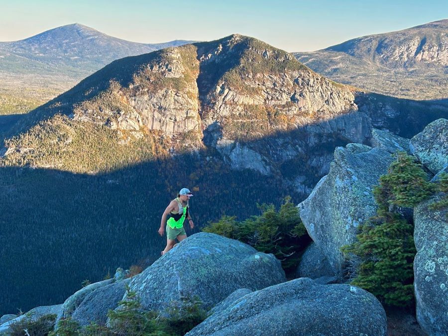
Enjoying the alpine zone descent along the Helon Taylor Trail
Looking down towards Basin Ponds (left), Sandy Stream Pond (right) and Turner Mountain range
- At Roaring Brook Campground we signed the trail register and took a short break before we made the 3.5 mile easy trek to Chimney Pond. Along the way we stopped at one of my favorite outlooks at Basin Pond.
Pano from lower Basin Pond. What a view!
- From Basin Pond we motored on up to Chimney Pond and signed in at the ranger's cabin before hooking onto the Dudley Trail. The trail starts off relatively tame for the first half mile plus as the lower section was rerouted a few years back after a rockslide wiped out a part of the trail. Instead of shooting straight up to Pamola Peak, the trail follows a long sweeping switchback before it rejoins the original trail where it then heads straight up over boulders of all sizes with unbelievable views.
Lower boulder field on the Dundley Trail. South Basin tucked away to the right and Cathedral Ridge and the Saddle in the middle-right
Basin Ponds and some prime foliage at lower elevations of the Turner Mountain range
Index Rock
Going up and looking back down at Index Rock
- Quiet time on the trails was over as we summited Pamola Peak for the second time. We were greeted with an enthusiastic, "No Way, No Way!" from a pair of hikers who we saw on the Helon Taylor Trail some three hours ago and then we passed another group we saw earlier carefully descending the Chimney. The highlight was for the second straight year we ran into a young group of Amish from their community in Patten, ME making their way across the Knife Edge, they were moving better than most hikers who had significant advantages in gear over the Amish.
- Heading from Pamola to Baxter in this direction is definitely easier as the Chimney is not as problematic, coming from Baxter there is an awkward downclimb from Chimney Peak which can be a little unnerving.
- When we reached Baxter Peak we took a break, there were several thru-hikers lounging around after finishing their A.T. journey. The lucked out and had a gem mint finishing day weather wise!
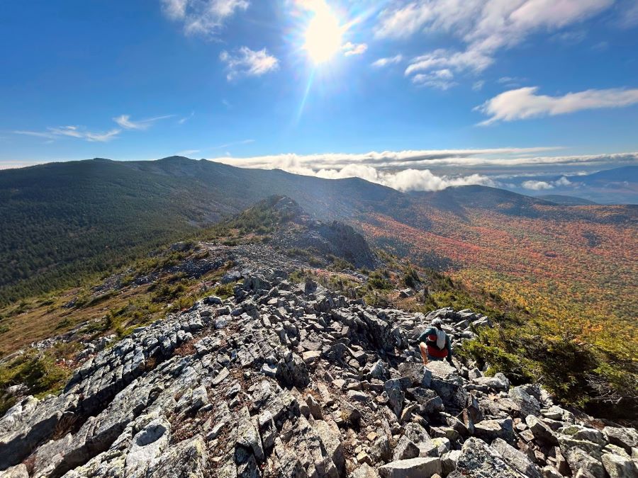
Afternoon view of the Knife Edge from Pamola Peak
Todd steeply descends to the Pamaola/Chimney col and cruising along the Knife Edge
Knife Edge
Baxter Peak
South Basin and Chimney Pond
- Last section of the day was a run down to Thoreau Spring before one last steep descent of the Abol Trail back to the valley. We lucked out as there was high cloud cover so we were in the shade for the first mile as even though it was the last day of September the weather had a mid-summer feel on Katahdin. Back into the sun we carefully picked our way down the top half of Abol Trail before the grades moderated at the new switchback up high, the trail was relocated as a rockslide wiped out part of the trail below this spot making the middle section of Abol Trail much easier than before to descend.
- We made decent time back to the trailhead where we signed the hiker log book at the ranger's station before making quick work of the two miles along the tote road arriving at Katahdin Stream campground 8 hours and 40 minutes after we started, which was basically spot on from our 8 hours and 42 minutes from last year, all day pace equals always consistent!
- We got cleaned off and relaxed for awhile at Katahdin Stream before heading back to Neso Field where we planned our hike for getaway day, the Travelers!
Todd heads down the Hunt Trail towards Thoreau Spring
Descending the steep upper section of the Abol Trail
Tote Road running and the view from Katahdin Stream Trailhead
Date of Hike: 10/1/24
Pogey Notch Trail: 1.5 miles / Center Ridge Trail: 2.3 miles / Traveler Mount Trail: 4.5 miles / North Traveler Mountain Trail: 2.8 miles
Total Miles: 11.1 (4000' elevation gained)
- On travel day we headed to the north end of the park to South Branch Pond Campground to hike one of the most underrated hikes in Baxter State Park, the Travelers.
- The Travelers has several unique aspects to them; Little Knife Edge, highest volcanic mountain in New England, and super expansive views created from wildfires from over a hundred years ago.
- The loop consists of parallelling Lower and Upper South Branch Ponds, a steep ascent to treeline to Peak of the Ridges Summit, Little Knife Edge, moss covered single track, a talus field to Traveler Mountain, open ledges and moss-covered woods to North Traveler, and a beautiful descent in and out of the woods back to South Branch Campground. Highly recommend for anyone who has hiked the main attractions of Baxter and Hamlin to head to the Travelers, and unless you are peak bagging the NE67 or NE Hundred Highest I would tell anyone skip the Brothers, Coe and Fort and head to South Branch, it's well worth the extra drive on a good weather day.
- The Travelers Loop was our last excursion in Baxter State Park before leaving the park from the Matagamon Gate and eventually making our way back to I-95 for the long but easy ride back to our homes in the White Mountains. It was another successful fall trip to a place that for me is the Cathedral of hiking east of thew Rockies!
Peak of the Ridges
Heading towards the Little Knife Edge
Partial undercast on Mount Katahdin
Left - Beautiful sections of moss and soft dirt single track between Peak of the Ridges and Traveler
Right - Mountain. Unexpected Birch glade along the northern shoulder of North Traveler Mountain
Looking back to Peak of the Ridges
A magnificent Talus field leading up to Traveler Mountain
Pano view of Turner - Katahdin - Hamlin - Brothers
Traveler Mountain summit
Todd heads down from Traveler Mountain high above a never-ending band of low-level clouds
Descending North Traveler
Not much has grown back above 3000' from the fires during the early twentieth century. Makes for a beautiful trek
Lower and Upper South Branch ponds


No comments:
Post a Comment