Date of Hike: 4/29/12
Garfield Trail: 4.8 miles
Garfield Ridge Trail / Campsite Spur: 3.5 miles
Frost Trail: 1.0 miles
Twinway / North Twin Spur: 4.2 miles
Garfield Ridge / Gale River Trail: 4.8 miles
Gale River Road: 1.7 miles
Total Miles: Around 20 miles (6,200 elevation gain)
Trip Report:
- The forecast on Sunday called for clear skies but high winds so I decided it would be a perfect day to head over for a long hike up to Mount Garfield, across the Garfield Ridge to Galehead, and then up the Twinway to South an North Twin.
- Temperatures were around freezing when I started hiking at 8am. The Garfield Trail has very easy and moderate grades with decent footing. There's not much excitement to the trail but it follows the old fire/logging road which is pretty cool.
- The bottom of the trail was snow free, the middle section was a mix of rocks, ice, mud, standing water, and ground cover snow, while the top section where the switchbacks are was snow and ice.
- I made it up to the summit of Mount Garfield quickly and was greeted by the wind which was whipping around 20-25mph with higher gusts. I was able to find a spot on the ledges right behind the old fire tower foundation completely out of the wind and took in the views of the Pemigewasset Wilderness for a good ten minutes before heading north on the Garfield Ridge Trail to Galehead Mountain.
- along the way I stopped in at the Garfield Ridge Campsite to check out the new shelter, it is solidly built and looks magnificent compared to the old one.
- The steep section of the trail just below the campsite which is basically a waterfall was iced over and slow going but fun to maneuver down. I had my microspikes on which only helped out a little since they are old and worn down and one of them has a broken link which managed to snag through my the lower pant leg on my other foot then hooked into a tiny loop hanging from my boot, the chances of this happening are probably about one in a million, but since I was on a trail which made me cry when I was eight, defeated me last year on my quest for the 24 Hour H2H, the odds became 2 to 1. Needless to say I had no idea what happened and stumbled around like a shackled prisoner for about ten feet and fell on my ass!
- When I reached Galehead Hut I finally ran into another hiker who was taking his dog up his first 4,000 footer, the dog was a huge dog, biggest one I've seen on the trails and looked like he was having a good time, although I hope for the hound's sake he wasn't tricked into thinking he was hiking all this way for views!
- In case anyone was wondering, Galehead Mountain summit is still a small bump, with small pile of rocks, in the middle of the woods.
- After the exciting trek to Galehead Summit I headed up the steep Twinway 1,150 feet of elevation gain in just 0.8 miles, it's one of my favorites sections of trail, I love to beat myself up to see how fast I can hike up it where I get awarded with the awesome views from South Twin. It was a little tougher with the snow and ice but I still made good time. As I ascended a helicopter came zooming by just above the trees, at first I thought it was SAR but then it became clear it was doing drop-offs at Galehead Hut to get it ready for opening. Over the next two hours it would fly back and forth dropping stuff off.
- South Twin's summit was very windy but I knew where to go to get out of the wind to enjoy some lunch and stare at the Presidential Range before heading out to North Twin and back.
- The hike over to North Twin was fast and I came across a couple basically doing the opposite hike of what I was doing and three guys doing an out n' back of the Twins. It was windy on North Twin's summit so I wasn't able to enjoy the views that much so I just took pictures and booked it back to South Twin and took a nice break in my favorite spot before slipping and sliding my way down the Twinway to Galehead Hut.
- At the hut the Helicopter came back to pick up the two guys that had been dropped off with the items for Galehead Hut. It was pretty cool to see the helicopter land, take off, and blow everything around, it sure was loud to.
- I talked to a man and a woman from VT who along with their dog had just started hiking the 4,000 footers in NH last August, so far they have enjoyed their hikes in the White Mountains and were looking forward to hiking the rest of them.
- As I descended the Gale River Trail I decided to stay on the original now defunct trail that heads along the Gale River. The new relocated trail stays up on a ridge in the woods and is very boring. The old section is pretty and you get to cross the river twice which is fun.
- Once out to the road I had just under two miles back to the car from the Galehead Trailhead, it's an easy walk that took about thirty minutes, I did find some weird looking man made channels and ponds about two hundred feet in the woods off the road, I have no idea what it was but it sure was interesting and made for a nice end to an great day of hiking!
-On trail at 8am, Garfield 10am, Galehead 11:45am, South Twin 12:30pm, North Twin 1:05pm, Galehead Hut 2:05pm, Gale River Road 3:45pm, Finished 4:20pm. Temperatures in the low 30's to low 40's, winds 20-30 mph on exposed summits, mostly sunny blue skies.
Pictures: Click here for all pictures

Mount Lafayette and Lincoln as seen from Mount Garfield

Garfield Ridge Shelter

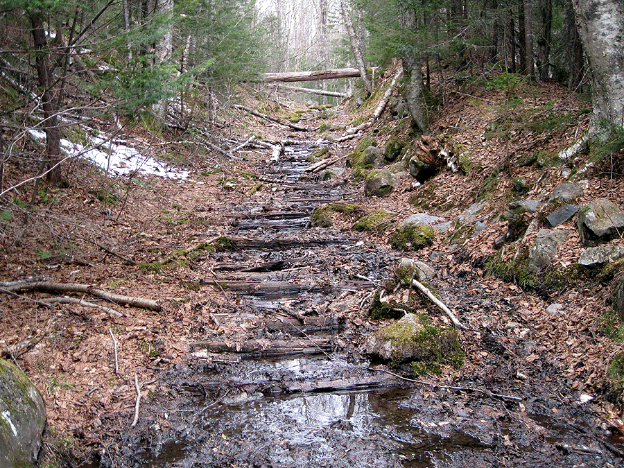
Garfield Ridge Trail

Galhead Hut and South Twin from the Frost Trail Outlook

Presidential Range as seen from South Twin Summit

North Twin Spur Trail

Garfield and Franconia Ridges from North Twin Summit, along with seven 4,000 footers
(Galehead, Garfield, Lafayette, Lincoln, Liberty, Flume, and Owl's Head can bee seen in this photo)

South Twin Summit

Helicopter at Galehead Hut

???